Volcano cycle path
| Volcano cycle path | |
|---|---|

|
|
| overall length | 94 km |
| location |
|
| Starting point | Altenstadt |
| Target point | slot |
| Places along the way | Altenstadt , Gedern , Hartmannshain , Herbstein , Lauterbach , Bad Salzschlirf , Schlitz |
| Flooring | mostly paved |
| Height difference |
100 m to 580 m / approx. 740 m ascent Link to altitude profile |
| difficulty | easy - medium |
| Traffic volume | low |
| Connection to |
Railway cycle path Hessen , German Limes cycle path , Vogelsberger Südbahn cycle path , summit tour , R1 , R2 , R7 , D-Route 9 |
| Website URL | vulkanradweg.de |
The Vulkanradweg is a 94 kilometer long Hessian cycle path that connects the Wetterau with the high Vogelsberg . Today the Vulkanradweg is part of the BahnRadweg Hessen .
Route profile
The cycle route uses the former railway line of the Vogelsbergbahn, now known as the Oberwaldbahn , to Lauterbach . The route originally led from Altenstadt via Gedern , Hartmannshain and Herbstein to Lauterbach . The route was later signposted via the Hessian long-distance cycle route R7 via Bad Salzschlirf to Schlitz .
The path connects the Wetterau over the Vogelsberg with the Lauterbach / Schlitz region. The Vogelsberg as an extinct volcano gave the bike path its name. The Limes cycle path is crossed in Altenstadt .
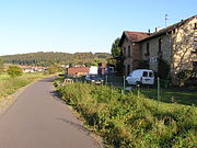
The continuously asphalted course enables you to cross the low mountain range without extreme climbs (max. 3%).
The highest point of the volcano cycle path is the former Hartmannshain train station at around 580 m above sea level. NN. At the same time, the Vogelsberger Südbahnradweg to Birstein and Wächtersbach and the Hoherodskopfsteig branch off from here .
Stops and train stations
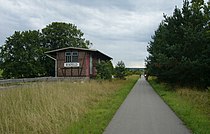
Several former train stops now serve as resting places (e.g. former stopping point at Schloss Eisenbach), as restaurants (e.g. former train stations in Frischborn , Rixfeld and Grebenhain-Crainfeld), and as museums (today's model railway station in Glauburg-Stockheim) ) or as overnight accommodation (e.g. former Nösberts-Weidmoos train station ). The former Hartmannshain station is now a privately-used residential building, as is u. a. the former train stations Blitzenrod , Herbstein , Ilbeshausen and Bermuthshain .
Mileage signs
The information for cyclists and orientation points for emergency rescue are provided by kilometer signs that are set up 500 meters from Lauterbach-Stadtpark (km 0.0) to Hartmannshain (km 28.5). In addition to the km distance, the name of the respective district in which the sign is installed is listed here.
Entry points
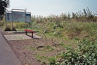
Numerous parking spaces directly on the bike path offer the opportunity to switch from car to bike. Such entry points include a. the Steinigsgrund sports and leisure center in Lauterbach, the former Eisenbach stop at the Rosenbahnhof in Rixfeld and the highest point of the cycle path at the Tor zum Vogelsberg restaurant in Hartmannshain .
Bicycle bus
From May 1st to the last Sunday in October the regular buses of the Vogelsberger Vulkanexpress RMV run every Saturday and Sunday as well as on public holidays with bicycle trailers and cover the transport needs to the heights of the Vogelsberg. With the train stations Altenstadt or Glauberg and Lauterbach , the cycle path is connected to the German rail network.
The buses to the Hoherodskopf run centrally from Schlitz , Lauterbach (rail connection), Mücke (rail connection), Laubach , Nidda (rail connection), Stockheim (rail connection) and Altenstadt (rail connection).
Connection to other major bike paths
- The German Limes Cycle Path crosses the volcano cycle path in Altenstadt.
- The Vogelsberger Südbahnradweg ends in Hartmannshain on the Vulkanradweg. This creates a 35 km long connection between the volcano cycle path in Vogelsberg and the Kinzig valley.
- Between Hartmannshain and Bad Salzschlirf, the summit tour , the connection between Hoherodskopf and Wasserkuppe, and the volcano cycle path run over 40 km on the same route.
- The Hessian long- distance cycle path R7 meets the volcano cycle path shortly before Lauterbach and accompanies it to Schlitz. It connects Werra and Taunus via the Vogelsberg.
- The Hessian long-distance cycle path R2 meets the volcano cycle path in Lauterbach and accompanies it to Bad Salzschlirf. The R2 (The Four Rivers Tour) starts in Biedenkopf and leads over 202 km through the river valleys of Lahn , Lauter , Lüder and Fulda to Sinntal in the Spessart .
- The Hoherodskopf-Steig leads from Hartmannshain to the Hoherodskopf and on to Schotten, where there is a connection to the Hessian long-distance cycle route R4 and the Niddaradweg.
Web links
- Vulkanradweg In: Radroutenplaner Hessen.
- Vulkanradweg In: www.bahntrassenradwege.de
- Vulkanradweg bike tour travel report. In: HESSENMAGAZIN.DE. Archived from the original on March 30, 2016 .
- Vogelsberger Vulkanexpress bicycle bus
Coordinates: 50 ° 40 ′ 58.6 " N , 9 ° 35 ′ 18.6" E


