Solztalradweg
| Solztalradweg | |
|---|---|

|
|
| overall length | 27 km |
| location |
|
| map | |
| Link to map and elevation profile | |
| Starting point | Bad Hersfeld |
| Target point | Philippsthal (Werra) |
| Places along the way | Sorga , Malkomes , Schenksolz , Lampertsfeld , Schenklengsfeld |
| Flooring | approx. 98% asphalt or concrete |
| Height difference |
200 m to 360 m / approx. 240 m ascent |
| difficulty | easy (0-3% gradients) |
| Traffic volume | Low |
| Connection to | Railway cycle path Hessen , Werra valley cycle path, Hessian long-distance cycle paths R1 , R7 , D-Route 9 |
| Website URL | Hesse cycle route planner |
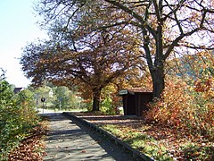
The Solztalradweg is a cycle path between Bad Hersfeld an der Fulda and Philippstal an der Werra . With a few exceptions, the first 15 kilometers run on the former railway line of the Hersfeld Kreisbahn in Solztal to Schenklengsfeld . A height difference of 120 meters is overcome. The rest of the way to Philippsthal leads over cycle paths and farm roads. Today the Solztalradweg is part of the BahnRadweg Hessen . See there for further details.
history
After the Hersfeld circular railway was partially closed in December 1993 , the dismantling of the tracks on the section between Bad Hersfeld and Schenklengsfeld began in 1999. The entire route is still a railway line and remains dedicated as such. The railway line from Schenklengsfeld to Heimboldshausen was sold to a museum railway association on September 11, 2009. The asphalting work was completed by autumn 2003; however, the Fulda bridge near Bad Hersfeld had to be restored in 2005. In April 2008, a better connection of the cycle path to the Bad Hersfeld train station will be implemented and the previously undeveloped section in front of Malkomes will be paved on the railway line.
Connection to other major bike paths
- Hessian long-distance cycle route R1 near Bad Hersfeld
- Werratal cycle path in Philippsthal.
Web links
- Solztalradweg In: Hesse cycle route planner.
- Solztalradweg In: www.bahntrassenradwege.de
Coordinates: 50 ° 52 '4.4 " N , 9 ° 43' 1.7" E

