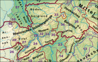
Westerwald (natural area)
| Westerwald | |||
|---|---|---|---|
| Systematics according to | Handbook of the natural spatial structure of Germany | ||
| Greater region 1st order | Low mountain range threshold | ||
| Greater region 2nd order | 24–25, 27–33, 56 → Rheinisches Schiefergebirge |
||
| Natural space |
32 → Westerwald |
||
| Natural area characteristics | |||
| Landscape type | Low mountain range ( basement , partly volcanically raised) | ||
| Highest peak | Fuchskaute ( 657.3 m ) | ||
| Geographical location | |||
| Coordinates | 50 ° 39 '40.1 " N , 8 ° 6' 5.3" E | ||
|
|||
| state | Hesse , North Rhine-Westphalia , Rhineland-Palatinate | ||
| Country | Germany | ||
Westerwald is a main unit group with the ordinal number "32" in the system of natural spatial division of Germany. According to this system, it follows that the main unit group Westerwald belongs to the basement floodplain, which describes the type of mountain structure. The main unit group extends over Hesse , North Rhine-Westphalia and Rhineland-Palatinate . It is roughly limited by the valleys of Lahn (east and south), Rhine and Sieg (via Heller ), whereby the elevations immediately south of Heller and Sieg are not included.
Natural structure
Below the main unit group are the main units, which in turn are divided into sub-units, sub-units and basic units.
- 320 - Gladenbacher Bergland (780 km²)
-
- 320.0 Lahn-Dill-Bergland
- 320.00 Breidenbacher Grund
- 320.01 Bottenhorn plateaus
- 320.02 Scheldt Forest
- 320.03 inches Beech
- 320.04 Hörre
- 320.05 Krofdorf-Koenigsberger Forest
- 320.1 Gladenbach hill country
- 320.10 Damshausen hilltops
- 320.11 Elnhausen-Michelbacher depression
- 320.12 Salzbödetal
- 320.13 Niederweidbach basin
- 320.2 Upper Lahn valley
- 321 - Dilltal (174 km²)
- 321.0 Lower Dill Valley
- 321.1 Upper Dill Valley (with Dietzhölzetal)
- 321.2 Struth
- 322 - High Westerwald (346 km²)
- 323 - Oberwesterwald (669 km²)
-
- 323.0 Westerwald-Osthang ( Dillwesterwald )
- 323.1 Oberwesterwald hill country
- 323.2 Dreifelder Weiherland
- 323.3 South Upper Western Forest hill country
- 323.30 Steinefrenzer plate
- 324 - Niederwesterwald (1316 km²)
-
- 324.0 Emsbach-Gelbach-Heights
- 324.00 Horchheimer Höhe
- 324.01 Emsbachtal
- 324.02 Plateau of Welschneudorf
- 324.03 Gelbachtal
- 324.04 Eppenroder plateau ( Hochstein ridge )
- 324.1 Montabaurer Höhe
- 324.2 Montabaur Valley
- 324.3 Kannenbäcker plateau
- 324.4 Rhine-Wied ridge
- 324.5 Waldbreitbacher Wiedtal
- 324.6 Sayn-Wied plateau
- 324.60 Isenburg Sayntal
- 324.7 Dierdorf depression
- 324.8 Asbach-Altenkirchener plateaus
- 324.80 Asbach plateau
- 324.81 Altenkirchen plateau
- 324.9 Rheinwesterwälder volcanic ridges
The Westerwald in the narrower sense is usually understood by the delimitation of the main unit groups 322 to 324.
Individual evidence
- ^ Landscapes in Rhineland-Palatinate: Westerwald
- ↑ Map and legend of the Westerwald in the Environmental Atlas of Hesse
- ↑ Map services ( Memento of the original from December 19, 2012 in the Internet Archive ) Info: The archive link has been inserted automatically and has not yet been checked. Please check the original and archive link according to the instructions and then remove this notice. of the BfN
- ↑ Map services of Rhineland-Palatinate with maps of natural and landscape areas (→ Landscape experience → Landscapes in Rhineland-Palatinate)
See also
Web links
-
Landscape profiles of the Federal Agency for Nature Conservation ( information )
- 320 Gladenbacher Bergland
- 32001 Lahn-Dill-Bergland (320.0)
- 32002 Gladenbacher Hügelland and Upper Lahn Valley (320.1–2)
- 321 Dill Valley
- 322 High Westerwald
- 323 Oberwesterwald
- 324 Niederwesterwald
- 32402 "Montabaurer Westerwald" (324.0–1, 324.3–6, 324.9)
- 32401 "Niederwesterwald" (324.2, 324.7–8)
- 320 Gladenbacher Bergland
literature
- Emil Meynen, J. Schmithüsen et al. (Hrsg.): Handbook of the natural spatial structure of Germany. Self-published by the Federal Institute for Regional Studies, Remagen 1953–1962 (Part 1, includes delivery 1-5), DNB 451803159 .
- Emil Meynen, J. Schmithüsen et al. (Hrsg.): Handbook of the natural spatial structure of Germany. Self-published by the Federal Institute for Regional Studies, Remagen 1959–1962 (Part 2, includes delivery 6-9), DNB 451803167 .

