Montabaurer height
| Montabaurer height | ||
|---|---|---|
|
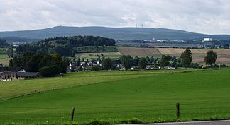
View over Vielbach am Lanzenberg (front) to the south to the Montabaurer Höhe with the Köppel (left) and the alarm pole |
||
| Highest peak | Alarm bar ( 545.2 m above sea level ) | |
| location | at Montabaur ; Westerwaldkreis , Rhineland-Palatinate ( Germany ) | |
| part of | Niederwesterwaldes | |
|
|
||
| Coordinates | 50 ° 25 ′ N , 7 ° 44 ′ E | |
| Type | Low mountain range | |
| rock | Quartzite | |

The Montabaurer Höhe is a 10 to 15 km long, mostly wooded mountain range in the southwestern Westerwald and is largely located in the Westerwaldkreis . The ridge is geographically classified as sub- natural area 324.1 of the Niederwesterwald (main unit 324) and contains at 545.2 m above sea level. NHN its highest mountain - the alarm pole . Its summit is located six kilometers west of the eponymous city of Montabaur and about 12 km northeast of Koblenz .
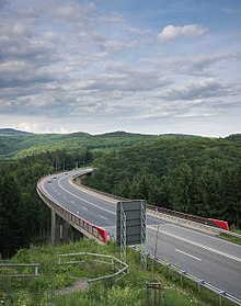
The Montabaurer Höhe is divided by the approximately 280 m high, clay- filled Ransbacher Mulde , through which the route of the federal motorway 48 runs, into the actual Montabaurer Höhe (in the south) and the up to 394 m high Neuhäusel state forest with the Hölzberg ( Hölzenberg ; in the north), both of which contain a lot of quartzite . The town of Ransbach-Baumbach is located within the depression immediately north of the motorway ; outside the depression, the Montabaurer Höhe is almost entirely wooded.
Location and limits
The Montabaurer Höhe lies almost entirely in the southwest of the Westerwaldkreis . Only a small, unpopulated strip in the extreme south is located in the district of Arzbach , Rhein-Lahn-Kreis .
Localities
The following communities surround the Montabaurer Höhe directly (counterclockwise):
- Association municipality of Ransbach-Baumbach
-
Verbandsgemeinde Höhr-Grenzhausen
- Kammerforst (north west)
- Höhr-Grenzhausen (south west)
- Hillscheid (west south)
-
Verbandsgemeinde Montabaur
- Kadenbach (south)
- Niederelbert (east south)
- Horressen (southeast)
- Elgendorf (south east)
- Verbandsgemeinde Wirges
In the Ransbacher Mulde , in addition to the central, eponymous city of Ransbach-Baumbach, the communities Hundsdorf (VG Ransbach-Baumbach, northwest) and Hilgert (VG Höhr-Grenzhausen, west) are located.
Streets
The federal motorway 48 crosses the ridge over the Ransbacher Mulde in the middle in a west-east direction and separates the completely wooded height focus in the south from the northern part. From east to north the ridge is flanked by the federal highway 3 , in the south by the federal highway 49 .
Natural structure
The Montabaurer Höhe is naturally allocated and structured as follows:
-
(to 32 Westerwald (natural area) )
-
(to 324 Niederwesterwald )
-
324.1 Montabaurer Höhe (in the broader sense)
- Montabaurer height in the narrower sense
- Ransbacher Mulde
- Hölzberg (Hölzenberg)
-
324.1 Montabaurer Höhe (in the broader sense)
-
(to 324 Niederwesterwald )
The three-part breakdown of the Montabaurer Höhe was not numbered in the breakdown on sheet 138 Koblenz , which is why there are no two-digit decimal numbers for these natural areas. However, it is listed explicitly and is also used by the Rhineland-Palatinate nature conservation authority.
Adjacent natural areas
The Montabaurer height the valley of the join in the northwest Saynbachs and Sayn-Wied Plateau on, to the west the Kannenbacker plateau which, to the south Emsbach-Gelbach Heights with Horchheimer height , Emsbachtal and plateau of Welschneudorf and to the east the Montabaurer Valley . In the far north, the Dierdorf depression is touched.
landscape
The mountain ranges in the north and south are continuously forested, but only like islands, close to nature, such as on Mahlbergskopf in the northeast and in places in the extreme south. There are spruce forests .
There are numerous clay quarries in the Ransbacher Mulde . It sees itself as part of the Kannenbäckerland known for its ceramic industry .
The southern part belongs entirely to the Nassau Nature Park . The Limes runs through its extreme southwest .
Waters
Due to the rapid increase in the Neuwied Basin in the west, the annual precipitation increases rapidly from 650 to 700 mm at the edge of the basin to 850 to 900 mm at the center of the Montabaurer Höhe.
The watershed between the Lahn and the systems of Hillscheider Bach flowing into the Rhine below the mouth of the Lahn and, north of the alarm pole , of Saynbach runs over the southern part, the "actual" Montabaurer Höhe . The watershed continues on the eastern edge of the Ransbacher Mulde to the north, which is why the Mulde slopes down to the west. The northern part of the Montabaurer Höhe (Neuhäusel State Forest) with the Hölzberg is drained, as is the Mulde completely to the Sayn.
The east of the "actual" height drains over the Gelbach to the Lahn. The Biebrichsbach , the main source of the Stadtbach , which flows into the Aubach in Montabaur, rises directly between the peaks of Alarmstange and Lippersberg . From then on this is called Gelbach.
In the south of the Höhe, south of the Lippersberg, the Hillscheiderbach rises, which it leaves at Hillscheid and drains to the west directly to the Rhine.
The Brexbach, which rises to the north of the "actual" height northwest of the Köppel and leaves the height to the west in the direction of Höhr-Grenzhausen , drains into the Sayn. Its right tributary Masselbach rises in the southeast of the Ransbacher Mulde, immediately north of the route of the A 48 , flows around the north of the Mulde via Ransbach and Hundsdorf to the west and leaves the natural area in Kammerforst .
In the Ransbacher Mulde in Ransbach-Baumbach , among other things, lies the Erlenhofsee , which was created through clay mining. The Brexbach was dammed in the north-west of the southern part to form some smaller fish ponds.
mountains

The mountains and elevations of the Montabaurer Höhe include - sorted by height in meters (m) above sea level (NHN; unless otherwise stated according to):
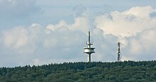
- Alarm bar ( ⊙ ); 545.2 m, central part; Rhein-Lahn-Wasserscheide , telecommunication tower Hillscheid alarm pole
- Köppel ( ⊙ ); 540.2 m, central part, northeast of the alarm pole; Rhine-Lahn watershed, Köppel observation tower
- Lippersberg ( ⊙ ; 534.4 m); Central part, southeast of the alarm pole
- Niessling ( ⊙ ; 406.5 m); South part, south of the alarm pole
- Hölzberg ( Hölzenberg ; ⊙ ); 394.0 m (north crest / summit), 391.2 m (south crest), northern part
- Mahlbergskopf ( ⊙ ); 359.0 (south crest / summit), 356.1 m (north crest), northern part, west of the Hölzberg
Individual evidence
- ↑ a b c d Map service of the landscape information system of the Rhineland-Palatinate nature conservation administration (LANIS map) ( notes )
- ↑ a b c d e f g Landscape profile of the landscape area 324.1 Montabaurer Höhe of the landscape information system of the Rhineland-Palatinate nature conservation administration ( notes )
- ↑ a b c Map services of the Federal Agency for Nature Conservation ( information )
- ↑ a b Heinrich Müller-Miny, Martin Bürgener: Geographical land survey: The natural spatial units on sheet 138 Koblenz. Federal Institute for Regional Studies, Bad Godesberg 1971. → Online map (PDF; 5.7 MB)
- ↑ Water Management Administration Rhineland-Palatinate - data via GeoExplorer
literature
- Mischa Ferdinand, Ursula Braun: The fern flora of the Montabaurer Höhe , Zweckverb. Nassau Nature Park, 1997


