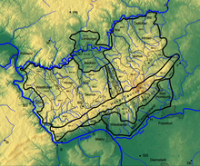
Harvester knolls
The Bodenroder Kuppen is a natural sub-unit of the eastern Hintertaunus (main unit 302) with the division number 302.2. It is bounded to the north by the valleys of Solmsbach and Kleebach , to the west by the valley of the Wiesbach and to the east by the Wetterau with the Mörlener Bucht (234.21) or by the Großenlindener Hügelland (348.11), which, like the valley adjoining to the north the Lahn , part of the Giessen basin .

Natural location
On the eastern edge of the Wetterau and Mörlener Bay there is a slight bulge on the plateaus of the eastern Hintertaunus in the Hesselberg ( 518 m ) and the local mountain ( 485.7 m ). The deeply cut valleys in between are traversed by the central streams of the Solmsbach , Kleebach and Wetzbach. In this north-eastern sub-area, the bottom harvesters appear as a more dissolved mountain and hill country. The Mörlen Bay encroaches on the lower mountain range of the Taunus between Bad Nauheim and Butzbach . It is bounded in the south by the Taunus main ridge, which slopes down from Winterstein ( 482.3 m ) to Johannisberg ( 264.8 m ). In the north it is entwined with arched plateaus around the local mountain near Butzbach, which (determined by volcanism) continue into the area of the Stoppelberg in the Hüttenberg / Wetzlar area of the Wetzlarer Hintertaunus (302.0) to the north .
The eponymous place of the Bodenroder Kuppen is Bodenrod in the valley head of the Eichelbach , a left southern tributary of the Solmsbach. Other places are Espa in the upper Solmsbach and Kleebachtal and Weiperfelden in the upper Solmsbachtal, which is about 750 m northeast, above the confluence of the Eichelbach in the Solmsbach.
- 302 Eastern Hintertaunus
- 302.2 Ground harvester knolls (52.70 km²)
Explanation of the name
The low mountain range is called croup and not hilltop . This naming should come from the Roman-Germanic end / transition phase. There the ground Roder croup presented the Germanic / Roman changing border situation at the southwest Wetterau edge is. Limes northern tip in central Germany with Roman forts / Limes line Saalburg / Butzbach / Münzenberg / Arnsburg / Schiffenberg / Langgoens and newer sites such Reiterkastell Glauberg .

Mountains and elevations
The mountains and elevations of the bottom harvester knolls include - sorted according to height in meters (m) above mean sea level (NHN):
- Hesselberg (approx. 518 m)
- Gickel (505.1 m)
- nameless elevation (500.8 m), northeast of the Markwald
- Markwald (493.0 m)
- Hornbeam head (492.3 m)
- Backmost head (491.1 m)
- Schmidtsheck (491.3 m)
- Hausberg (485.7 m)
- Donnerskopf (485.2 m)
- Gaulskopf (474 m)
- Vorderer Köppel (460.0 m)
- Goose Rod (448.5 m)
- Bruler Berg (424.2 m), southwestern foothills of the Hausberg
Individual evidence
- ↑ Eugen Ernst: Der Taunus - Ein L (i) ebensworth Mittelgebirge , Societäts-Verlag, 2009, p. 21 u. 34
- ↑ Map ( Taunus & Gießen-Koblenzer Lahntal ) and legend ( Taunus ) - attention: web links without return! - Environmental Atlas Hessen of the Hessian State Office for Environment and Geology: The natural areas of Hesse and their main units
- ↑ Map of soil harvesters . In: Landesgeschichtliches Informationssystem Hessen (LAGIS).
swell
- Federal Agency for Nature Conservation:
- Map services of the Federal Agency for Nature Conservation ( information )
- Landscape profile: Eastern Hintertaunus
- Environmental Atlas Hessen:
- map
- Description (natural area 302.0)