Cedeira
| Cedeira municipality | ||
|---|---|---|
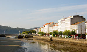
 Promenade in Cedeira
|
||
| coat of arms | Map of Spain | |

|
|
|
| Basic data | ||
| Autonomous Community : |
|
|
| Province : | A Coruña | |
| Comarca : | Ferrol | |
| Coordinates | 43 ° 40 ′ N , 8 ° 3 ′ W | |
| Height : | 137 msnm | |
| Area : | 85.42 km² | |
| Residents : | 6,640 (Jan 1, 2019) | |
| Population density : | 77.73 inhabitants / km² | |
| Postal code : | 15350 | |
| Municipality number ( INE ): | 15022 | |
| Nearest airport : | A Coruña | |
| administration | ||
| Official language : | Castilian , Galician | |
| Mayor : | Pablo Diego Moreda Gil (PSdeG-PSOE) | |
| Address of the municipal administration: | Avda. Castelao, 35 - 15350 Cedeira (A Coruña) - Tel .: +34 628 631 170 | |
| Website : | cedeira.es | |
| Location of the municipality | ||

|
||
Cedeira is a small port town and seaside resort in the province of A Coruña on the north coast of Galicia .
Geographical location
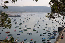
Cedeira is located in the protected bay named after her, Ría de Cedeira, at the mouth of the small rivers Río Condomiñas and Río Mestas . The latter forms the border with the territory of the municipality of Valdoviño . To the east, the municipality extends to the Garita de Herbeira on the Serra da Capelada . The sanctuary of San Andrés de Teixido also belongs to this area .
Sub-municipalities
Cedeira consists of the following parroquias :
- Cedeira (Santa María del Mar)
- Cervo (Santalla)
- Esteiro (San Félix)
- Montoxo (San Julián)
- Piñeiro (San Cosme)
- Régoa (Santa María)
- San Román de Montoxo (San Román)
politics
| Political party | 2015 | 2011 | ||
|---|---|---|---|---|
| Be right % | Seats | Be right % | Seats | |
| PP | 43.17% | 6th | 50.91% | 7th |
| PSOE | 23.38% | 3 | 29.83% | 4th |
| BNG | 13.61% | 2 | 13.54% | 2 |
| AINA | 13.84% | 2 | ||
history
Prehistory and Antiquity
The Serra da Capelada is home to the earliest evidence of human settlement in the neighborhood: stone tools that are more than 4,000 years old and the remains of dolmens are evidence of Neolithic culture. A single find on the edge of the path from Teixido testifies to the Copper Age around 1,500 BC. A rich find of polished stone axes has come down to us from the Bronze Age . Part of it is owned by the University of Santiago de Compostela , part of the legacy of the historian Federico Maciñeira . Another part, the yield of local finds, is owned by the city of Cedeira. They should find their place as exhibits in a planned local museum. Some of the axes date from the Mediterranean Bronze Age around 2,000 BC, while others were dated to the Atlantic Bronze Age around 1,500 BC.
Archaeological field research found further valuable pieces from the later Iron Age. There is hardly a parroquia in the area of Cedeira in which no evidence of one or more fortified settlements, so-called castros , has been found. The gold necklace of Montoxo dates from that period and is now exhibited in the National Archaeological Museum. A coin of Augustus from the Castro As Croas in Esteiro indicates that this place was still populated even in the early phases of Romanization.
Ptolemy gives us written evidence of the settlement of the region from Roman times . In his geographical work, he describes the current city of Ortiguera as Lapatiancorum Promontorium , Cape of the Lapatians . This is what the inhabitants of the area were called at that time.
middle Ages
In the ninth century there was a place on the seashore called Cetaria , probably the forerunner of Cedeira. A church dedicated to St. Mary as the patron saint of the sea may be the nucleus of the settlement that emerged in the 12th century. Medieval parchments tell of a settlement called Terra de Cetaria . The noble family of Count Traba ruled there. The church was an important power factor in the area: large estates around Cedeira passed into the possession of the monasteries of Pedroso, Xubia and Sobrado as well as the Order of Malta in the 12th century . In the 13th century, the same thing happened with the monastery of Oseira. Also in the 13th century the place took up trade relations with other cities and countries across the sea.
At that time a city wall was built. A castle was built in the 14th century. At that time the inhabitants became vassals of the noble Lemos family; a condition that lasted until the early 19th century. A large number of documents have survived from that time. They tell of the hard work in agriculture, of fraudulent merchants and clerks, of financial worries of the nobles and knights, the fear of enemy attacks from the sea, of alliances and festivals.
Modern times
In the 18th century, the Castelo da Concepción was built to protect against British attacks. The population had grown by then, but now the youth preferred to work in the Ferrol warehouses, where the work was paid more.
The first half of the 19th century turned out to be sad. The population shrank, the war of independence against the Napoleonic occupation cost great victims. Of the fifteen municipalities that belonged to the seat of the Cedeira court, eight left this association. This included San Juan de Moeche with its significant monthly market. In the second half of the century the place recovered. The city expanded its settlement area on the seashore, factories for canned meat and fish farms emerged, and money sent by emigrants contributed to prosperity.
This growth continued into the dawning 20th century. The city beautified itself, improved the supply and installed lighting. Tourism developed as an industry. The Spanish Civil War interrupted this positive development. After that, the place only gradually, then quickly regained importance and is now a well-kept holiday resort on the Galician north coast.
Population development

Source: INE archive - graphic processing for Wikipedia
Festivals
The most important festival of the year is August 15th, the Assumption of Mary . In honor of their patron saint Nuestra Señora del Mar , the fishermen go in a procession with their decorated boats.
The anniversary of San Cosme de Piñeiro is September 26th. On the following early Sunday morning at 1:00 a.m., a large fireworks display was set off at the church. Then there is music and dancing until the early hours of the morning.
Other festive days are:
- the consecration of San Isidro on May 15th;
- the consecration of San Antonio on June 13;
- the feast of St. Anne on July 26th;
- the feast of San Félix de Esteiro on July 31;
- the San Andrés Parish Fair on September 8th.
Recreation and sightseeing
Praza Roxa
The former Praza do Sagrado Corazón was called Praza Roxa , Red Square, by the local population for many years because of its red covering . In June 2016, the city government decided to officially adopt this popular name.
A large part of small-town life takes place in the square and in the cafés around it. Children play in the playground at the north end of the square or use the smooth red surface for fast rides on scooters, children's bikes or roller blades.
beaches
Cedeira has a large main beach and a number of small, partly hidden beaches:
- The main beach, the 1,400 m long Praia da Magdalena , is right next to the city. It's flat, sheltered and family-friendly. At low tide, however, the end of the river at the mouth of the river turns into a mud flats in whose silt the locals look for navajas , razor clams .
- The Praia Area Longa is located at the port and is not muddy at low tide.
- The Praia Sonreiras is below Punta Sarridal and is accessible by a footpath or by boat.
- The Praia Mi Señora located on the north side of the headland Punta Robaleira and is accessible only on foot. You can only swim there at low tide, because the small sandy beach disappears completely under water at high tide.
- The Praia das Burbullas (span. Burbujas for air bubbles) is located on the south side of Punta Robaleira and is also accessible only on foot. It bears this name because of the air bubbles emerging from the sand at low tide.
Praia Vilarrube, which can be reached in a few minutes by car, is also popular with bathers in Cedeira . The protected dune and wetland area with its large sandbank is located south of the Punta Robaleira headland , but is already part of the Valdoviño area .
building
- The Gothic parish church of Santa María do Mar was built in the 14th century in place of an ancient predecessor. It consists of three naves, a rectangular apse and a chapel. Later side parts were added, so that a transept and a cross-shaped floor plan were created.
- The Castelo da Concepción towers over the harbor on the ridge of the Punta Sarridal .
- The chapel of Ermida de San Antonio de Corveiro , built in the 17th century, is only a few hundred meters away as the crow flies, but can only be reached via a kilometer-long detour by road .
- In the center of the town there are a number of well-kept buildings in typical Galician architecture with bright, glazed verandas .
- The two lighthouses at Punta Candieira and at Punta Robaleira mark the entrance to the Bay of Cedeira. The Punta Candieira can be reached by car via a narrow, approx. 8 km long mountain road. To Punta Robaleira you just come to walking on a path through dense eucalyptus forest.
Individual evidence
- ↑ Cifras oficiales de población resultantes de la revisión del Padrón municipal a 1 de enero . Population statistics from the Instituto Nacional de Estadística (population update).
- ↑ 2015 Spanish Ministry of the Interior ( page no longer available , search in web archives ) Info: The link was automatically marked as defective. Please check the link according to the instructions and then remove this notice.
- ↑ 2011 Spanish Ministry of the Interior
- ↑ The illustration in the sections on the history of the website follows, unless explicitly stated otherwise, Historia ( Memento of the original of 3 February 2015, Internet Archive ) Info: The archive link is automatically inserted and not yet tested. Please check the original and archive link according to the instructions and then remove this notice. from Todocedeira.com as amended on October 3, 2014
- ↑ Jose Couceiro Formigo: Galicia . Editorial Everest, Léon. P. 69. ISBN 978-84-241-0058-2 .
- ↑ Tobias Büscher: Galicia and Jacobsweg . Dumont Travel Paperback. P. 208. ISBN 978-3-7701-7397-6 .
- ↑ Playas ( Memento of the original from July 21, 2014 in the Internet Archive ) Info: The archive link was inserted automatically and has not yet been checked. Please check the original and archive link according to the instructions and then remove this notice. at Todacedeira.com , accessed October 3, 2014
- ↑ Lonely Planet Spain , p. 544. ISBN 978-3-8297-2301-5
Web links
- Información de Turismo Rural de Cedeira , rural tourism around Cedeira
- Tourist Information


