Touro (A Coruña)
| Touro municipality | ||
|---|---|---|
| coat of arms | Map of Spain | |

|
|
|
| Basic data | ||
| Autonomous Community : |
|
|
| Province : | A Coruña | |
| Comarca : | Arzúa | |
| Coordinates | 42 ° 52 ′ N , 8 ° 19 ′ W | |
| Height : | 322 msnm | |
| Area : | 115.34 km² | |
| Residents : | 3,574 (Jan 1, 2019) | |
| Population density : | 30.99 inhabitants / km² | |
| Postal code : | E-15122, 15819, 15822, 15966 | |
| Municipality number ( INE ): | 15085 | |
| Nearest airport : | Santiago de Compostela Airport 19.90 km | |
| administration | ||
| Mayor : | Ignacio Codesido Barreiro ( PPdeG ) | |
| Address of the municipal administration: | Carrer Fuente Diaz, s / n - 15822 TOURO | |
| Website : | concellodetouro.com | |
| Location of the municipality | ||

|
||
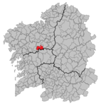
Touro is a municipality , a parroquia and a place in the province of A Coruña of the autonomous community of Galicia , in the north of Spain . The 3574 inhabitants (as of January 1, 2019) live on an area of 115.34 km 2 , 83.30 kilometers from the capital A Coruña .
history
Wall castles from the time of the Castro culture attest to the early settlement of the community.
The settlement of the region is proven up to the time of the Romans .
The first mention by name comes from the 12th century, when Diego Gelmírez describes the pilgrimage route via Touro in the Codex Calixtinus .
Attractions
- The parish churches of the Parroquias offer an insight into the religious architecture of the region.
- Numerous structures from Hórreos of farms to country houses and castles are scattered in the municipality.
On the Camino de Santiago
The Camino Francés has been running through the municipality for ages, which has left its mark. Numerous pilgrim hostels are along the way.
politics
The municipal council is elected every four years, the seats are distributed as follows:
| Political party | 1995 | 1999 | 2003 | 2007 | 2011 |
| PP | 4th | 5 | 9 | 8th | 8th |
| PSOE | 8th | 1 | 1 | ||
| Democracia Galega | 7th | ||||
| BNG | 1 | 2 | 2 | 2 | |
| AVT | 1 | ||||
| Total | 13 | 13 | 11 | 11 | 11 |
Source: Spanish Ministry of the Interior
economy
| Employees | Percentage | ||||
|---|---|---|---|---|---|
| total | 281 | 100 | |||
| Agriculture, livestock and fishing | 7th | 2.49 | |||
| Industry | 47 | 16.73 | |||
| Construction industry | 72 | 25.62 | |||
| Service companies | 134 | 47.69 | |||
| Others | 21st | 7.47 | |||
| * Data from the Statistical Institute of Galicia, status 2011 , IPI | |||||
Demographics

Source: INE archive - graphic processing for Wikipedia
Parroquias
| Name spanish |
Patronage (nickname) |
Residents | location | Name spanish |
Patronage (nickname) |
Residents | location |
|---|---|---|---|---|---|---|---|
| Andeade | Santiago | 112 |
|
Foxás | San Breixo | 257 |
|
| Bama | San Vicenzo | 288 |
|
Loxo | Santa María | 439 |
|
| Bendaña | Santa María | 66 |
|
Novefontes | Santiago | 144 |
|
| Beseño | San Cristovo | 213 |
|
Prevediños | Santiago | 329 |
|
| Calvos de Socamiño | San Martiño | 170 |
|
Quión | San Fiz | 348 |
|
| Circes | Santa Mariña | 116 |
|
San Miguel de Vilar | San Miguel | 225 |
|
| Cornado | Santiso | 148 |
|
San Pedro de Ribeira | San Pedro | 97 |
|
| Enquerentes | San Miguel | 64 |
|
Touro | San Xoán | 639 |
|
| Fao | Santa Uxía | 207 |
|
Turces | Santa María | 193 |
|
| Fontes Rosas | San Xoán | 27 |
|
Total | 4082 |
Web links
Individual evidence
- ↑ Cifras oficiales de población resultantes de la revisión del Padrón municipal a 1 de enero . Population statistics from the Instituto Nacional de Estadística (population update).
- ^ Touro ( Spanish ) Spanish Ministry of the Interior. May 22, 2011. Accessed November 16, 2019.
