O Pino
| O Pino municipality | ||
|---|---|---|
| coat of arms | Map of Spain | |

|
|
|
| Basic data | ||
| Autonomous Community : |
|
|
| Province : | A Coruña | |
| Comarca : | Arzúa | |
| Coordinates | 42 ° 56 ′ N , 8 ° 20 ′ W | |
| Height : | 488 msnm | |
| Area : | 131.90 km² | |
| Residents : | 4,641 (Jan 1, 2019) | |
| Population density : | 35.19 inhabitants / km² | |
| Postal code : | E-15818 | |
| Municipality number ( INE ): | 15066 | |
| Nearest airport : | Santiago de Compostela Airport 13.30 km | |
| administration | ||
| Mayor : | Manuel Taboada Vigo ( PPdeG ) | |
| Address of the municipal administration: | Rúa do Concello, s / n - Pedrouzo, Arca (O Pino) | |
| Website : | www.concellodeopino.com | |
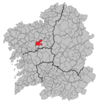
| Location of the municipality | ||

|
||
O Pino (sometimes incorrectly: El Pino ) is a municipality , a parroquia and a place in the province of A Coruña of the autonomous community of Galicia in the north of Spain . The 4641 inhabitants (as of January 1, 2019) live on an area of 131.90 km 2 , the place is 76.70 kilometers from the government capital A Coruña .
history
It is very likely that people lived here as early as the Bronze Age . Excavations to prove this are currently (2012) carried out near the village of San Lourenzo de Pastor.
The settlement of the region is proven up to the time of the Romans . The Roman bridge at A Ponte Puñide is still almost in its original state and was an important point on the Roman military route from Braga to Astorga . There is also said to have been a Roman settlement near the bridge, which is still being searched for.
economy
| Employees | Percentage | ||||
|---|---|---|---|---|---|
| TOTAL | 686 | 100 | |||
| Agriculture, livestock and fishing | 343 | 50.00 | |||
| Industry | 78 | 11.37 | |||
| Construction industry | 154 | 22.45 | |||
| Service companies | 111 | 16.18 | |||
| * Data from the Statistical Office for Economic Development in Galicia , IPI | |||||
Attractions
- Sobrado Monastery ( Santa María de Sobrado ) from the 10th century
- Parish churches of the Parroquias offer an insight into the religious architecture of the region
- Roman bridge at "A Ponte Puñide" (dated 360/70)
- Numerous structures from Hórreos of farms to country houses and castles are scattered in the municipality
On the Camino de Santiago
The Camino Francés has been leading through the municipality since ancient times, which has left its mark. Numerous pilgrim hostels are along the way.
politics
| Political party | 2015 | 2011 | ||
|---|---|---|---|---|
| Be right % | Seats | Be right % | Seats | |
| PSOE | 24.42% | 3 | 19.89% | 2 |
| PP | 58.13% | 7th | 65.85% | 8th |
| BNG | 15.41% | 1 | 12.29% | 1 |
Demographics

Parroquias
| Name spanish |
Patronage (nickname) |
Residents January 1, 2019 |
location |
|---|---|---|---|
| Arca | Santaia | 805 |
|
| Budiño | Santa María | 436 |
|
| Castrofeito | Santa María | 480 |
|
| Cebreiro | San Xiao | 272 |
|
| Cerceda | San Miguel | 367 |
|
| Ferreiros | San Breixo | 401 |
|
| Gonzar | Santa Maria | 492 |
|
| Lardeiros | San Xiao | 388 |
|
| Medin | Santo Estevo | 309 |
|
| pastor | San Lourenzo | 211 | |
| Pereira | San Miguel | 268 |
|
| O Pino | San Vicenzo | 235 |
|
| San Mamede de Ferreiros | Santa Mamede | 270 |
|
Web links
Individual evidence
- ↑ Cifras oficiales de población resultantes de la revisión del Padrón municipal a 1 de enero . Population statistics from the Instituto Nacional de Estadística (population update).
- ↑ 2015 Spanish Ministry of the Interior ( page no longer available , search in web archives ) Info: The link was automatically marked as defective. Please check the link according to the instructions and then remove this notice.
- ↑ 2011 Spanish Ministry of the Interior
