A Laracha
| A Laracha municipality | ||
|---|---|---|
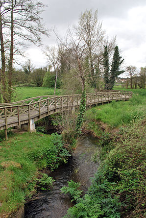
 Rio Quenxe near Laracha
|
||
| coat of arms | Map of Spain | |

|
|
|
| Basic data | ||
| Autonomous Community : |
|
|
| Province : | A Coruña | |
| Comarca : | Bergantiños | |
| Coordinates | 43 ° 15 ′ N , 8 ° 35 ′ W | |
| Height : | 184 msnm | |
| Area : | 125.95 km² | |
| Residents : | 11,347 (Jan 1, 2019) | |
| Population density : | 90.09 inhabitants / km² | |
| Postal code : | 15145 | |
| Municipality number ( INE ): | 15041 | |
| Nearest airport : | A Coruña Airport 25 km | |
| administration | ||
| Mayor : | José Manuel López Varela ( PP ) | |
| Address of the municipal administration: | Av. Finisterre, 0, 15145 A Laracha, Tel .: +34 981 60 50 01 | |
| Website : | concellolaracha.com | |
| Location of the municipality | ||

|
||
A Laracha ( Galician ) or Laracha ( Spanish ) is a municipality in Galicia . It is located 22 km southwest of the city of A Coruña . The municipality extends from the coastal town of Caión in the north a few kilometers inland. Neighboring communities are Arteixo , Culleredo , Cerceda and Carballo .
Population development municipality

Sub-municipalities
Laracha consists of the following parroquias :
|
|
The town of Cendón belongs to the municipality .
Personalities
- The Franciscan Lino Gómez Canedo (1908–1990), a historian with a valuable legacy of old documents, was born in the Parroquia San Xián de Coiro.
- The actor Enrique Muiño (1881–1956), who emigrated to Argentina with his family, was born in A Laracha.
- The basketball player José Ramón Esmoris (* 1975) comes from the community.
Web links
Commons : A Laracha - Collection of images, videos and audio files
Individual evidence
- ↑ Cifras oficiales de población resultantes de la revisión del Padrón municipal a 1 de enero . Population statistics from the Instituto Nacional de Estadística (population update).
