
Haintchen
|
Haintchen
Selters (Taunus) municipality
Coordinates: 50 ° 21 ′ 36 ″ N , 8 ° 19 ′ 1 ″ E
|
|
|---|---|
| Height : | 363 m above sea level NN |
| Area : | 12.02 km² |
| Residents : | 891 (Dec. 31, 2019) |
| Population density : | 74 inhabitants / km² |
| Incorporation : | July 1, 1974 |
| Postal code : | 65618 |
| Area code : | 06475 |
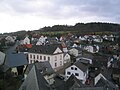
 View of Haintchen
|
|
Haintchen is a district of the municipality of Selters (Taunus) in the central Hessian district of Limburg-Weilburg .
Geographical location

Haintchen is located in the eastern Hintertaunus , on a plateau on the watershed between the valleys of Emsbach and Weil , on the northwestern foothills of the Feldberg-Langhals-Pferdskopf-Scholle , northwest of the Großer Feldberg . Right on the border of the Limburg-Weilburg district and the Hochtaunus district in the Taunus Nature Park .
The village extends in a valley basin of the Eisenbach that opens to the northwest , between the elevations of the Koberg ( 461 m ) in the south and the Blumenstück ( 445 m ) in the southeast. Other elevations are the Hebenberg ( 440 m ) in the southwest, the Liewersberg ( 475 m ) in the southeast and the Suterkopf ( 462 m ) south of the Koberg . The altitude of the district is in the middle course of the Eisenbach valley in the west at around 300 m and in the elevations in the south reaches up to 500 m above sea level. NN . The district area is 12.02 square kilometers, of which 7.43 km² is forest area.
From the higher parts of the village, when the weather is clear, there is a wide view to the west over the Goldener Grund to the foothills of the western Hintertaunus. To the northwest over the Limburg Basin to the Westerwald . To the north over the foothills of the Eastern Hintertaunus and Weilburger Lahntalgebiet to the Westerwald and to the northeast towards the Gladenbacher Bergland with the basalt cone of the Dünsberg . This distant view extends on cold, clear winter days, when there is an inversion weather situation, sometimes up to 40 kilometers away.
The next larger cities in the area are Bad Camberg (12 km southwest), Limburg a. d. Lahn (21 km northwest) and Usingen (22 km east).
The district borders on Eisenbach and Münster in the west . The Weilmünster districts of Wolfenhausen , Laubuseschbach and Langenbach connect to the north and northeast . The Hochtaunuskreis with the Weilroder districts of Emmershausen and Hasselbach connects to the east and southeast .
history
First mention
The first documentary mention is from 1388. In the mention of July 25, 1388 in a continuation of the interest book of the Cistercian convent Gnadenthal created by Abbess Sophie von Lindau, it says: "Item we all born jar the kyerchin to the Hayne 1/2 punt waisis un (d) 6 young h. zu oistirn also von Husin, unsim hoibe.- "(So every year we give the church at Haintchen half a pound of wax and six young Heller at Easter also from Hausen, our farm).
As early as 1388 there was a predecessor of today's church in the village, probably also consecrated to Saint Nicholas as the patron saint of travelers due to its location on the old Hessenstrasse . There was also an extensive rectory with the old rectory and the barn.
Regional and feudal lords were Diez , later Nassau and Kurtrier , the official seat was the nearby Camberg. The place was probably created as a clearing settlement in the 11th or 12th century. The name Haintchen can be derived from the old word " Hain ", cleared or light and cherished forest. The location on the old West / East Fernstraße, which was only recently called Hessenstraße, suggests that the village had existed for several centuries when it and its church were first mentioned in the Gnadenthal interest book of 1388. An important property near the village was the Hof zu Hausen , which is also mentioned in the document from 1388 and still exists today, but now in the area of the neighboring town of Eisenbach .
Early spellings: Hayne, Haynchen, Hayngen, Haingen, Haintgen.
Walk through the centuries

The protected valley location and the favorable location halfway up the site, with a wide view of the surrounding area, were probably decisive for the foundation of the village at that time. The trade route of the old Hessenstrasse , which runs through the village, and the Rennstrasse , which leads directly past Haintchen , were also important transport and transshipment routes for the village at that time.
Late Middle Ages
At that time, the Haintchen court was probably assigned to the Camberg office, the beginnings of which as an administrative district around the castle and town of Camberg go back to that time. Since then, Haintchen has remained linked to the Counties of Diez and Camberg under the heirs and pledges of this part. The Lords of Eppstein received a further quarter in 1428, which, however, was bought in 1453 by the Counts of Katzenelnbogen and in 1479 as heir to the Landgraves of Hesse . At times Nassau-Dillenburg had pledged another eighth between 1454 and 1481 to Katzenelnbogen and later to Hesse.
Early modern age
In 1508 the Eppstein half came to the Counts of Königstein-Eppstein . When these died out in 1535, Kurtrier, as feudal lord, took possession of this half by force. It was a heavy price to pay for the families of the heirs who had in good faith consented to the transfer of fiefdom from the kingdom to Kurtier. In the Frankfurt Treaty, which ended the dispute over the Katzenelnbogen inheritance, Hesse gave its quarter to Nassau-Dillenburg in 1557 . Since then Kurtrier and Nassau-Dillenburg were each half masters of this community of the Camberg district. For more than 200 years, the ownership structure for Haintchen has not changed.
From 1607 to 1628 Nassau-Hadamar was half involved in the Nassau half alongside Nassau-Diez . Thereafter, this half of the community was part of the county, since 1655 of the Principality of Nassau-Diez.
Before the Thirty Years' War there were 40 households in Haintchen, i.e. about 240 inhabitants. The old, guaranteed news from the Wiesbaden archive show how terrible this war was. In 1620 the Spanish-Walloon army under Count Spinola came through Haintchen and spread fear and terror. In 1622 34 men from Haintchen were drafted and drafted in Camberg. Marshal Tilly camped in this area too . It is well known how much money, food and feed had to be given for the horses. In 1626 Wallenstein came to this area and brought the plague with him as a gift from the war. Bad harvests and diseases did not allow the population to rest, and when peace was finally concluded in 1648, 16 people were still living in Haintchen.
The villages of Frohndorf, Wilhelmshain, Bruchhausen, Obernhain and Nahausen were close to the village, but did not survive the Thirty Years' War and had disappeared from the ground. For decades the pastor of Eisenbach also had to pastorate Niederselters , Hasselbach and Haintchen. “He came to care for the sick and to comfort the troubled.” It was not until 1650 that Haintchen and Hasselbach got a common pastor.
A smaller church stood on the Kirchberg, probably built around the middle of the 17th century. Before that there was a chapel, the so-called Old Chapel with Hohenfeld Castle (also known as Hohenfeld Castle). Like the villages of Obernhain and Steinbruch, it had suffered badly in the Thirty Years' War and died when peace was made. From the castle cave in the western Eisenbachtal there is said to have been an underground tunnel (passage) to connect to Hohenfeld Castle on the Kirchberg. The entries speak for their constituents book Stock of Haintchen. In old purchase files there is a plot of land on Kirchberg listed as Hohenfeldches plot. The meadow areas south of the Kirchberg and the road are referred to as von Hohenfeldche Wiesen. Around 1900 the schoolchildren sang a little song at a dance that had survived from the Hohenfeldchen era and refers to the countess of the same name. The family of the "governor of the Nassau region", Achatius von Hohenfeld , owned the "Hof zu Hausen" estate at that time. This noble family came from Aistersheim Castle in Upper Austria and resided in nearby Camberg. On a map from 1711, the forest district close to the village: Laubus, a Hohenfeld chapel is shown there.
Haintchen belonged to the Principality of Orange-Nassau since 1743 . Temporary pledging of the Trier and Nassau halves can be disregarded here. Triggered by the French Revolution, there was also a large-scale political land consolidation here.
In the 18th century, the village experienced a huge boom. There was an extraordinarily heavy haulage on the Hessenstrasse which ran through the village. There was a horse-changing station in the old "Zum Hirsch" inn on Hessenstrasse, where carters and travelers could stop off. The horse-drawn carts loaded with pitchers of the carbonate Seltzer water drove into the whole of Hesse . The removal of iron and silver ores from the mine near Haintchen made the old Hessenstrasse an important transport route. Haintchen was at the center of it and probably had a considerable number of inhabitants in this heyday. During this period of upswing, from 1749 to 1750, a new Catholic church was built in the Baroque style and inaugurated in 1751 by the Trier Elector Franz Georg von Schönborn . With its tower reaching towards the sky, the church represents the outstanding focal point from all directions of the village.

Within the old Camberg Office, Haintchen was the fourth largest town after Camberg, Erbach and Würges . In 1790 it had 312 inhabitants. In Haintchen lived five manorial freemen and 269 taxable subjects and 38 residents, residents without full citizenship and without own property. The old town hall in Haintchen not only housed the municipal administration, but also the municipal bakery.
The two equal rulers Kurtier and Nassau-Dillenburg were at the end of the 18th century the Elector and Archbishop of Trier, Clemens Wenzeslaus of Saxony , and the Prince of the House of Nassau-Orange, Wilhelm V. In the French Revolution, on November 9th, 1792 advanced The French troops coming from Königstein and Usingen entered the Camberg office and briefly occupied Haintchen, whose Nassau-Orange mayor and the council had to pay a total of 517 guilders for food and lodging costs. (Due to the looting, the offices became impoverished). It was not until 1831 that the mayor was able to inform the council that Haintchen was free of debt.
19th century
On May 31, 1802, the famous robber Johannes Bückler , also known as Schinderhannes, was arrested on the border between Haintchen and Wolfenhausen. The arrest was in the area mentioned at the time: Almenseifen, today this is called Hinterm Ziegengraben. There was the old border of the former Community Office Camberg to the Highness of Wied-Runkel .
Before 1806 the place was divided into two parts: the upper village and the lower village. Haintchen used to belong politically to the Electorate of Trier, partly to Nassau-Orange. In 1816 the village came to the Usingen district .
In 1839 the first cemetery complex was laid out , outside the existing churchyard at the St. Nicholas Church, northeast outside the village at the current location. This covered an area of 3000 square meters.
At the beginning of July 1843 the foundation stone for the new school building was laid. A year later, at the end of October 1844, the schoolhouse was officially inaugurated.
In the late summer of 1857, another important construction project could begin: the construction of a well pipe. In March of the following year, water flowed from the spring into the village well for the first time. In order to be able to better supply the upper part of the village, land was acquired in the Laubus forest district in order to develop another spring.
Dysentery epidemic 1872
At the end of the Franco-Prussian War in 1870/71, a soldier who had dysentery - according to current knowledge a highly contagious gastrointestinal inflammation - came back home. In 1872 there was a very dry summer and autumn. The contagious disease spread very quickly and residents died every day. In September, more than 50 people from Haintchen fell ill with dysentery, 17 infected people died. It was noticeable that most of the sick people were counted in the upper part of the village and that the majority of those affected were women. The residents didn't know what to do and said: Only God can help. They decided to take a vow, with a nine-day devotion to St. Sebastian and a procession with the Holy of Holies . When the procession lined up for the first time on the Sunday after Michael (29 September) and you left the church, it suddenly became very dark. As the procession moved through Gartenstrasse, it began to rain. When you got to the lower village, it was raining harder and harder; no one opened the umbrella and no man put his hat on. People got soaked to the skin. The pastor went with two altar boys with the holy of holies in every courtyard where there was a dysentery and gave the blessing again. When they came back to the church, the pastor blessed all participants in the procession. It kept raining all day. When the next morning to light rang, all opened the window; but there was no longer a death knell. Here and there a resident from Haintchen fell ill, but none of them died. After three weeks, during which four doctors and the pastor worked tirelessly, the disease was finally overcome. The doctors had also prescribed schnapps and red wine as antidotes, which apparently also helped.
With astonishment at the versatility of the citizens of Haintchen, the then teacher Pehl wrote the following: "In general, one could have thought that the oppressive, frightening feeling would have found some echo in the actions of the residents; after about 3 weeks alone this was Parish fair celebrated, and lo and behold - it went in the most jovial way. "
Even today, on the Sunday after the feast of St. Michael, the vow is held in Haintchen in the form of the "Ruhr procession".
20th century

In spring 1906, the cemetery laid out in 1839 was expanded to include a new facility.
In the summer of 1906 the government in Wiesbaden finally granted permission for the construction of a "high-pressure water pipeline" after having been complaining about a water emergency for years. The source was created in the direction of Obernhain of the source area of the Eisenbach. On October 1, 1908, the water pipe was handed over and the whole village was provided with very good water.
During the First World War , 20 people fell and 4 were missing. For the two small bells requisitioned in 1917, two new ones were procured in 1926.
In 1921 the conditions for the supply of electricity were created . A transformer house, called "Lichthäuschen", was built on the upper Hessenstrasse. On the Friday before Pentecost 1922, Haintchen was supplied with electricity for the first time.
In the 1920s, the planning for a war memorial was in progress. This was then built in 1929 at the St. Nicholas parish church.
In 1932 Haintchen was spun off from the Usingen district and joined the Limburg district with Hasselbach .
At the end of March 1945, the end of the Second World War was near for Haintchen. A group of SS men was still in the village intending to offer resistance. American tanks drove through Wolfenhausen on Wednesday in Holy Week. On Maundy Thursday, the SS mined the intersection and then moved in the direction of Hasselbach. During the night, some courageous men put up a warning barrier in front of the mined intersection. Perhaps that is why Haintchen was saved from destruction, because on Good Friday morning, March 30, 1945, 12 heavy tanks were standing in the field of the guard hedge, the cannons aimed at the village. The American soldiers cleared the mines at the intersection and the war was over for Haintchen. The Mariengrotto was later built out of gratitude. There were 29 people killed and 11 missing.
A large contingent of troops was in the village over the Easter weekend. This is because the SS group shot 12 Americans with machine guns on the border to Hasselbach.
In the course of 1946, more than 200 displaced persons were assigned to Haintchen, which increased the population of the small village immensely. In the two halls of the inn, "Zum Hirsch" and "Zum Taunus", the arriving people were initially accommodated in mass quarters.

In 1950 the two large bells that had been requisitioned in 1942 could be procured again.
In 1961, a 100-meter-deep drilling well was sunk in the quarry east of the village . Unfortunately, however, it did not produce the desired success and therefore a second well had to be built in 1973 at the "Kölbenköpfel" in the upper Eisenbachtal.
In 1973/1974 the cemetery complex was expanded again and a new cemetery hall was built, which was inaugurated on May 21, 1974.
Until June 30, 1974, Haintchen was an independent municipality. As part of the regional reform in Hesse , the municipality of Haintchen was merged on July 1, 1974 with the previously independent municipality of Niederselters, Eisenbach and Münster to form the new municipality "Selters (Taunus)".
In 1976 the new kindergarten building was built with great ambition in the village, and in 1977 it was commissioned and opened.
In 1980 Haintchen was awarded the title of state-recognized resort and thus documented as a destination. The identification signs are at the entrance to the village, they are signs carved from wood.
In 1988, in mid-June (over the weekend of June 17th ), the first documentary mention of the 600-year history of Haintchen is celebrated.
Old streets and old footpaths
The old Hessenstrasse was an important transport route for the village at that time. The road L3449 coming from Niederselters has the same course as the old Hessenstraße.
The Rennstraße, which comes from Hasselbach in the southeast, passes Haintchen in the immediate vicinity, was once one of the most important trade routes and high-altitude routes that connected the Rhine-Main area with the Hintertaunus and led to Weilmünster . The course of this old street can probably be dated to the Franconian period.
Territorial history and administration
The following list gives an overview of the territories in which Haintchen was located and the administrative units to which it was subordinate:
- before 1803: Holy Roman Empire , (1/2) Kurfürstentum Trier , Unteres Erzstift and (1/2) Principality Nassau-Diez , Amt Camberg
- from 1803: Holy Roman Empire, Principality of Nassau-Weilburg (through Reichsdeputationshauptschluss ), Office Camberg
- from 1806: joint ownership of the principalities of Nassau-Usingen and Nassau-Orange
- from 1816: German Confederation , Duchy of Nassau, Office Usingen
- from 1849: German Confederation, Duchy of Nassau, Idstein district office
- from 1854: German Confederation, Duchy of Nassau, Usingen office
- from 1867: North German Confederation , Kingdom of Prussia , Province of Hessen-Nassau , Administrative Region of Wiesbaden , Untertaunus District
- from 1871: German Empire , Kingdom of Prussia, Province of Hessen-Nassau, administrative district of Wiesbaden, Untertaunuskreis
- from 1886: German Empire, Kingdom of Prussia, province of Hessen-Nassau, administrative district of Wiesbaden, district of Usingen
- from 1918: German Empire, Free State of Prussia , Province of Hessen-Nassau, Administrative Region of Wiesbaden, District of Usingen
- from 1932: German Empire, People's State of Hesse , Limburg district
- from 1944: German Empire, Free State of Prussia, Nassau Province , Limburg District
- from 1945: American zone of occupation , Greater Hesse , Wiesbaden district, Limburg district
- from 1949: Federal Republic of Germany , State of Hesse , Wiesbaden district, Limburg district
- from 1968: Federal Republic of Germany, State of Hesse, administrative district Darmstadt , district Limburg
- On July 1, 1974, Haintchen was incorporated as a district of the newly formed community of Selters (Taunus).
- from 1974: Federal Republic of Germany, State of Hesse, administrative district Darmstadt, district Limburg-Weilburg
- from 1981: Federal Republic of Germany, State of Hesse, Gießen district, Limburg-Weilburg district
Population development
Population in the 17th to the middle of the 18th century:
- in 1610 about 240
- 1648 (after the end of the Thirty Years War) 16
- 1659 about 75 inhabitants
- 1665 about 85 inhabitants
- 1700 about 160 inhabitants
- 1755 about 250 inhabitants
Population from the end of the 18th century:
| Haintchen: Population from 1792 to 2014 | ||||
|---|---|---|---|---|
| year | Residents | |||
| 1792 | 312 | |||
| 1834 | 594 | |||
| 1840 | 629 | |||
| 1846 | 664 | |||
| 1852 | 677 | |||
| 1858 | 632 | |||
| 1864 | 691 | |||
| 1871 | 639 | |||
| 1875 | 663 | |||
| 1885 | 643 | |||
| 1895 | 640 | |||
| 1905 | 596 | |||
| 1910 | 567 | |||
| 1925 | 526 | |||
| 1939 | 532 | |||
| 1946 | 810 | |||
| 1950 | 722 | |||
| 1956 | 653 | |||
| 1961 | 689 | |||
| 1967 | 716 | |||
| 1970 | 747 | |||
| 1987 | 875 | |||
| 1999 | 969 | |||
| 2006 | 982 | |||
| 2012 | 949 | |||
| 2014 | 922 | |||
| Data source: Historical municipality register for Hesse: The population of the municipalities from 1834 to 1967. Wiesbaden: Hessisches Statistisches Landesamt, 1968. Other sources: | ||||
Culture and sights
societies
- Choral society "Sängerkranz" 1886 Haintchen eV
- Gymnastics and Sports Club 1902 Haintchen eV
- Freiwillige Feuerwehr Haintchen eV, founded in 1932 (since November 14, 1973 with its youth fire brigade )
- VdK local group Haintchen / Ts., Founded in 1951
- Rifle club "Hubertus" 1967 Haintchen eV
- Interest group kindergarten 1976 Haintchen eV
- Beautification Community 1978 Haintchen eV
- Motorcycle club "Taunuswölfe" 1980 Haintchen eV
- Haintchener Backesverein eV ( Heimatverein )
Buildings

For the listed cultural monuments of the place see the list of cultural monuments in Haintchen .
Baroque church of St. Nicholas
The Catholic parish church, built between 1749 and 1750, which was placed under the patronage of St. Nicholas , is one of the few places of worship in the wider area whose complete furnishings from the Baroque era , the 18th century, have been preserved. It is an east-facing hall church with a narrower choir closed on three sides. The interior has a trough-shaped wooden barrel vault with eight painted oval medallions with stucco frames. The classicist sober room setting dates from around 1810. The elaborate furnishings from the Baroque period , which come from the Hadamar school, are almost completely preserved .
The 36 m high west tower, which is crowned by a baroque hood , looks far into the valley floor. The magnificent summer linden tree , which has been protected by nature conservation since 1934 by the then District Administrator of the Limburg district , helps to complete the sight.
School building (former elementary school)

The schoolhouse, built between 1843 and 1844 in the late Classicist style, is stately and still emphasized by the high location, and is another attraction of the village. The former school stable (economic building), which was converted into a new classroom in 2002/2003, is symmetrically located in the courtyard.
Until the end of the school year 1967/1968 the building served as a primary school . Since the school year 1968/1969 the school building was used as a primary school. In August 2012, on the initiative of the headmaster of the Niederselters center school, first, second and third grade classes were given at the Niederselters location. Only the 4th grade was taught in Haintchen until the summer holidays of the 2012/2013 school year. In August 2013 there was no more schooling at the Haintchen location. Up until this point in time, the Haintchen primary school was one of the smallest primary schools in the Limburg-Weilburg district.
→ Main article: Schoolhouse (Haintchen)
Holy houses and wayside shrines

Also worth mentioning are several holy houses and shrines that can be found in the village and in the district. Most of these were built in the 18th century. Holy houses are mostly built on paths on the outskirts of the village, where in earlier times long distances were covered by foot to get to the surrounding villages. There they prayed for a safe way there and back.
The youngest saint's house is dedicated to St. Hubertus and was built in 1992 by the "Hubertus" Haintchen shooting club. In November 2008, a two-meter high Hubertus cross made of oak was erected next to the Holy House.
It is striking how many holy houses and shrines there are in comparison to other localities in Haintchen, which certain families have maintained over generations and decorated on various occasions.
Fountain

The old historical Johannisbrunnen in Unterdorf, located at Freie Platz, is dedicated to Johannes von Nepomuk and bears his portrait with the inscription on the relief panel: “ST. JOHANNES NEPOMUCENUS - I HAVE KEEP YOUR SECRET WITH ME. - ANNO 1764 ". The fountain is a listed building . It is believed that the Johannisbrunnen is closely related to the beginnings of the settlement history of Haintchen. The fountain was renovated in 1972, has been used as an ornamental fountain since then and no longer has any water. At St. John is there since 1975. Born festival celebrated.
The Ecker-Born is another well in the Unterdorf, on Camberger Weg, was repaired in 1978 and leads through a source of water. The Ecker-Bornfest has been celebrated there since the repair work on the last weekend of the summer holidays .
Between the church and the school there was a well carved entirely into the rock until around 1845 and 1850 , which at that time was the only water supply for the upper village.
Economy and Infrastructure
Public facilities
Since 1932, the Haintchen volunteer fire brigade (from November 14, 1973 with the youth fire brigade ) has provided fire protection and general help in this area. The municipal day-care center is on Wolfenhäuser Weg.
Leisure and sports facilities
There are opportunities for hiking , jogging and walking. There is a soccer field and tennis courts on the sports grounds . The recreational area consists of a natural swimming pool , foot baths, barbecue hut and wetlands .
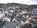
View of Haintchen
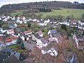
View towards the sports area, the primary school building in front
View of the Liebfrauenberg

View towards Liewersberg
View of the Koberg

View of the Eisenbach valley

View of the guard hedge

View towards Wolfenhausen


literature
- 600 years of Haintchen, 1388 - 1988, Seltersdruck & Verlag, ISBN 3-923811-04-7 .
- Field names, forest districts, departments in the Haintchen / Ts. District, 2002.
- Literature about Haintchen in the Hessian Bibliography
Web links
- District Haintchen on the website of the municipality of Selters.
- our little hair. Local history, local advisory board, information. In: www.unser-haintchen.de. Working group Haintchen 2020
- Haintchen, Limburg-Weilburg district. Historical local dictionary for Hessen. In: Landesgeschichtliches Informationssystem Hessen (LAGIS).
Individual evidence
- Mean height of Haintchen: TK Kompass Östlicher Taunus 840 1: 50,000
- ↑ a b Selters (Taunus) at a glance: Population figures HW , accessed on March 1, 2020.
- ↑ a b Karl Liesering: 600 years Haintchen - Between 1914 and 1988
- ↑ Law on the reorganization of the Limburg district and the Oberlahn district. (GVBl. II 330-25) of March 12, 1974 . In: The Hessian Minister of the Interior (ed.): Law and Ordinance Gazette for the State of Hesse . 1974 No. 5 , p. 101 , § 8 ( online at the information system of the Hessian state parliament [PDF; 809 kB ]).
- ^ Federal Statistical Office (ed.): Historical municipality directory for the Federal Republic of Germany. Name, border and key number changes in municipalities, counties and administrative districts from May 27, 1970 to December 31, 1982 . W. Kohlhammer GmbH, Stuttgart and Mainz 1983, ISBN 3-17-003263-1 , p. 370 .
- ^ A b Haintchen, Limburg-Weilburg district. Historical local dictionary for Hessen. (As of February 3, 2017). In: Landesgeschichtliches Informationssystem Hessen (LAGIS).
- ^ Michael Rademacher: German administrative history from the unification of the empire in 1871 to the reunification in 1990. State of Hesse. (Online material for the dissertation, Osnabrück 2006).
- ^ Rudolf Wolf: 600 years of Haintchen - family history in the 17th and 18th centuries
- ↑ Dr. Norbert Zabel: 600 years of Haintchen - from the upheaval at the end of the 18th century to the First World War (population development of Haintchen between 1792 and 1988)
- ^ Community of Selters (Taunus): Haintchen population statistics
- ↑ List of natural monuments in the Limburg-Weilburg district (PDF; 33 kB) at the Lower Nature Conservation Authority (UNB) of the Limburg-Weilburg district .
- ↑ Unser.haintchen.de ,: "The end for primary school" Link: http://www.unser-haintchen.de/presseartikel_grundschule-1.html
- ↑ Council and citizen information system: "13th meeting of the Haintchen local council on May 24th, 2000 - repair of the Johannisbrunnen free space" Link: https://selters-taunus.more-rubin1.de/beschluesse_details.php