Nauroth (Heidenrod)
|
Nauroth
municipality Heidenrod
Coordinates: 50 ° 8 ′ 44 ″ N , 7 ° 56 ′ 38 ″ E
|
|
|---|---|
| Height : | 439 m above sea level NHN |
| Residents : | 577 (Feb 11, 2014) |
| Incorporation : | December 31, 1971 |
| Postal code : | 65321 |
| Area code : | 06775 |
|
Town hall of Nauroth
|
|
With around 580 inhabitants, Nauroth is the third largest district in the municipality of Heidenrod in the Rheingau-Taunus district in southern Hesse .
geography
Nauroth lies with Hilgenroth and Dickschied on a ridge running in north-south direction in the northeastern Wispertaunus high above the Wispertal in the east and the Herzbach , a right tributary of the Wisper, in the west. Nauroth is the northernmost of the three districts. The place is surrounded by extensive agricultural areas, which are framed by partly steeply sloping wooded valley slopes.
The spatial proximity to the local recreation areas Rheingau and Middle Rhine , to the Loreley , as well as to the Aar and Lahntal on the one hand and to the economically strong Rhine-Main area on the other hand contribute significantly to the residential quality of the district.
history
Nauroth was first mentioned in documents in 1335 under the name Neurot . The ending "-rot" or "-roth" is of Franconian origin and indicates the emergence of clearing around the turn of the millennium.
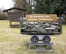
Until 1964 slate from the deposits of the Kauber Zug was mined in two pits in Nauroth . The mine of Meier's hope is now used for the water supply. The area of the Rosit pit , known for its roofing slate of the highest quality during its operating time, has been recultivated and designated as a nature reserve.
In the course of the regional reform in Hesse , the municipality of Nauroth merged with 15 other municipalities on December 31, 1971 on a voluntary basis to form the municipality of Heidenrod . For Nauroth, as for all other districts, a local district with a local advisory board and a local mayor was set up.
Culture and sights
The club life is supported by the men's choir, volunteer fire brigade , sports club, traffic and beautification club, senior and youth club. Annual highlights are the slaughter festival, the cap meeting, the linden festival, the hose throwing championship, the wine festival, the recital, the curb and the annual Christmas tree celebration.
The former town hall (which was completely destroyed by fire in 2001, but then rebuilt) and the modern Catholic round church are worth mentioning. The center of the village is the so-called 'Backesplatz' at the intersection of Mühlstrasse and Kirchstrasse.
Economy and Infrastructure

tourism
The Wispertaunus , in which Nauroth is located, is one of the most densely forested parts of the Taunus and has largely been designated as an FFH area. In addition, the region is part of the Rhein-Taunus Nature Park , which aims to enable people to relax in a natural environment. The district of Nauroth was upgraded as a hiking area by expanding a network of hiking trails with benches.
traffic
Over the ridge on which Nauroth lies, the state road 3035 runs in a north-south direction, which leads north to the Kemeler Heide four kilometers away , where there is a connection to the federal road 260 and to the road to Laufenselden , the central district of Heidenrod. The district town of Bad Schwalbach and Wiesbaden with the Rhine-Main area can be reached in a southerly direction on the federal road .
The country road 3035 leads south via the neighboring villages Hilgenroth and Dickschied down into the Wispertal , follows it a few hundred meters down the valley to the west in the direction of Lorch , but then turns from the Wisperstraße to the south into the Gladbach valley to over Hausen before the height of Kiedrich and Eltville to reach.
Web links
- History & districts. In: Website of the municipality of Heidenrod.
- Nauroth. Local history, pictures. In: www.heimatverein-heidenrod.de. Heimatverein Heidenrod e. V.
- Nauroth, Rheingau-Taunus-Kreis. Historical local dictionary for Hessen. In: Landesgeschichtliches Informationssystem Hessen (LAGIS).
- Literature on Nauroth in the Hessian Bibliography
Individual evidence
- ↑ Districts of the municipality of Heidenrod, population HW , accessed in April 2016
- ↑ a b c Topographic map 1: 25,000
- ↑ Grube Rosit Naturschutzhaus eV
- ^ Federal Statistical Office (ed.): Historical municipality directory for the Federal Republic of Germany. Name, border and key number changes in municipalities, counties and administrative districts from May 27, 1970 to December 31, 1982 . W. Kohlhammer, Stuttgart / Mainz 1983, ISBN 3-17-003263-1 , p. 378 .
- ↑ main statute. (PDF; 100 kB) § 5. In: Website. Heidenrod municipality, accessed February 2019 .


