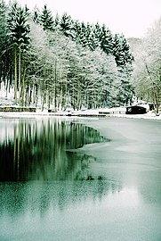
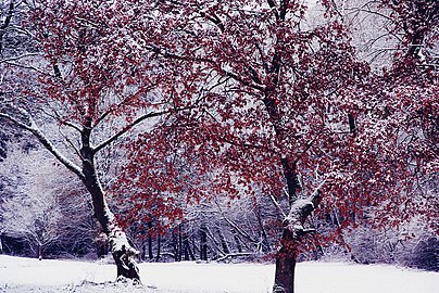
Theiss valley from Niedernhausen
|
Theiss valley from Niedernhausen
|
||
|
Waldsee in Theiss valley |
||
| location | between Wiesbaden and Niedernhausen im Taunus | |
| surface | 49.57 ha | |
| Identifier | 1439029 | |
| WDPA ID | 165875 | |
| Geographical location | 50 ° 9 ' N , 8 ° 16' E | |
|
|
||
| Sea level | from 530 m to 315 m | |
| Setup date | July 31, 1992 | |
The Theiss valley of Niedernhausen is a local recreation area , nature reserve and FFH area between Wiesbaden and Niedernhausen ( Hesse , Germany ) in the upper reaches of the Theissbach .
geography
The two-part protected area is located in the districts of Engenhahn and Königshofen von Niedernhausen in the Rheingau-Taunus district and Kloppenheim , Auringen and Bierstadt in the independent city of Wiesbaden , but belongs to the Wiesbaden districts of Naurod and Rambach . To the north and west of the valley lies the Taunushauptkamm , in the north the Hohe Kanzel ( 592 m ) and to the west of the ridge the nature reserve Silberbach, Schwarzbach and Fürstenwiese bei Wehen . South of the valley is a side ridge with the mountains Rassel ( 539 m ) and Hahnberg ( 446 m ), over which the Rheinhöhenweg on the right bank of the Rhine and the European long-distance hiking trail E3 run.
The Theißbach springs ⊙ about 100 m below the Taunus main ridge approximately 530 m height and flows in an easterly direction. After around 3 km the nature reserve is interrupted by a fishing lake with a shelter, the following part of the nature reserve is around 600 m long. The FFH area includes further underlying areas. The Theissbach continues to flow eastwards, crosses under the three Theiss valley bridges under the high-speed route Cologne – Rhine / Main and the federal motorway 3 , passes under the Niedernhausen train station and flows ⊙ shortly before Idsteiner Strasse into the Daisbach , which drains into the Rhine via Schwarzbach and Main .
The mean temperature in the Theiss valley is 7–8 ° C, the mean annual precipitation 750–850 mm.
natural reserve
The Theiss valley is located in the natural area of the Wiesbaden high Taunus (part of the High Taunus ) in the Rhine-Taunus nature park . The nature reserve, designated on July 31, 1992, consists of two parts and has a total size of 49.57 hectares . The nature reserve is part of the 82.51 hectare FFH area “Theiss Valley of Niedernhausen with adjacent areas”, which belongs to the Natura 2000 network. The FFH area also includes the meadows in the valley below the nature reserve up to approx. 250 m above the Theiss valley bridge , as well as the slopes to the north with old farmland and orchards , leisure properties , Christmas tree cultivation and an old landfill. Surrounded the nature reserve of FFH area is beech forests north of Wiesbaden , the parts lying on the Wiesbaden district are also part of the conservation area town Wiesbaden . The biotope complex, which has been legally protected since 1996, is located within the protected area, the “grassland-fresh wood complex on and in the Theiss valley west of Niedernhausen” with several individual biotopes .
The valley areas of the area are old agricultural areas. The valley played an important role in drinking water production from around 1900 , in the valley there are some smaller water abstraction systems , and in north-south direction it is crossed by the Kellerskopfstollen belonging to Wiesbaden's water supply , the mouth of which is southwest of the Kellerskopf near Wiesbaden-Rambach in the valley of the Rambachs is located. Because of the protection of the groundwater , the meadows in the middle and upper valley were probably never fertilized and grazed, but were used for the production of hay and the grazing of game . However, this use ended in the course of the 20th century, so that some meadows became forested.
The purpose of the protection is to preserve and secure almost its entire length of a forest meadow valley typical of the Hoher Taunus natural area with endangered animal and plant species. The valley contains meadows with bristle grass , pipe grass , oats , marsh marigolds , meadow foxtail and large meadow button , as well as swamps with rushes and brown sedges . In addition, there are wooded areas with black alders and ash trees along the naturally meandering Theissbach. The aim is the extensive use and maintenance of the valuable grassland, the pushing back of fallow land, the ecological upgrading of the micro-bodies of water and the medium-term transfer of the spruce stands to alder-ash forests. Protect values species are the brook lamprey and the dark Burnet-Large Blues , a butterfly .
The protected area is looked after by the Forsthaus Chausseehaus von Hessen-Forst .
See also
Web links
Individual evidence
- ↑ a b c d Ordinance on the "Theißtal von Niedernhausen" nature reserve of July 31, 1992 . In: State Gazette for the State of Hesse , No. 36, September 7, 1992, pp. 2180–5.
- ↑ a b nature reserves , website of the city of Wiesbaden. Retrieved May 2, 2020.
- ↑ City map of the state capital Wiesbaden, select administration > local districts , accessed on May 20, 2020. The boundaries of local districts and districts are often, but not always, identical in Wiesbaden, cf. State capital Wiesbaden (Ed.): Wiesbaden city analyzes: Land use of the Wiesbaden city area , April 2012, ISSN 0949-5983 , p. 19.
- ↑ a b c d e Berthold Hilgendorf: Basic data acquisition for the FFH area 5815-303 "Theiss valley of Niedernhausen and adjacent area" , December 7, 2001.
- ↑ Geographical Land Survey 1: 200,000 - Natural Spatial Structure of Germany, sheet 138 , 1971.
- ^ Theiss valley Von Niedernhausen in Germany , www.protectedplanet.net. Retrieved May 2, 2020.
- ↑ a b 5815-303 Theiss valley of Niedernhausen with adjacent areas (FFH area) . Federal Agency for Nature Conservation , accessed on May 2, 2020.
- ^ Theiss valley of Niedernhausen with adjacent areas in Germany , www.protectedplanet.net. Retrieved May 2, 2020.
- ↑ Overview map of the landscape protection area "City of Wiesbaden" . Retrieved May 2, 2020.
- ↑ Natureg Viewer , Hessian State Office for Nature Conservation, Environment and Geology . Retrieved May 2, 2020.
- ↑ Darmstadt Regional Council : Management plan for the FFH area 5815-303 "Theiss valley of Niedernhausen with adjacent areas" , 23 November 2012.
- ↑ Overview of the local area management - nature reserves , status: July 15, 2013.


