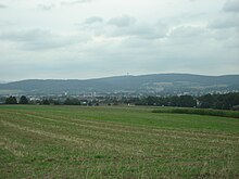
Franconian line

The Franconian Line is a major geological fault in Central Europe. It delimits the table top mountains of the southern German layer level country to the east and northeast against the Variscan basement of the Thuringian-Franconian-Vogtland slate mountains (including the Münchberger gneiss mass ), the Fichtelgebirge and the Upper Palatinate Forest . The Franconian Line runs geographically from northwest to southeast from Kronach to Weiden.
This fault line penetrates the entire earth's crust to a depth of over 30 km. Along this line, the north-eastern Bavarian basement was pushed onto the rocks to the west and thus strongly lifted out. The reason for this was the formation of the Alps .
The Franconian Line, with its current deferment character, was created towards the end of the Variscan mountain formation from a reactivation of an even older leaf movement. It probably had its most active phase between 100 and 50 million years ago, when the foreland was pushed under the Fichtel Mountains or the Upper Palatinate Forest with its Variscan granite bodies , Pre- Variscan gneisses , Paleozoic meta sediments and metabasalts. Parts of the foreland were already filled with sediments from the Rotliegend onwards , and over time the existing basins enlarged due to the further subsidence of the foreland compared to the delivery areas. In addition to the vertical offset, which is between 1000 m in Wirsberg and 10,000 m in other areas, it probably has a dextral component today .
Web links
- For the geology of the Geopark area on the website of the Geopark Bavaria-Böhmen
- A detailed electromagnetic investigation of the Franconian Lineament / Bavaria (English; PDF; 785 kB)
Individual evidence
- ^ Franconia with foreland. Bavarian State Office for the Environment, 2011, accessed on July 2, 2015 .
- ↑ Harald G. Dill: Heavy mineral response to the progradation of an alluvial fan: implications concerning unroofing of source area, chemical weathering and palaeo-relief (Upper Cretaceous Parkstein fan complex, SE Germany). In: Sedimentary Geology. 95, 1995, pp. 39-56, doi : 10.1016 / 0037-0738 (94) 00096-D .
- ↑ http://www.geopark-bayern.de/Public/earthcaching/Unterwappenoest.htm
