
Southwest German step country

The Southwest German Stufenland is a geological and geomorphological by escarpments embossed large landscape east of the Upper Rhine Graben in Baden-Wuerttemberg , Bavaria , Hesse , Thuringia and, in small amounts, in Switzerland . It was created by the raising of the Black Forest and Odenwald since the Oligocene in direct connection with the collapse of the Upper Rhine Rift. On the left bank of the Rhine you will find the northern French layered plain opposite.
The Southwest German Stufenland is in the literature under Südwestdeutsches cuesta landscape , southwest German cuesta landscape , Swabian-Franconian (s) cuesta landscape (company) and Süddeutsche (s) cuesta landscape (company) out, which terms in the strict sense only the "real" cuesta landscapes from Trias and Jura denote what the basement of the Spessart , Black and Odenwald Mountains in the west.
According to the work of the former Federal Institute for Regional Studies, the south-west German stepland is a large landscape of the 2nd order; the Upper Palatinate-Upper Main hill country is sometimes understood as an independent large landscape of the 2nd order.
Location and brief description
The south-west German stepland abuts steeply in the west against the Upper Rhine Graben and in the northwest against the Rhine-Main lowlands . In the north it meets the East Hessian mountains with Vogelsberg and Rhön , in the north-east the Thuringian-Franconian low mountain range with the Thuringian Forest , Thuringian Slate Mountains , Franconian Forest and Fichtel Mountains (all parts of the low mountain range ) and in the east the Upper Palatinate and the Bavarian Forest , the parts of the Bohemian mass . To the south, the Danube valley draws the border to the foothills of the Alps .
The large landscape includes, from west to east: 1. the low mountain range Black Forest , Odenwald and Spessart ( basement and red sandstone ); 2. the bands of the Gäu landscapes ( Muschelkalk ) and the Keuperbergland ( Keuper ) running side by side from southwest to northeast ; 3. the tables of the Swabian and Franconian Alb ( Jura ).
The proportions of basement mountains in the west of this large landscape in Spessart, Odenwald and Black Forest are not counted as part of the south-west German layered level land in the narrower sense. According to the different levels of resistance of the rocks in the south-west German layer level country, four main layer levels developed (see section Geological development ).
Natural structure
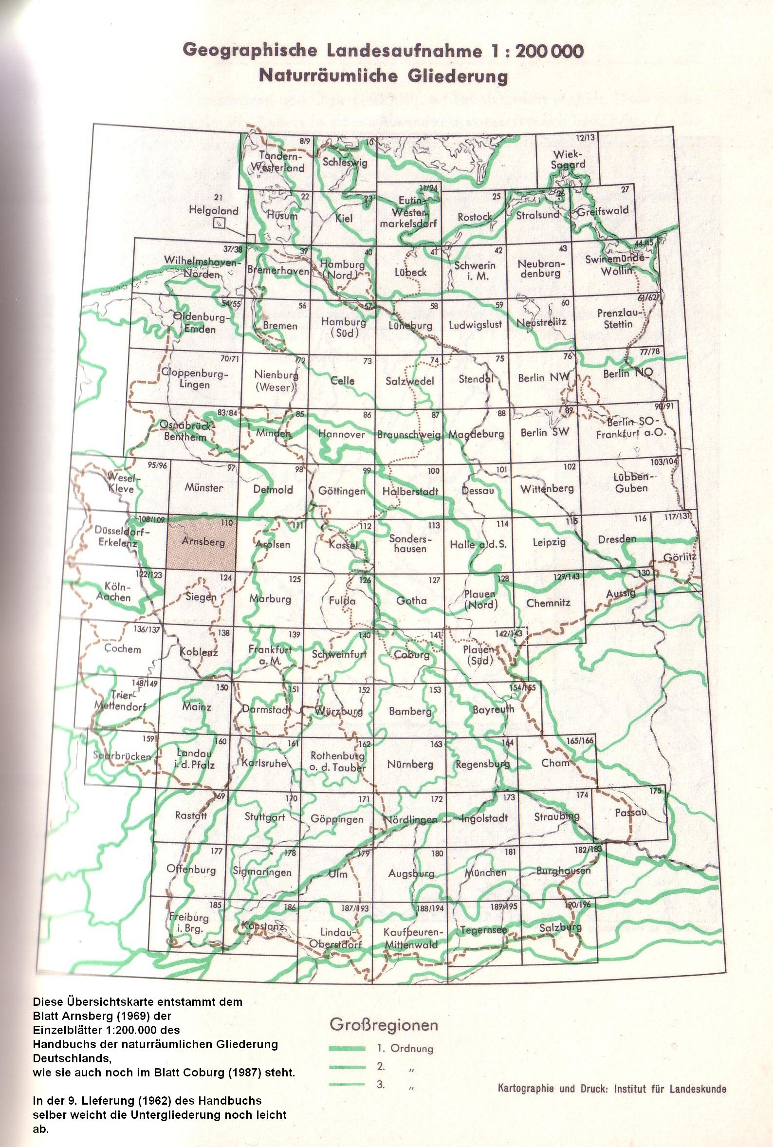
According to the handbook of the natural spatial structure of Germany and its follow-up publications, the south-west German stepland is a natural spatial large region of the 2nd order within the low mountain range (1st order). The subordinate large regions of the 3rd order are usually main unit groups, but here they are divided into a Swabian and a Franconian group in the stages of Muschelkalk (Gäue), Keuper-Lias (-Dogger) and Jura (or Malm, Alben).
The following is a breakdown of the south-west German stepland into main unit groups (two-digit) and main units (three-digit):
(in brackets, the affiliation to the basement (G) or to the layer level Buntsandstein (B), shell limestone (M), Keuper (K), Black Jura (SJ, Lias ), Brown Jura (BJ, Dogger ) and White Jura (WJ, Malm ))
- 07 (= D62) Upper Palatinate-Upper Main hill country
- 070 Upper Palatinate hill country (various)
- 071 Upper Main Hill Country (SJ, BJ)
- 08 (= D61) Franconian Alb
- 080 Northern Franconian Alb (WJ)
- 081 Middle Franconian Alb (WJ)
- 082 Southern Franconian Alb (WJ)
- 09 (= D60) Swabian Alb
- 090 Randen ( Klettgau - and Randenalb) (WJ)
- 091 1 Hegaualb (WJ)
- 091 2 Western Alb with Danube breakthrough (WJ)
- 092 Baar-Alb and Upper Danube Valley (WJ)
- 093 High Swabian Alb (WJ)
- 094 Middle Kuppenalb (WJ)
- 095 Middle Area Alb (WJ)
- 096 Albuch and Härtsfeld (WJ)
- 097 Lone Valley Alb (Lower Alb) (WJ)
- 098 Riesalb (WJ)
- 10 (= D58) Swabian Keuper-Lias-Land
- 100 Foreland of the western Swabian Alb ( K, SJ, BJ)
- 101 Foreland of the central Swabian Alb (SJ, BJ)
- 102 Foreland of the eastern Swabian Alb (SJ, BJ)
- 103 Nördlinger Ries (SJ, BJ. WJ)
- 104 Schönbuch and Glemswald (K)
- 105 Bay of Stuttgart (M)
- 106 Filder (M, SJ)
- 107 Schurwald and Welzheimer Wald (K)
- 108 Swabian-Franconian Forest Mountains (K)
- 11 (= D59) Franconian Keuper-Lias-Land
- 110 Foreland of the Southern Franconian Alb (SJ, BJ)
- 111 Foreland of the Middle Franconian Alb (SJ, BJ)
- 112 Foreland of the Northern Franconian Alb (SJ, BJ)
- 113 Middle Franconian Basin (K)
- 114 Swiss francs (K)
- 115 Steigerwald (K)
- 116 Hassberge (K)
- 117 Itz-Baunach-Hügelland (K, SJ)
- 12 (= D57) Neckar and Tauber-Gäuplatten
- 120 Alb-Wutach area (M)
- 121 Baar (M)
- 122 Upper Daue (M)
- 123 Neckar basin (M)
- 124 Stromberg and Heuchelberg (K)
- 125 Kraichgau (M)
- 126 Kocher-Jagst Plains (M)
- 127 Hohenloher and Haller level (M)
- 128 building land (M)
- 129 Tauberland (M)
- 13 (= D56) Main Franconian plates
- 130 Ochsenfurt Gau and Gollachgau (M)
- 131 Windsheim Bay (M)
- 132 Marktheidenfelder Platte (M)
- 133 Middle Main Valley (M)
- 134 Gäuplatten in the Main Triangle (M)
- 135 Wern Lauer plates (M)
- 136 Schweinfurt Basin (M)
- 137 Steigerwaldvorland (M)
- 138 1 grave field (M)
- 138 2 Werra-Gäuplatten ( Meininger Kalkplatten , M)
- 139 Hesselbacher Waldland (M)
- 14 (= D55) Odenwald, Spessart and Südrhön
- 140 South Rhön (B)
- 140–142 Spessart
- 141 Sandstone Spessart (B)
- 142 Front Spessart (G)
- 143 Büdinger Forest (B)
- 144–145 Odenwald
- 144 Sandstone Odenwald (B)
- 145 Front Odenwald (G)
- 15 (= D54) Black Forest
- 150 Black Forest edge plates (B)
- 151 Grindenschwarzwald and Enzhöhen (B)
- 152 Northern Black Forest Valley (G)
- 153 Middle Black Forest (G , B )
- 154 Southeastern Black Forest (G , B )
- 155 Black Forest (G)
- 16 (= D69) Upper Rhine area ( Dinkelberg and Hochrheintal )
- 160 Hochrheintal (border area to the Jura Mountains )
- 161 Dinkelberg (M)
The Federal Agency for Nature Conservation combines the south-west German stepland with the entire Upper Rhine lowland (also a large region of the 2nd order and border region to the north French layer stepland in the west) to form the correspondence between the southwest low mountain range / stepland .
Anticline stepland between Paris and the Bohemian Forest
The southwest German stepland is part of an anticline stepland that extends from the Bohemian Forest to the Paris Basin . This anticline stepland was created by tectonic bulging of the earth's surface between Paris and the Bohemian Forest. After the collapse of the Upper Rhine Rift in the area of maximum uplift and expansion, stratiform states formed primarily to the west and east of the rift valley, the rock strata of which sloped away from the Upper Rhine: in the west (northern France and the Palatinate) the north French stratiform land and in the east (Baden-Württemberg and Northern Bavaria) the south-west German layer level country. These two large-scale stratified countries are connected in the south by the strata, especially the " Tafeljura " on the Upper Rhine , in the Basel region as well as in the Ajoie and the rest of the Burgundian Porte . In the area of the Folded Jura around the southern edge of the Upper Rhine Graben in the Sundgau (Pfirter Jura), the two layer level countries (unfolded layers) are separated from one another at a short distance.
The rock layers involved were deposited in the Mesozoic Triassic and Jurassic periods . Because of the different erosion resistance and fissures of various unfolded and slightly sloping rock layers, the erosion created layers .
Geological development

Today's escarpment country was during the Mesozoic (Mesozoic) Sedimentationsgebiet. About 350 million years ago the large Germanic Basin , surrounded by mountain ranges and thresholds, had formed in this area . Initially, erosion products from the Variski Mountains accumulated in numerous depressions as red-lying deposits. In the Triassic and Jurassic , the area was sometimes above and sometimes below sea level, so that alternating layers with continental and marine deposits formed.
The strata that are characteristic of today have been formed since the Neogene , after the Upper Rhine Graben was created around 30 million years ago due to plate tectonic processes . The areas on both sides of the trench were raised significantly, with the Black Forest on the German side and the Vosges in the west on the French side . The elevation tilted the layers from horizontal to sloping position in the entire southern German layered basin, so that they now fall from the Upper Rhine Graben to the west and east. Due to the elevation and inclination of the layers, they were now exposed to increased weathering ; harder layers withstood the erosion longer than softer ones. Clay stones weather very easily and form flats, while the hard sandstone or limestone is less susceptible to weathering and forms steep steps. The resulting structural shapes open up the geological strata on the earth's surface.
The most important deposit layers are named after periods of the Mesozoic Era; In the order in which they were struck from west to east, they are Buntsandstein , Muschelkalk , Keuper , Schwarzer Jura , Brauner Jura and Weißer Jura . The red sandstone forms the first of the four large layers. It can be found in the northern Black Forest , in the Spessart and on the eastern edge of the Odenwald. Since the soil created on it is not very fertile, there are still large forest areas here today. The shell limestone is the basis of the fertile gauze landscapes from the Baar to Lower Franconia ; the second major stage formed by him is usually not very pronounced. The Keuper, in turn, less fertile, gives its name to the layer of the Keuper mountains , which is the third major layer of Keuper sandstone. Finally, the highest and most prominent strata - the north and north-west edge of the Swabian and Franconian Jura - is mainly formed by the White Jura, and in the southwest also by the Brown Jura.
Significance for the discovery of evolution
In the spatial superimposition of the formations of the overburden , the chronological succession of their sedimentation in the course of geological epochs is shown, which took place before the Rhine rift valley began to sink, when the basement base was not yet sloping and the emerging or already formed layers of the overburden over the area of today's Upper Rhine Graben still formed a coherent land surface. The fossils stored in the formations of the overburden , which are particularly easily accessible at the strata and on the strata, gave the biologist Jean-Baptiste de Lamarck reason to suspect that in the course of the earth's history plant and Animal species changed, so that there was an evolutionary history , which is also shown here. The discoveries made by Jean-Baptiste de Lamarck and other paleontologists in the northern French layered plains could be supplemented by rich finds on the southern German side and later worldwide.
Human use and economic importance
In the Upper Rhine Graben and in the Mainz Basin there are relatively fertile arable landscapes due to the ice age loess deposits . In contrast, the soils in the mountains of the lowlands only produce low to medium yields. Where there is limestone on the surface, karstification leads to the formation of caves, which means that in these regions the precipitation almost completely seeps away and the landscape is very arid. For example on the Swabian and Franconian Alb, which extend north of the upper reaches of the Danube . Viticulture is widespread in the lower elevations of the layered plain, while forestry plays an important role in higher mountain regions .
See also
- List of natural spatial units in Baden-Württemberg
- the special explanations under shift level
- Geological structural shape
literature
- Hansjörg Dongus : The surface forms of southwest Germany. Borntraeger, Berlin / Stuttgart 2000, ISBN 3-443-01042-3
- OF Geyer, MP Gwinner: Geology of Baden-Württemberg. E. Schweizerbart'sche Verlagbuchhandlung, Stuttgart 1991.
- E. Meynen , J. Schmithüsen , J. Gellert, E. Neef , H. Müller-Miny, JH Schultze (eds.): Handbook of the natural spatial structure of Germany . Volume II, Bad Godesberg 1959–1962.
- Peter Rothe : The geology of Germany. 48 landscapes in portrait. Scientific Book Society, Darmstadt 2005.
- Roland Walter et al .: Geology of Central Europe . 5th edition. Schweizerbart'sche Verlagsbuchhandlung, Stuttgart 1992, ISBN 3-510-65149-9 , pp. 369 .
Individual evidence
- ↑ Meschede, Martin, 1957-: Geology of Germany: A process-oriented approach . Springer Spectrum, Berlin 2015, ISBN 978-3-662-45297-4 , p. 182 .
- ↑ Distribution since 1969 , as it was published until the Federal Agency was dissolved in the early 1990s.
- ^ Emil Meynen and J. Josef Schmithüsen : Handbook of the natural spatial structure of Germany . First delivery, Federal Institute for Regional Studies, Remagen 1953
- ^ Westermann's Lexicon of Geography . Braunschweig 1973
- ↑ Map of the major regions and main unit groups, under the link "Source" an original map overview of the Federal Institute for Regional Studies of the major regions of the 1st to 3rd order.
- ↑ a b map services ( memento of the original from December 19, 2012 in the Internet Archive ) Info: The archive link was inserted automatically and has not yet been checked. Please check the original and archive link according to the instructions and then remove this notice. of the BfN
- ^ E. Meynen and J. J. Schmithüsen : Handbook of the natural spatial structure of Germany, Volume 2 - Federal Institute for Regional Studies, second delivery Remagen 1955, updated map 1: 1,000,000 with main units 1960
- ↑ a b The exact delimitation of Baaralb, Hegaualb and Donautal differs between sheet 178 Sigmaringen (1959) and sheet 186 Konstanz (1964), the list shows the breakdown according to sheet Konstanz. On sheet Sigmaringen the Danube breakthrough is part of the unit 092 Baaralb and Donautal and the western area alb is counted as 091 Hegaualb .