Hermannskogel
| Hermannskogel | ||
|---|---|---|
|
Steep view from the Rohrerwiese to the Hermannskogel. The top of the observation tower on the horizon |
||
| height | 542 m above sea level A. | |
| location | Vienna , Austria | |
| Mountains | Kahlengebirge , Vienna Woods | |
| Dominance | 17.7 km → Hinterer Föhrenberg | |
| Notch height | 172 m ↓ trenches | |
| Coordinates | 48 ° 16 '13 " N , 16 ° 17' 37" E | |
|
|
||
| rock | Flysch | |
| Age of the rock | Campanium | |
| Normal way | From the Jägerwiese | |
| particularities | Highest mountain in Vienna and the Kahlengebirge | |
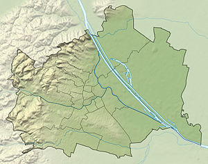
The Hermannskogel is 542 m above sea level. A. the highest point in the municipal area of Vienna and is located in the 19th district of Döbling . The state border between Vienna and Lower Austria runs around 150 meters north of the Hermannskogel summit. The Habsburgwarte on its summit plateau was the fundamental point in the Austria-Hungary surveying network until 1918
geography
The Hermannskogel is a wooded, comb-like mountain in the northern Vienna Woods . At 542 meters, it is the main summit of the Kahlengebirge and the highest mountain in Vienna. It lies in a northeastern foothill of the Eastern Alps and is geologically part of the flysch zone , which is composed of quartz and sand-lime stones , marl and other sediments . The flysch layers falling to the south-east and only a few centimeters thick can be seen particularly well on the south-western ascent just before the summit, where the outcrop forms several cliff-like steps.
Three kilometers east of the Hermannskogel are the Viennese local mountains Kahlenberg and Leopoldsberg , behind which the Wiener Pforte is located (the Danube breaks through the Vienna Woods), and half the distance is the Vogelsangberg and in the southwest of the Dreimarkstein .
history
The mountain was first mentioned in documents in 1355 as hermannschobel in the tithe register of Klosterneuburg Abbey . The name goes back to the first name Hermann , which was common in the Middle Ages , and contains as a basic word the term Kogel or Kobel, which is often used in mountain names, for a conical mountain. In the Middle Ages, the Hermannskogel was still covered with vineyards. In 1256, the village of Albero von Feldsberg was ceded to Klosterneuburg Abbey. In 1346 the place was still there, but then it perished at the end of the 15th century, probably due to the devastation of the Hungarians . With the village, the vineyards finally disappeared and wild growth covered the summit again.
In 1683 the relief army from Saxony and other parts of the Holy Roman Empire , which ended the Second Turkish siege of Vienna , camped here . In the 19th century, several requests from Klosterneuburg Abbey to build a lookout tower on the Hermannskogel were rejected. The 27-meter-high Habsburgwarte (1938–1974 Hermannskogelwarte ) was not built until 1888 and opened a year later.
The Hermannskogel as a fundamental point
The Habsburgwarte on the summit plateau of the sandstone dome was chosen at the end of the 19th century as the fundamental point ( origin of coordinates ) for the land survey of Austria-Hungary. In the 1920s, however, Austria (like Germany ) switched to the 3 ° stripe system of the Gauß-Krüger projection . As a fundamental point, the Hermannskogel had the same function as the Rauenberg in Berlin . The transition to the European Terrestrial Reference System will take place in the near future .
literature
- Christian F. Winkler, Alfred Hengl: From Leopoldsberg to Hermannskogel. History of the Kahlengebirge. Sutton Verlag, Erfurt 2007, ISBN 978-3-86680-097-7
Web links
Individual evidence


