
Ollen
| Ollen | ||
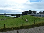
 Western Ollen in Berne |
||
| Data | ||
| Water code | DE : 49561 (Ollen Ost), 49562 (Ollen West), 496949 (Untere Ollen and Alter Huntearm) | |
| location | District Wesermarsch , Lower Saxony , ( Germany ) | |
| River system | Weser | |
| Drain over | Hunte → Weser → North Sea | |
| source | Altenesch 53 ° 7 ′ 30 ″ N , 8 ° 37 ′ 41 ″ E |
|
| Source height | 1 m above sea level NHN | |
| two different mouths | Ollen east and west through Motzen Canal into the Weser
53.1801 ° N 8.557 ° E ; Lower Ollen – Alter Huntearm Lichtenberger Siel in theHuntecoordinates: 53 ° 9 ′ 31 ″ N , 8 ° 32 ′ 11 ″ E, 53 ° 9 ′ 31 ″ N , 8 ° 32 ′ 11 ″ E |
|
| Mouth height | 1 m above sea level NN | |
| Height difference | 0 m | |
| Bottom slope | 0 ‰ | |
| length | Total of the partly opposing sections 19.1 km; Ollen Ost = 9.43 km *, with Motzen Canal 12.23 km *; Ollen West = 5.24 km; Untere Ollen – Alter Huntearm 4.39 km, with Berne and Kimmer Bäke 28.4 km; (*) of which 0.93 km unclassified |
|
| Catchment area | 99 km² (Motzen Canal) and 119 km² (Untere Ollen) | |
| Left tributaries | der Ollen Ost: Hörsper Ollen, Hörspe, Ollen West; of the Lower Ollen: Berne (its upper course), Schlüter Tief |
|
| Right tributaries | the Ollen West: Neue Ollen, Rekelner Canal; of the Lower Ollen: Piependammer Sieltief | |
| Communities | Altenesch, Bardewisch , Hörspe, Harmenhausen, Hekel, Hiddigwarden, Berne | |
The Ollen is a river with no gradient in the Wesermarsch district of Lower Saxony , historically a tributary of the Hunte . The yards of marsh farmers standing on their banks on Wurten form the historical core area of Stedingen .
Changed river routes
The 19 kilometer long, strongly meandering river has its origin near Altenesch -Süderbrook, a district of Lemwerder . It drains both the low-lying marshland ( Lechterseite between Ollen and Weser and Brookseite between Ollen and Geest) and the Geest around Bookholzberg and Hude . In order to prevent the marsh from being flooded by water from the Geest, the course of the Ollen in the village of Berne was divided by a verlaat to the east of the mouth of the Berne and the Motzen pumping station on the Weser opposite Bremen-Blumenthal in 1958 to drain the marsh including a larger part of the Ollen built. The Untere Ollen from Berne to the Lichtenberger Siel an der Hunte mainly carries water from the Geest. Siel and pumping station in Lichtenberg are more efficient than those in Motzen.
Motzener Kanal and Hörsper Ollen
The Ollen, southeast of the Verlaat in Berne, has been drained into the Weser by a pumping station and sluice in Motzen since 1959. As a result, the Motzen Canal forms the common lower course of the Ollen West between Berne and the Bernese district of Katjenbüttel, which flows against the original direction of the current, and the Ollen Ost , the natural upper course. Its old, but today water-economically insignificant inflow from the Geest is the Hörspe . One kilometer east of its mouth, a polder pumping station was built that drains the eastern part of the Brookseite and the original headwaters of the Ollen southeast of Süderbrook. The supply line to the pumping station is the Hörsper Ollen (GKZ 495612), a series of straight drainage ditches that bend at almost right angles.
Tributaries from the Geest
Halfway between Ollen and Geestfuß, the Stedinger Canal was laid parallel to Ollen . It collects the water from the streams coming from the Geest and from the ditches of the former moors between it and the Geest and directs it into the Berne . The trenches from the Stedinger Canal to Ollen, including the Hekelner Canal and the Neue Ollen , are blocked by verlaate at the exit from the Stedinger Canal.
Drains into the Hunte
The Untere Ollen flows into a sealed old hunt loop at Dreisielen . Its downstream part is called the Alter Huntearm and hydrographically forms a unit with it. The upstream part of the loop is assigned to the Schlüter low . The Lichtenberger Siel , through which the drainage from the Old Huntearm into the Hunte takes place, is named after a residential area on the opposite bank of the Hunte.
The Neuhuntorfer Siel west of Huntebrück, which drains into this independently of the Ollen Marsch and Moor south of the Hunte, also belongs to the complete representation of the drainage routes.
"Young" Ollen Ost in Altenesch
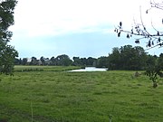
Ollen Ost near Butzhausen
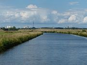
Motzen Canal, view of the road embankment for the new B 212 , water tower (large) and church tower of Bremen-Blumenthal

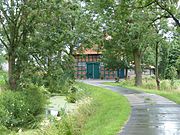
Stedinger Siel sewage system and pumping station on the Motzen Canal in Motzen
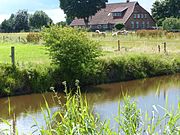
Ollen West (seen upstream today) just before Berne
Alter Huntearm as the lowest part of the Untere Ollen, on the right the Lichtenberg pumping station


Web links
- A mud cure for the Ollen Weser Kurier on December 11, 2013
- Lower Saxony map - Wesermarsch
Individual evidence
- ↑ measure with drawn GPS tracks
- ↑ www.umwelt.niedersachsen.de: Waters network and coastal waters of Lower Saxony → Area directory Weser
- ↑ Compared to the list, 5 km² have been subtracted from the catchment area of the Motzen Canal (according to the list for the Stedinger Canal incorrectly assigned to this in the list) and added to the lower Ollen. In comparison with maps, the catchment area of the Stedinger Canal would have to be at least 10 km².