Dörverden barrage
| Dörverden barrage | ||
|---|---|---|
| View over the upper water to the power plant | ||
| location | ||
|
|
||
| Coordinates | 52 ° 51 '5 " N , 9 ° 12' 43" E | |
| country | Germany | |
| place | Dörverden | |
| Waters | Weser | |
| Kilometers of water | km 308.832 | |
| Height upstream | 14.6 m above sea level NN | |
| power plant | ||
| operator | Statkraft Markets GmbH Dörverden run-of-river power plant | |
| construction time | 1911-1913 | |
| Start of operation | 1914 | |
| technology | ||
| Bottleneck performance | 4.2 megawatts | |
| Average height of fall |
3.5 m | |
| Expansion flow | 149 m³ / s | |
| Standard work capacity | 22 million kWh / year | |
| Turbines | 2 Kaplan turbines in a jack arrangement 1 Kaplan propeller turbine 1 special design |
|
| Others | ||
| was standing | 2015 | |
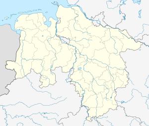
The Dörverden barrage is a barrage on the Weser in Dörverden in the south of the Verden district . It consists of a weir and a hydroelectric power station .
Weir
After a barrage had already been built in Bremen-Hemelingen as the end point of the lower Weser correction , another barrage was built in Dörverden from 1907 to 1914 in order to enable the delivery of Weser water for irrigation of agricultural areas between Hoya and Bremen in dry times. The first weir, a steel lattice construction, was built in 1911/1912 by the Aug. Klönne company.
The Dörverden barrage at Weser kilometer 308.8 was built with today's weir from 1931 to 1933 as the second barrage of the Middle Weser in order to keep the water level as constant as possible and to make the waterway passable for large ships. The weir is 104.90 m wide and consists of two 40 m wide fields, the third field is 24.90 m wide. The water level is 4.60 m. In summer the headwater level is kept constant at 14.60 m above sea level, in winter at 15.10 m above sea level. The weir is operated by the Verden Waterways and Shipping Office .
Cyclists and pedestrians can cross the weir over the Weser between Dörverden and Hilgermissen from March 15 to October 15, but using stairs with side sliders.
Prahmschleuse / fish ladder
A small sluice is integrated between the weir and the hydroelectric power station (usable length 28 m, usable width 6.50 m.), Which was only used by the water and shipping authorities. In 2012, the operators of the weir and the power plant decided to jointly plan and build a fish pass with an integrated descent. The decommissioned Prahm lock is to be used for this pilot system.
Hydroelectric power plant
The run-of-river power plant belonging to the barrage was built between 1911 and 1913. Initially, electricity was generated by steam power until the last steam turbine was shut down in 1927. The first Francis turbine- type water turbines went into operation as early as 1914 , at that time the largest in Europe. For several decades, the hydropower plant supplied the main pumping station at the Minden waterway intersection with electricity via its own high-voltage line, which pumped water from the Weser into the Mittelland Canal. The districts of Verden, Hoya, Nienburg, Neustadt and Fallingbostel were electrified for the first time with excess electricity.
With a head of 3.5 meters and a flow rate of 149 m³ / s, the power plant with its four current turbines (two Kaplan turbines in a lifting arrangement , one Kaplan propeller turbine and a special design) has a capacity of 4.2 MW. The turbines run at speeds of 63 or 60 rpm; the generators with 100, 125 and 1000 rpm and deliver an average of 22 GWh of electricity per year , which corresponds to an average output of 2.5 MW.
The hydropower plant was built by the Prussian state, operated from 1927 by the PreußenElektra company, which was merged into E.ON Wasserkraft GmbH in 2000 . Through an exchange of shares with the Norwegian energy company Statkraft , the latter has been the owner and operator of the power plant since January 1, 2009. All other run-of-river power plants in the Mittelweser are operated from the power plant in Dörverden, while the power plants are monitored from a central control room in the Erzhausen pumped storage plant .
Lock channel
The lock canal runs east and is only about half as long as the shortened loop of the Weser.
Web links
Individual evidence
- ↑ The damming regulation of the Mittelweser on www.wsa-verden.wsv.de accessed on September 2, 2015
- ↑ Aug. Klönne 1879-1929, Memorandum (1929), Fig. 51 , accessed on September 7, 2015
- ↑ Wehr Dörverden: Technical data , at www.wsa-verden.wsv.de, accessed on September 2, 2015.
- ↑ Cycling and hiking at www.doerverden.de, accessed on September 2, 2015
- ^ Fish ladder at the Dörverden weir Weser Kurier dated December 14, 2012, accessed on September 3, 2015
- ↑ Statkraft Markets GmbH Dörverden run-of-river power plant at www.landkreis-verden-navigator.de, accessed on September 3, 2015
- ↑ Statkraft: 100 years of Dörverden power station, accessed on September 7, 2015
- ↑ Dörverden power station at www.statkraft.com, accessed on September 2, 2015


