Steinhuder Meerbach
|
Steinhuder Meerbach Meerbach, Aue, Bäke |
||
|
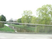
Steinhuder Meerbach in the Meerbruchswiesen at Steinhuder Meer |
||
| Data | ||
| Water code | EN : 478 | |
| location | Lower Saxony , Germany | |
| River system | Weser | |
| Drain over | Weser → North Sea | |
| source |
Steinhuder Meer 52 ° 28 ′ 10 ″ N , 9 ° 16 ′ 35 ″ E |
|
| muzzle | At Nienburg in the Weser Coordinates: 52 ° 38 ′ 11 " N , 9 ° 12 ′ 16" E 52 ° 38 ′ 11 " N , 9 ° 12 ′ 16" E
|
|
| length | 29 km | |
| Catchment area | 355.92 km² | |
| Discharge at the Schessinghausen A Eo gauge : 277 km²
|
NNQ MNQ 1988-2002 MQ 1988-2002 Mq 1988-2002 MHQ 1988-2002 HHQ |
200 l / s 420 l / s 1.73 m³ / s 6.2 l / (s km²) 8.03 m³ / s 18.2 m³ / s |
| Discharge at the mouth of the A Eo : 355.92 km² |
MQ Mq |
2.23 m³ / s 6.3 l / (s km²) |
| Medium-sized cities | Nienburg | |
| Communities | City of Rehburg-Loccum , Central Weser municipality | |
The Steinhuder Meerbach , often just called "Meerbach" by its residents, is a 29 km long orographically right tributary of the Weser in Lower Saxony .
course
The Steinhuder Meerbach is the natural outflow of the Steinhuder Meer . Its water flow clearly exceeds that of the surface tributaries of the lake. It leaves it at its northwestern end and flows from there in a westerly direction through the Meerbruch nature reserve and the town of Rehburg . It then turns its course to the north and flows into the Weser after 29 km at Nienburg with an average water flow of a good 2 m³ / s .
The Steinhuder Meerbach is canalised almost along its entire length. In the city of Nienburg it is also often called the Aue , and in the neighboring towns to the south it is also called the Bäke .
At the point of the sharp bend to the west in Nienburg shortly before the mouth of the Weser, the Meerbach flowed further northeast and flowed into the Aller at Rethem . Today the Schipsegraben follows its earlier course.
See also
Individual evidence
- ↑ List of areas for the Lower Saxony hydrographic map, updated on July 13, 2010
- ↑ Gauge value Schessinghausen increased by the discharge of the remaining catchment area (6.3 / s.km² on 79 km²), determined for the enclosing intermediate catchment area of the Liebenau (Weser), Steyerberg (Große Aue), Schessinghausen (Meerbach) and Dörverden (Weser) gauges , as well as from the hydrological atlas of Germany - annual discharge head

