Walk
| Walk | ||
|
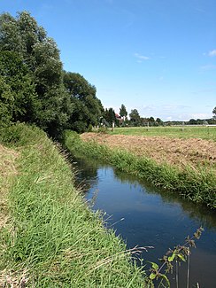
The Gehle in Petershagen-Bierde |
||
| Data | ||
| Water code | EN : 474 | |
| location | North Rhine-Westphalia , Germany | |
| River system | Weser | |
| Drain over | Weser → North Sea | |
| source | at Sülbeck 52 ° 17 ′ 36 ″ N , 9 ° 8 ′ 20 ″ E |
|
| Source height | approx. 77 m above sea level NN | |
| muzzle | At Ilvese in the Weser Coordinates: 52 ° 27 '38 " N , 9 ° 1' 22" E 52 ° 27 '38 " N , 9 ° 1' 22" E |
|
| Mouth height | approx. 32 m above sea level NN | |
| Height difference | approx. 45 m | |
| Bottom slope | approx. 1.7 ‰ | |
| length | 27 km | |
| Catchment area | 163.476 km² | |
| Discharge at the Bierde A Eo gauge : 121 km². Location: 11.19 km above the mouth |
NNQ (08/27/1996) MNQ 1974/2008 MQ 1974/2008 Mq 1974/2008 MHQ 1974/2008 HHQ (03/04/1979) |
67 l / s 135 l / s 933 l / s 7.7 l / (s km²) 14.5 m³ / s 28.2 m³ / s |
The Gehle is a 27 km long right-hand tributary of the Weser in the Schaumburg district in Lower Saxony and in the Minden-Lübbecke district in North Rhine-Westphalia . It flows into the Weser at the level of the town of Ilvese in the city of Petershagen .
The Gehle carries the water of the Sülbecker Stolln, which was excavated in 1714 as a water solution tunnel on the northern slope of the Bückeberg near Sülbeck . After it has left the Schaumburg Forest and thus the state of Lower Saxony, it flows in a northerly direction towards its mouth. At Bierde the Ils joins from the right. Due to the inflow of the Ils, the Gehle is polluted with pollutants from the former special waste dump in Münchehagen in Lower Saxony . The tributary of the Riehe, north of Bierde, also pollutes the Gehle, which then flows through Ilse and Döhren to Ilvese .
Others
There is a Gehle level at Bierde.
Web links
Individual evidence
- ↑ Topographic map 1: 25,000
- ^ German basic map 1: 5000
- ↑ a b Topographical Information Management, Cologne District Government, Department GEObasis NRW
- ^ Deutsches Gewässerkundliches Jahrbuch Weser-Ems 2008 Lower Saxony State Agency for Water Management, Coastal Protection and Nature Conservation, accessed on January 22, 2016 (PDF, German, 6184 kB).
- ↑ Erich Hofmeister, Werner Schöttelndreier: The Sülbecker work. (PDF; 1.4 MB) in: Excursion through the municipality of Nienstädt . Mining Working Group of the Schaumburg Adult Education Center, May 2008, p. 35 , accessed on September 17, 2016 .
