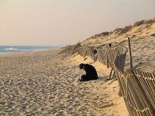
Flat coast
On a flat coast , the land gradually merges into the sea . Flat coasts can arise either through the advance of the sea on gently sloping land or through abrasion in loose rock. They can basically be divided into two sections parallel to the coast: the Schorre and the beach .
Flat coasts consist of loose material such as sand and gravel , the wind transports fine grains of sand over the dunes into the country. The sea washes away rubble and sand from the coast and deposits it in other places.
Flat coast littoral series
The typical spatial arrangement of the form components created by the sea is called the littoral series .
Barre and Priel
The littoral series of the flat coast begins in the permanently flooded shallow water area with a sand or gravel reef (also called barre ). The bar is an elongated ridge that can be found in the wave run-up zone below the chute on some flat coasts, running parallel to the shore, which usually consists mainly of gravel or sand, depending on the material available on the coast. The flanks of the bar slope flat on both sides. The bar suggests that the wave movement is already transporting and relocating the material on the sea floor. There can also exist a plurality of parallel bars, all the longitudinal axes extend parallel beach and shore also parallel channels or gullies are separated. In wadden areas , the drainage channels also run across the coast.
Schorre and beach
The chute (or underwater chute) on flat coasts in the narrower sense only encompasses the area that is constantly subject to the action of the moving water. This means that the landside border between Schorre and Strand is on the line of the mean low water. However, this delimitation is not generally applicable and often varies from author to author in the literature. While some define the beach as the landside transition to the Schorre, which extends to the uppermost flood limit, i.e. the zone that is only periodically or episodically (after a storm surge ) flooded by water, other authors use the term beach as the landside area of the Flat coast not at all. They call the area of the tides between the mean low water and the mean high water as the tidal choir and the area above the mean high water line as the high choir, which can only be reached directly from the water during storms. Because the Hochschorre appears much flatter compared to the tidal choir, which is clearly inclined towards the sea, it is often also referred to as a beach platform, which means that this area of the beach can usually be understood as an actual beach. The most inland part reached by storm surges is bounded by the dune belt, whereby the tides can form a sand cliff here.
Beach wall
On the beach (the beach platform) there is often a long sand or gravel ridge, usually only a few decimeters high, running parallel to the shore, which is known as the beach wall . On its landward side there is often a shallow beach channel in places. The beach wall is created by the material carried along by the waves that are thrown above the mean water level. The coarse-grained material that can no longer be removed by the return flow remains. The location and thickness of the beach wall is subject to constant seasonal changes. The winter beach wall created by the storm surges of winter is usually much more pronounced and higher up on the beach than the beach wall created by the summer floods.
If there is permanent water in the beach channel, it is called a beach lagoon .
Beach losses and gains

In general, beaches are in some cases severely eroded and the beach profile steepened during storm surges , while with normal waves on flat coasts there is a tendency for the beach to rise. It is not uncommon for entire series of beach walls lying parallel to one another to emerge, whereby with the gradual increase in terrain that goes along with it, the shoreline shifts towards the sea over time. A striking example of land-forming beach wall systems in a row is Skagen Odde on the northern tip of Vendsyssel in the far north of Denmark . This headland is still growing today with the addition of beach ridges.
Groynes , stone walls or tetrapods made of concrete, which are supposed to act as breakwaters , serve as coastal protection from erosion . The first plants such as B. sea buckthorn or beach grass , which prevent it from being carried away by the wind.
See also
literature
- Klaus Duphorn et al .: The German Baltic coast . Collection of geological guides, Volume 88, 281 pp., Numerous. Fig. And maps, Bornträger, Berlin 1995.
- Heinz Klug, Horst Sterr, Dieter Boedecker: The German Baltic coast between Kiel and Flensburg. Morphological character and recent development . Geographische Rundschau 5, pp. 6-14. Braunschweig 1988.
- Harald Zepp : Ground plan general geography - geomorphology . UTB 2008, ISBN 3-8252-2164-4 .
- Frank Ahnert: Introduction to Geomorphology . UTB 2003, ISBN 3-8252-8103-5 .


