
Turnow-Preilack
| coat of arms | Germany map | |
|---|---|---|

|
Coordinates: 51 ° 53 ' N , 14 ° 23' E |
|
| Basic data | ||
| State : | Brandenburg | |
| County : | Spree-Neisse | |
| Office : | Peitz | |
| Height : | 62 m above sea level NHN | |
| Area : | 38.02 km 2 | |
| Residents: | 1118 (Dec. 31, 2019) | |
| Population density : | 29 inhabitants per km 2 | |
| Postal code : | 03185 | |
| Area code : | 035601 | |
| License plate : | SPN, FOR, GUB, SPB | |
| Community key : | 12 0 71 401 | |
| Community structure: | 2 districts | |
| Address of the municipal administration: |
Schulweg 19 03185 Turnow-Preilack |
|
| Mayor : | René Sonke | |
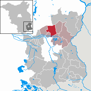
| Location of the municipality of Turnow-Preilack in the Spree-Neisse district | ||
  |
||

Turnow-Preilack , Turnow-Pśiłuk in Lower Sorbian , is a municipality in the Spree-Neisse district in Brandenburg . It is administered by the Peitz Office.
geography
The community is located in the southeast of the state of Brandenburg in Niederlausitz in the traditional settlement area of the Sorbs / Wends . The Malxe and Hammergraben flow in a westerly direction through the southernmost part of the municipality .
Community structure
Districts are Turnow (Turnow) and Preilack (Pśiłuk) . To the district Turnow belongs the living space expansion windmill (Wutwarki pśi wětšniku) .
history
Turnow emerged as a result of the construction of the Peitz fortress in the 16th century and was first mentioned in 1567 under the name Neue Peiz . Because many residents lost their land due to the building of the fortress, they settled in the vicinity of a sheep farm, which initially resulted in the Turnow farm. The place Turnow has an identical German and Sorbian name as a special feature. The Holländermühle built in 1858 belongs to the town of Turnow . Located on the grass swamp or meadow, the Lower Sorbian name Psiluk means Preilack, first mentioned in 1587 as Preylangk . The village was set on fire by Swedish troops in the Thirty Years War in 1641. The place has with the former Chausseegeldhebestelle (also called "Zollhaus") and the Prussian round milestone over witnesses of the Prussian traffic history.
Turnow and Preilack belonged to the Cottbus district in the Prussian province of Brandenburg since 1816 and to the Cottbus-Land district in the GDR district of Cottbus from 1952 . Since 1993 the places have been in the Brandenburg district of Spree-Neisse.
The municipality of Turnow-Preilack was created on December 31, 2001 from the voluntary amalgamation of the previously independent municipalities of Turnow and Preilack.
The municipality promotes the Wendish / Sorbian culture, language and the effective political participation of the Wendish / Sorbian citizens. The labeling of public buildings and facilities, streets, paths, squares and bridges is done gradually in German and Sorbian.
Population development
| year | Turnow | Preilack | year | Turnow-Preilack | year | Turnow-Preilack | ||
|---|---|---|---|---|---|---|---|---|
| 1875 | 548 | 331 | 2001 | 1 290 | 2017 | 1 145 | ||
| 1910 | 865 | 371 | 2005 | 1 289 | 2018 | 1 136 | ||
| 1939 | 840 | 411 | 2010 | 1 204 | 2019 | 1 118 | ||
| 1946 | 976 | 566 | 2011 | 1 184 | ||||
| 1950 | 960 | 545 | 2012 | 1 163 | ||||
| 1971 | 889 | 402 | 2013 | 1 150 | ||||
| 1990 | 787 | 335 | 2014 | 1 145 | ||||
| 1995 | 807 | 366 | 2015 | 1 154 | ||||
| 2000 | 890 | 401 | 2016 | 1 147 |
Territory of the respective year, number of inhabitants: as of December 31 (from 1991), from 2011 based on the 2011 census
politics
Community representation
The community council consists of 10 community representatives and the honorary mayor.
| Party / group of voters | Seats |
|---|---|
| Turnow-Preilack community of voters | 6th |
| CDU | 2 |
| AfD | 2 |
(As of: local election on May 26, 2019 )
mayor
- 2003–2014: Helmut Fries
- since 2014: René Sonke (Turnow-Preilack voter association)
Sonke was elected in the mayoral election on May 26, 2019 with 91.0% of the valid votes for a term of five years without a candidate.
coat of arms
The coat of arms was approved on April 18, 2011.
Blazon : "In red a silver oblique left-hand bar, covered with a blue wavy strip, after the division accompanied by two cut silver branches, a sloe with five black fruits on top and a globe flower with three flowers on the bottom."
Attractions
In the list of architectural monuments in Turnow-Preilack and in the list of ground monuments in Turnow-Preilack are the monuments entered in the list of monuments of the state of Brandenburg.
traffic
The community is located on federal road 168 between Lieberose and Peitz and on state road 50 between Peitz and Guben .
The nearest train station is Peitz Ost on the Guben – Cottbus railway line . It is served by the regional train line RB 11 ( Frankfurt (Oder) - Cottbus ).
Personalities
- Měto Bukwaŕ (1789–1843), pastor, keeper of the Sorbian language ; born in Turnow
- Maria Hartmann , b. Loback (1798-1853), Moravian missionary; born in Turnow
- Mjertyn Moń ( Martin Moyn ; 1848–1905), teacher, Sorbian folklorist and linguist; born in Turnow
Web links
- Community website
- Turnow in the RBB program Landschleicher on November 23, 2008
- Preilack in the RBB program Landschleicher on November 14, 1993
Individual evidence
- ↑ Population in the State of Brandenburg according to municipalities, offices and municipalities not subject to official registration on December 31, 2019 (XLSX file; 223 KB) (updated official population figures) ( help on this ).
- ↑ Federal Agency for Nature Conservation: Location of Turnow-Preilack according to Geospatial services. Protected areas in Germany. Retrieved May 5, 2013 .
- ^ Service portal of the state administration Brandenburg. Turnow-Preilack municipality
- ^ Formation of a new municipality in Turnow-Preilack. Announcement of the Ministry of the Interior of October 30, 2001. Official Gazette for Brandenburg Common Ministerial Gazette for the State of Brandenburg, Volume 12, 2001, Number 49, Potsdam, December 5, 2001, p. 831 PDF
- ↑ Historical municipality register of the state of Brandenburg 1875 to 2005. District Spree-Neisse . Pp. 30-33
- ↑ Population in the state of Brandenburg from 1991 to 2017 according to independent cities, districts and municipalities , Table 7
- ^ Office for Statistics Berlin-Brandenburg (Ed.): Statistical report AI 7, A II 3, A III 3. Population development and population status in the state of Brandenburg (respective editions of the month of December)
- ^ Result of the local election on May 26, 2019
- ↑ Local elections October 26, 2003. Mayoral elections , p. 33
- ^ Result of the mayoral election on May 25, 2014
- ↑ Brandenburg Local Election Act, Section 73 (1)
- ^ Result of the mayoral election on May 26, 2019
- ↑ Coat of arms information on the service portal of the state administration of Brandenburg
- ^ Alfred Roggan: The Sorbian / Wendish missionary Maria Lobak / Marija Lobakojc from Turnow - called Maria Lobach (1798-1853) on www.ebu.de.
Briesen (Brjazyna) | Castle (Spreewald) (Bórkowy (Błota)) | Dissen-Striesow (Dešno-Strjažow) | Döbern (Derbno) | Drachhausen (Hochoza) | Drebkau (Drjowk) | Drehnow (Drjenow) | Felixsee (Feliksowy jazor) | Forest (Lausitz) (Baršć) | Groß Schacksdorf-Simmersdorf (Tšěšojce-Žymjerojce) | Guben (Gubin) | Guhrow (Góry) | Heinersbrück (Móst) | Jämlitz-Klein Düben (Jemjelica-Źěwink) | Jänschwalde (Janšojce) | Kolkwitz (Gołkojce) | Neisse-Malxetal (Dolina Nysa-Małksa) | Neuhausen / Spree (Kopańce) | Peitz (Picnjo) | Schenkendöbern (Derbno) | Schmogrow-Fehrow (Smogorjow-Prjawoz) | Spremberg (Grodk) | Tauer (Turjej) | Teichland (Gatojce) | Tschernitz (Cersk) | Turnow-Preilack (Turnow-Pśiłuk) | Welzow (Wjelcej) | Advertise (Vjerbno) | Meadow bottom (Łukojce)