Quitzdorf dam
| Quitzdorf dam | |||||||||||
|---|---|---|---|---|---|---|---|---|---|---|---|
| Reservoir | |||||||||||
|
|||||||||||
|
|
|||||||||||
| Coordinates | 51 ° 16 '42 " N , 14 ° 45' 42" E | ||||||||||
| Data on the structure | |||||||||||
| Construction time: | 1965-1972 | ||||||||||
| Height above valley floor: | 10.5 m | ||||||||||
| Height above foundation level : | 11.14 m | ||||||||||
| Height of the structure crown: | 162.62 m | ||||||||||
| Building volume: | 200,000 m³ | ||||||||||
| Crown length: | 1400 m | ||||||||||
| Crown width: | 4 m | ||||||||||
| Slope slope on the air side : | 1: 2.0 | ||||||||||
| Slope slope on the water side : | 1: 2.35 | ||||||||||
| Data on the reservoir | |||||||||||
| Altitude (at congestion destination ) | 160.10 m | ||||||||||
| Water surface | 750 ha | ||||||||||
| Storage space | 22.02 million m³ | ||||||||||
| Total storage space : | 25.17 million m³ | ||||||||||
| Catchment area | 174.5 km² | ||||||||||
| Design flood : | 55 m³ / s | ||||||||||
| dam | |||||||||||
The Quitzdorf dam is a dam in the Free State of Saxony . It is located in the municipality of Quitzdorf am See in Upper Lusatia . The lake is used to provide process water , flood protection, low water elevation, recreation and nature conservation. The reservoir is the largest reservoir in Saxony in terms of area and was the largest inland waterway in Saxony until the Lohsa II and Bärwalde reservoirs were flooded . According to the ICOLD criterion, the dam is a "large dam".
description
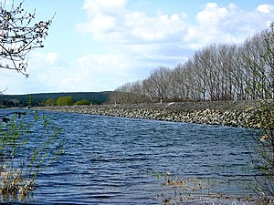
The dam of the Quitzdorf dam is a straight earth embankment made of gravel and sand with a clay concrete core seal. The dam in which the Schwarze Schöps is dammed was built in 1965–1972 near Niesky as a cooling water reservoir for the Boxberg lignite power station. Commissioning took place in 1974. The dam has a kind of pre- dam , the Reichendorf polder , and a side dam on the Kollm polder, from which the water is pumped into the dam.
Until 1969, Quitzdorf, which had 200 inhabitants, was located on the site of the reservoir . The community of Quitzdorf am See , which emerged in 1994 from the merger of the communities of Kollm and Sproitz, is a reminder of this. The village of Reichendorf , formerly Kaana, had to give way to the reservoir in 1981.
The reservoir and its banks are used for recreational activities such as swimming, fishing, camping and sailing. The dam has been open to pedestrians and cyclists during the day since 2010, and a board at the entrance informs visitors about this.
The high concentration of nutrients often leads to an increased formation of cyanobacteria (blue-green algae). The attempt to combat it with aluminum sulphate by the state dam administration of Saxony was unsuccessful.
Redevelopment
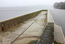
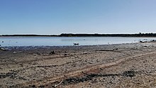
The dam is designed as a gravity wall. In April 2019, severe damage was found to the extraction structure on the water side. The renovation of the structure began with the first step, the damming, on June 24, 2019. If the water is drained, the basic renovation of the reservoir will also be examined.
tourism
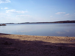
Numerous shoreline areas were renovated and sandy beaches were created on the lake. There are two campsites by the lake and numerous overnight accommodations. Near the shore, a so-called riverside circuit has been developed over 17.5 km, which is paved throughout and car-free.
See also
Web links
Individual evidence
- ↑ sz-online: Blue- green algae in the Quitzdorf reservoir - authorities warn against swimming . In: SZ-Online . ( sz-online.de [accessed October 4, 2017]).
- ↑ Blue- green algae in Quitzdorfer See not defeated . ( radiolausitz.de [accessed October 4, 2017]).
- ↑ https://www.medienservice.sachsen.de/medien/news/226395
- ↑ https://www.ltv.sachsen.de/cardomap3/ltv/wilma.aspx?pgId=162&WilmaLogonActionBehavior=Default
- ↑ Media LK Görlitz: Habitats in LK Görlitz accessed on June 12, 2019


