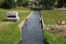
Black Schöps
|
Black Schöps Upper Sorbian Čorny Šepc |
||
|
The mouth of the Schwarzen Schöps in the Quitzdorf dam |
||
| Data | ||
| Water code | EN : 5824 | |
| location | District of Goerlitz , Saxony , Germany | |
| River system | Elbe | |
| Drain over | Spree → Havel → Elbe → North Sea | |
| source |
Sohland am Rotstein 51 ° 5 ′ 26 ″ N , 14 ° 48 ′ 14 ″ E |
|
| Source height | approx. 311 m above sea level NN | |
| muzzle | At Sprey in the Spree coordinates: 51 ° 25 '47 " N , 14 ° 31' 26" E 51 ° 25 '47 " N , 14 ° 31' 26" E |
|
| Mouth height | 116 m above sea level NN | |
| Height difference | approx. 195 m | |
| Bottom slope | approx. 2.9 ‰ | |
| length | 67 km | |
| Discharge at the Boxberg A Eo gauge : 639 km² Location: 7.8 km above the mouth |
NNQ (05/12/1967) MNQ 1927/2005 MQ 1927/2005 Mq 1927/2005 MHQ 1927/2005 HHQ (07/07/1958) |
0 l / s 1.55 m³ / s 4.52 m³ / s 7.1 l / (s km²) 25.9 m³ / s 76 m³ / s |
| Right tributaries | White Schöps | |
| Small towns | Reichenbach / OL | |
| Communities | Vierkirchen , Waldhufen , Quitzdorf am See , Mücka , Kreba-Neudorf and Boxberg / OL | |
The Schwarze Schöps , in Upper Sorbian Čorny Šepc , is a 67 km long right or eastern tributary of the Spree in the Saxon district of Görlitz ( Germany ). It belongs to the river system of the Elbe , which is reached via the Spree and the Havel.
The river rises west of Görlitz in Sohland am Rotstein . Its source is in the southern part of the municipality; The White Schöps rises a few kilometers to the east . From the river's origin, the river, which runs between Lausitzer Neisse in the east and Spree in the west, runs predominantly in a north-westerly direction.

The Schwarze Schöps passes Reichenbach / OL and the Königshain Mountains in the west and flows through the municipalities of Vierkirchen and Waldhufen to the north. The Schwarze Schöps is then dammed up near Quitzdorf am See to form the Quitzdorf reservoir. It then flows through Mücka , Kreba-Neudorf and the municipality of Boxberg / OL , where the White Schöps coming from the east joins. Parts of the lower reaches of the Schwarzen Schöps (from Mücka) run through the Upper Lusatian Heide and Pond Landscape Biosphere Reserve .
The section between the confluence of the Weißen Schöps near Reichwalde, a district of Boxberg / OL and the confluence with the Spree near Sprey also has the name United Schöps or simply Schöps in addition to the name Schwarzer Schöps . This short stretch of river lies entirely in the municipality of Boxberg / OL In Boxberg, the Schöps serves as a drainage water for the Bärwalder See .
By 2014, the White Schöps merged with the Black Schöps near Kringelsdorf.
As part of the relocation of the Weißen Schöps for the Reichwalde lignite mine, the river confluence with the Schwarzen Schöps was relocated.
Web links
Individual evidence
- ↑ Hydrological Handbook. (PDF; 637 kB) Part 3 - Main aquatic values. Free State of Saxony - State Office for Environment and Geology, p. 67 , accessed on December 25, 2017 .
