
Reichenbach / OL
| coat of arms | Germany map | |
|---|---|---|

|
Coordinates: 51 ° 8 ' N , 14 ° 48' E |
|
| Basic data | ||
| State : | Saxony | |
| County : | Goerlitz | |
| Management Community : | Reichenbach / OL | |
| Height : | 249 m above sea level NHN | |
| Area : | 62.64 km 2 | |
| Residents: | 4915 (Dec. 31, 2019) | |
| Population density : | 78 inhabitants per km 2 | |
| Postcodes : | 02894 (Reichenbach / OL, Sohland) | |
| Area code : | 035828 | |
| License plate : | GR, LÖB, NOL, NY, WSW, ZI | |
| Community key : | 14 6 26 450 | |
City administration address : |
Görlitzer Strasse 4, 02894 Reichenbach / OL |
|
| Website : | ||
| Mayoress : | Carina Dittrich (Independent Voting Association "Free Voters" Sohland a. R.) | |
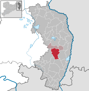
| Location of the city of Reichenbach / OL in the district of Görlitz | ||
  |
||

Reichenbach / OL ( Upper Sorbian Rychbach ) is a small Saxon town in the district of Görlitz in Upper Lusatia . The city is the administrative seat and fulfilling municipality for the administrative community Reichenbach / OL
geography
Community structure
The formerly independent villages Niederreichenbach (incorporated in 1957), Oberreichenbach (1969) and Oehlisch (1974) belong to the city itself . On January 1, 1994, other surrounding communities were incorporated into the city:
- Zoblitz : The place is on the other side of the old Saxon-Prussian border and belonged to the old district of Löbau before the municipal reform in Saxony. In a citizen survey, the population decided to belong to Reichenbach. There is a stop for local trains.
- Meuselwitz : Kirchdorf, to which at the time of incorporation the (formerly independent) communities Goßwitz, Schöps, Borda and Krobnitz also belonged as well as the districts Gurigk, Reissaus and Lehnhäuser .
- Dittmannsdorf with the Biesig district .
- Mengelsdorf , including Löbensmüh and field houses .
On January 1, 2014, the neighboring community of Sohland am Rotstein was incorporated .
history
The establishment of the forest homestead villages of Upper and Lower Reichenbach was at 1200. For the first time later Reichenbach is on February 22, 1238 in a privilege document of the Czech King Wenceslas for the near Ostritz located Cistercian monastery of St. Marienthal mentioned, where it is kept until today. This is a royal for Reichenbach ( Richembach ). Vogt proven. Since the place was located on the medieval trading route Via Regia , it quickly gained in importance. In 1301 the brothers Jencz and Ramfold von Gersdorf are named as lords of Gersdorf and Reichenbach. Reichenbach is expressly referred to as a city for the first time in 1306. The corresponding certificate is in the St. Marienstern monastery in Panschwitz-Kuckau .
-Ketzergrube.jpg)
In the Hussite Wars , Reichenbach was besieged by an 8,000-strong army under Prokop the Great at the turn of the year 1430/31 . The place was burned down, but the residents were able to hide and successfully defend themselves within the city church of St. Johannis, which was surrounded by a defensive wall. The killed Hussites were buried below the Töpferberg (284 m), which is why this place is still called the heretic pit. A gate in the defensive wall of the church, through which some besiegers are said to have penetrated, has since been called the Hussite Gate. In 1580 the Reichenbach estate fell from the von Gersdorff family to the von Warnsdorf family .

Napoleon crossed the town several times , taking quarters with the city's pharmacist. A plaque on the outside wall of the old pharmacy indicates this. In the battle near Reichenbach on May 22, 1813, the French had to surrender to the Russians. In the course of the state reorganization after the Congress of Vienna , the new Saxon-Prussian border was laid between Reichenbach and the neighboring Sohland aR and from 1816 the city belonged to the district of Görlitz in the Prussian province of Silesia .
After the Second World War , from the destruction of which the city was largely spared, the part of Silesia west of the Lusatian Neisse was added to the state of Saxony . After the dissolution of the states in the GDR , the city belonged to the Görlitz district in the Dresden district and, since 1990, again to the newly founded Free State of Saxony. In the meantime, the city fulfills the function of a sub-center in the new district of Görlitz.
Churches
The Evangelical Church Community Meuselwitz-Reichenbach / OL belongs to the Evangelical Church in Berlin-Brandenburg-Silesian Upper Lusatia . The Catholic parish belongs to the diocese of Görlitz , due to a new parish reform, the Catholic Church of St. Anna has been a branch church within the parish of Saint Wenzel Görlitz since September 1, 2012 . There is also an Evangelical Free Church Congregation ( Brethren Congregation ) and a Seventh-day Adventist Church .
politics
(+ 0.6 % p )
( n.k. )
(-8.6 % p )
(-0.7 % p )
( n / a )
Reichenbach is the seat of the administrative community Reichenbach / OL. In addition to the city, this includes the communities Königshain and Vierkirchen .
City council
Since the municipal council election on May 26, 2019 , the 18 seats of the city council have been distributed among the individual groups as follows:
- Independent Reichenbacher Citizens Initiative eV (URBI): 9 seats
- AfD : 4 seats
- CDU : 3 seats
- Independent voter community “Free Voters” Sohland aR (FWS): 2 seats
coat of arms

In blue over blue water, a golden castle with a closed red gate and two tin towers tapering towards the top; between them a small shield, divided and half-split by red, silver, and black.
meaning
The coat of arms in its current form is a new design from 1901. In the foreground is a river or brook that indicates the city name. Above it is a castle, the closed gate of which indicates the repulsed Hussite attacks. Between the towers of the castle in the center of the shield is the coat of arms of the Lords of Gersdorff, who - with interruptions - were the landlords of the town from 1380 to the 19th century .
Gold and blue and the battlements symbolize the location in Upper Lusatia, from whose coat of arms (or the coat of arms of the city of Bautzen ) these elements are taken.
Partner communities
Culture and sights
Cityscape and buildings
-Markt-Ostseite.jpg)
-Bibliothek-Frontansicht.jpg)
The cityscape is shaped by the large market square in the center. The old pharmacy, in which Napoleon and Friedrich Wilhelm III. guested. This is indicated by a plaque on the outside wall of the building facing Schlossgasse. From the back wall of the house, two cannon balls from this period are visible. The savings bank building on the east side of the square used to be an inn. Theodor Körner stayed here in 1809, which is also recorded on a memorial plaque. On the market side, the building is adorned with a relief representation of the city arms. The entrance on Görlitzer Strasse is flanked by large reliefs depicting men bringing their savings to the cash register.
In the center not far from the market there is the newly built city and district library. The Heimatverein Reichenbach built up the Ackerbürgermuseum Reichenbach , which is now part of the Silesian-Upper Lusatian Museum Association. The Bernhard Lekve Park is home to a number of botanical specialties. In Niederhofpark , a memorial stone marks Napoleon's command post during the battle near Reichenbach on May 22, 1813.
-Stadtkirche.jpg)

_Rittergut_Schlo%C3%9F.jpg)
The most striking building in the city is the Protestant town church St. Johannis , which was built in the 12th and 13th centuries. Century was built. Reichenbach did not have a city wall, but the church square is surrounded by a defensive wall. The so-called Hussite Gate is a reminder of the Hussite siege in 1430/31. At this point the besiegers are said to have managed to break through the defensive ring around the church. The church fell victim to a fire in 1670 and was rebuilt in its present form. The organ by the builder Friedrich Ladegast from 1866 was restored in 1999/2000. A comprehensive exterior and interior renovation of the church began in the eighties. The Catholic St. Anne's Church , a neo-Gothic building that was consecrated in 1900 , is located on Görlitzer Strasse, formerly outside the city . Before that there was a half-timbered chapel with a turret, which had been in ruins since 1813.
On the Töpferberg ( 284 m ) there is an old windmill that used to have five blades . On the top of the hill, a memorial stone erected in 1913 refers to the battle near Reichenbach in 1813.
In the incorporated villages, the restored castle in Krobnitz, used as a museum, deserves a special mention with its adjoining park, which the Prussian War and Navy Minister Albrecht Graf von Roon had chosen as his retirement home. In Mengelsdorf , the Tudor- style castle with surrounding park, built in 1859, serves as a socio-therapeutic home for the Caritas home “St. Hedwig ".
The Berlin sculptor Victor Seifert created a memorial for Reichenbach in 1914 for the Prussian politician Otto Theodor von Seydewitz , which was demolished after 1945.
The cultural monuments are recorded in the list of cultural monuments in Reichenbach / OL .
Sports
The outdoor pool was built in 1934 and reopened as an adventure pool in 1994 after extensive reconstruction and modernization. In addition to the swimming pool, the facility also includes sports facilities.
Economy and Infrastructure
traffic
Reichenbach is located on federal highway 6 , which, coming from Görlitz, continues via Dresden in the direction of Harz and Bremen . A bypass was completed in 2005 after two construction phases. The next junctions to Autobahn 4 are Weißenberg and Nieder Seifersdorf . The city was connected to the Görlitz – Dresden railway line in 1847 . The city's train station is now only used as a stop for local trains of the Länderbahn (" Trilex ") and the East German Railway (ODEG). Another stop is in the Zoblitz district between Reichenbach and Löbau . There are bus connections from Kraftverkehrsgesellschaft Dreiländereck and the Oberlausitz regional bus to the larger neighboring cities of Görlitz , Löbau, Niesky and to Bernstadt and Weißenberg.
education
At general schools in Reichenbach there is a secondary school and a primary school under the responsibility of the Saxon Education Agency, Bautzen regional office . The previous institution of both schools was the Polytechnic High School (POS) " Erich Weinert ". Furthermore, there is a branch of the Dreiländereck district music school in Reichenbach (headquarters in Löbau ), which is run by the Görlitz district .
Broadcasting station
The Reichenbach transmitter was inaugurated on July 8, 1937. The official groundbreaking ceremony took place on September 24, 1935 with a large participation of the Reichenbach citizens. Originally a free-standing 100 meter high wooden tower served as an antenna support. This tower was later replaced by a self-radiating transmission mast, which was renewed in 1999. The old transmission mast was blown up on May 7, 1945 at around 9 p.m. by the Wehrmacht. The Reichenbach broadcaster broadcast the MDR Info program on 1188 kHz with an output of 3 kilowatts until April 2013 .
Personalities
- Ernst Karl Gotthelf von Kiesenwetter (1757–1823; born in Leippa ), President of the Oberamtsregierung
- Christian Gottlieb Kauffer (1757–1830; died in Reichenbach / OL), pastor, historian
- Friedrich Wilhelm kauffer (1786–1851), councilor at the court of appeal in Zwickau
- Otto Carl Claudius (1796–1879; born in Sohland a. Rotstein), composer, cantor, musician
- Maximilian von Klotz (1796–1864; born in Biesig near Reichenbach / OL), German forester, from 1830 royal Saxon. Forester and raft supervisor in Bärenfels
- Albrecht von Roon (1803–1879), Prussian general and minister, retirement home at Krobnitz Castle
- Ludwig Eduard Nollau (1810–1869; born in Reichenbach / OL), missionary, co-founder of the Uniate Church in the USA (UCC)
- Otto Theodor von Seydewitz (1818–1898; died in Biesig b. Reichenbach / OL), President of the German Reichstag
- Damm von Seydewitz (1845–1899; born in Reichenbach / OL), governor of the Prussian Upper Lusatia
- Max Hermann Ohnefalsch-Richter (1850–1917), archaeologist
- Heinrich Edgar Martini (1871–1932), classical philologist
- Erich Bär (1905–1981), amateur astronomer and founder of the public observatory in Radeberg
- Werner Jochmann (1921–1994), historian, born in Biesig
- Barbara Bartos-Höppner (1923–2006), writer
- Manfred Freitag (1934–1995), scriptwriter and writer
- Andreas Böer (1950–2020), politician (CDU) and chairman of the Synod of the Evangelical Church in Berlin-Brandenburg-Silesian Upper Lusatia
See also
literature
- Traugott Richter (edit. And ed.): Chronicle of the city and parish Reichenbach O./L . Self-published, Reichenbach O./L. 1867 (Reprint. Books on Demand, Norderstedt 2004, ISBN 3-8334-2448-6 ).
- Between Löbau and Herrnhut (= values of the German homeland . Volume 56). 1st edition. Verlag Hermann Böhlaus successor, Weimar 1996, ISBN 3-7400-0935-7 .
- Heimatverein Reichenbach OL eV (Ed.): Reichenbach OL. A small town in Upper Lusatia. A historic town walk . Geiger-Verlag, Horb am Neckar 1992, ISBN 3-89264-726-7 .
Individual evidence
- ↑ Population of the Free State of Saxony by municipalities on December 31, 2019 ( help on this ).
- ^ Filial church St. Anna. Catholic parish of Saint Wenzel Görlitz, accessed on November 27, 2019 .
- ↑ Local council election 2019. State Statistical Office of the Free State of Saxony , accessed on November 27, 2019 .
- ↑ To the Reichenbach coat of arms. Retrieved March 17, 2013 .
- ↑ G. Köhler (1988): 750 years Reichenbach OL, Eine historical contemplation, p. 58
Web links
- City website
- Reichenbach / OL in the Digital Historical Directory of Saxony

Bad Muskau (Mužakow) | Beiersdorf | Bernstadt ad Eigen | Bertsdorf-Hörnitz | Boxberg / OL (Hamor) | Dürrhennersdorf | Ebersbach-Neugersdorf | Gablenz (Jabłońc) | Goerlitz | Groß Düben (Dźěwin) | Großschönau | Großschweidnitz | Chickens | Hainewalde | Herrnhut | Hohendubrau (Wysoka Dubrawa) | Horka | Jonsdorf | Kodersdorf | Königshain | Kottmar | Krauschwitz (Krušwica) | Kreba-Neudorf (Chrjebja-Nowa Wjes) | Lawalde | Leutersdorf | Löbau | Markersdorf | Mittelherwigsdorf | Mücka (Mikow) | Neißeaue | Neusalza-Spremberg | Niesky | Oderwitz | Olbersdorf | Oppach | Ostritz | Oybin | Quitzdorf am See | Reichenbach / OL | Rietschen (Rěčicy) | Rosenbach | Rothenburg / OL | Loop (slepo) | Schönau-Berzdorf ad Eigen | Schönbach | Schöpstal | Seifhennersdorf | Trebendorf (Trjebin) | Vierkirchen | Forest hooves | White chisel (Wuskidź) | White water (Běła Woda) | Zittau