
Beiersdorf
| coat of arms | Germany map | |
|---|---|---|

|
Coordinates: 51 ° 5 ' N , 14 ° 33' E |
|
| Basic data | ||
| State : | Saxony | |
| County : | Goerlitz | |
| Management Community : | Oppach-Beiersdorf | |
| Height : | 386 m above sea level NHN | |
| Area : | 6.45 km 2 | |
| Residents: | 1140 (Dec. 31, 2019) | |
| Population density : | 177 inhabitants per km 2 | |
| Postal code : | 02736 | |
| Area code : | 035872 | |
| License plate : | GR, LÖB, NOL, NY, WSW, ZI | |
| Community key : | 14 6 26 020 | |
| Community structure: | 5 districts | |
| Address of the municipal administration: |
Löbauer Strasse 69 02736 Beiersdorf |
|
| Website : | ||
| Mayor : | Hagen Kettmann ("EB Kettmann") | |
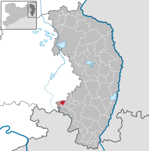
| Location of the municipality of Beiersdorf in the district of Görlitz | ||
  |
||

Beiersdorf ( Upper Sorbian Bejerecy ) is a Saxon community in the district of Görlitz, laid out as a forest hoof village . It belongs to the administrative association Oppach-Beiersdorf .
Geography and traffic
The municipality of Beiersdorf is located in the western part of the district of Görlitz in the Lausitzer Bergland , near the border with Northern Bohemia ( Czech Republic ) and is traversed by Beiersdorf water . It is located about 18 km south of Bautzen and 11 km west of Löbau . The highest mountain is the Bieleboh at 499 meters.
The federal highway 96 runs west of the municipality.
The Taubenheim – Dürrhennersdorf narrow-gauge railway ran through Beiersdorf until September 17, 1945, and was dismantled as a reparation payment for the Soviet Union as a result of the Second World War . The closest train station is now Neusalza-Spremberg on the Oberoderwitz – Wilthen railway line , about 5 km south of Beiersdorf.
history

The establishment of the Beiersdorf settlement apparently took place after 1200 during the time of the German peasant land seizure by locators. When it was first mentioned in a document on January 21, 1272, the place was listed as an episcopal Meissnian interest village, together with the villages of Cunewalde, Spremberg and Niederfriedersdorf. From 1559 on, Beiersdorf was part of the Electorate of Saxony and belonged to the Stolpen office. The Beiersdorf manor had only developed gradually. In 1489, Hans von Rechenberg auf Oppach was enfeoffed with Beiersdorf by Bishop Johann von Meißen . From then until the 17th century, the village remained in the possession of the Rechenberg family.
In 1939 Neulauba was incorporated.
Population development
In the census of May 9, 2011, 1233 people lived in the 461 residential buildings in the municipality. The core town of Beiersdorf had 816 inhabitants, the others lived in the mountains (189), row (80), Zwenke (55), Neulauba (47) and Schmiedenthal (46). The average age was 47.8 years, with clear differences between row (41.6) and Beiersdorf (48.9) as well as Neulauba (56.3), showing that the Neulauba district is over-aging.
| year | Residents |
| 1566 | 21 obsessed men, 15 gardeners |
| 1764 | 12 possessed men, 75 gardeners |
| 1834 | 1,232 |
| 1871 | 1,503 |
| 1890 | 1,544 |
| 1910 | 1,578 |
| 1925 | 1,594 |
| 1939 | 1,678 |
| 1946 | 1,958 |
| 1950 | 2,070 |
| 1964 | 1.937 |
| 1990 | 1,444 |
| 2000 | 1,374 |
| 2007 | 1,284 |
| 2009 | 1,253 |
| 2012 | 1,191 |
| 2013 | 1,174 |
Source: The historical directory of Saxony
Place name forms
The place name should be named after the locator "Beyer / Beier". Another origin of the name is derived from the tribal name of Bavaria.
The name developed as follows: 1272: Begerstorf, Beyerstorp, 1355: Beyersdorf, 1368: Beygirstorf, 1419: Beierßdorff, 1433: Beierstorff, 1504: Beyerßdorf, 1875: Beiersdorf b. Neusalza
Administrative affiliation
1590: Amt Stolpen, 1764: Amt Stolpen, 1816: Amt Stolpen, 1843: Amt Stolpen, 1856: Judicial Office Neusalza, 1875: Amtshauptmannschaft Löbau , 1952: District Löbau , 1994: District Löbau-Zittau, 2008: District Görlitz
religion
43% of the population are Protestant, 4% Catholic. Lutherans can use the Luther Church in Beiersdorf, which is part of the Löbau-Zittau church district of the Evangelical Lutheran Church of Saxony . The few Catholics are assigned to the parish of Mariä Namen in Löbau , Diocese of Dresden-Meißen , which maintains the St. Heinrich chapel in nearby Schönbach .
politics
Municipal council
In the municipal council election on May 25, 2014 , the 10 seats of the municipal council went to the candidates of the Free Voting Association "New Forum" (FWG, 99.5% of the votes). The turnout was 62.5 percent.
mayor
In July 2015, Hagen Kettmann was elected honorary mayor. The predecessor was Matthias Rudolf.
Attractions

- Evangelical Lutheran Church, built in 1855, with older baroque pulpit altar
- Mining hut with observation tower on the Bieleboh
- Atonement Cross
- Tannenhof
- Park in the Amselgrund
- School, built in 1903
- Water wheel board mill
The cultural monuments are listed in the list of cultural monuments in Beiersdorf .
Community structure
Districts are mountains , Neulauba , Schmiedenthal , line and Zwenke .
Sons and daughters of the church
- Ewald Redam (1884–1947), athlete, variety artist and model
literature
- Cornelius Gurlitt : Beiersdorf. In: Descriptive representation of the older architectural and art monuments of the Kingdom of Saxony. 34. Issue: Official Authority Löbau . CC Meinhold, Dresden 1910, p. 1.
Web links
- Beiersdorf in the Digital Historical Directory of Saxony
Individual evidence
- ↑ Population of the Free State of Saxony by municipalities on December 31, 2019 ( help on this ).
- ↑ 2011 census - Beiersdorf community
- ↑ Beiersdorf (4) . Institute for Saxon History and Folklore. Retrieved January 23, 2019.
- ^ Wenzel, Walter: Oberlausitzer Place Name Book: with an excursus on settlement history and multi-colored maps / Walter Wenzel. - Bautzen: Domowina-Verl., 2008
- ↑ census database
- ↑ Results of the 2014 municipal council elections
Beiersdorf | Mountains | New Lauba | Schmiedenthal | Line | Zwenke

Bad Muskau (Mužakow) | Beiersdorf | Bernstadt ad Eigen | Bertsdorf-Hörnitz | Boxberg / OL (Hamor) | Dürrhennersdorf | Ebersbach-Neugersdorf | Gablenz (Jabłońc) | Goerlitz | Groß Düben (Dźěwin) | Großschönau | Großschweidnitz | Chickens | Hainewalde | Herrnhut | Hohendubrau (Wysoka Dubrawa) | Horka | Jonsdorf | Kodersdorf | Königshain | Kottmar | Krauschwitz (Krušwica) | Kreba-Neudorf (Chrjebja-Nowa Wjes) | Lawalde | Leutersdorf | Löbau | Markersdorf | Mittelherwigsdorf | Mücka (Mikow) | Neißeaue | Neusalza-Spremberg | Niesky | Oderwitz | Olbersdorf | Oppach | Ostritz | Oybin | Quitzdorf am See | Reichenbach / OL | Rietschen (Rěčicy) | Rosenbach | Rothenburg / OL | Loop (slepo) | Schönau-Berzdorf ad Eigen | Schönbach | Schöpstal | Seifhennersdorf | Trebendorf (Trjebin) | Vierkirchen | Forest hooves | White chisel (Wuskidź) | White water (Běła Woda) | Zittau