Trebendorf
| coat of arms | Germany map | |
|---|---|---|

|
Coordinates: 51 ° 32 ' N , 14 ° 34' E |
|
| Basic data | ||
| State : | Saxony | |
| County : | Goerlitz | |
| Management Community : | loop | |
| Height : | 126 m above sea level NHN | |
| Area : | 32.05 km 2 | |
| Residents: | 854 (Dec. 31, 2019) | |
| Population density : | 27 inhabitants per km 2 | |
| Postal code : | 02959 | |
| Area code : | 035773 | |
| License plate : | GR, LÖB, NOL, NY, WSW, ZI | |
| Community key : | 14 6 26 560 | |
| LOCODE : | DE TDM | |
| Community structure: | 2 parts of the community | |
| Association administration address: | Friedensstrasse 83 02959 loop |
|
| Website : | ||
| Mayor : | Waldemar Locke ( CDU ) | |
| Location of the community Trebendorf in the district of Görlitz | ||
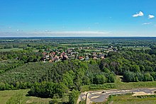
Trebendorf , Upper Sorbian , is a Saxon municipality in the district of Görlitz , which is part of the administrative community. The bilingual community is located in the Sorbian settlement area of Upper Lusatia .
The formerly independent municipality of Mühlrose has been part of Trebendorf since January 1st, 1999. Together, the two places form one of the smallest communities in Saxony in terms of inhabitants (2006: 15th place with 1058 inhabitants).
geography
Location and traffic
The municipality of Trebendorf is located in the northern part of the district, a wooded area on the northwestern edge of the Muskauer Heide . Trebendorf is 5 km west of Weißwasser and 15 km southeast of the Brandenburg town of Spremberg .
Coming from Spremberg, the federal road 156 runs parabolically around the villages of the Schleifer parish to Weißwasser and again in a westerly direction via Boxberg / OL to Bautzen. The Berlin – Görlitz railway line runs through Trebendorf from Loop to Weißwasser, at times parallel to Struga . Most of the area is south of the railway line, while to the north of it is the Halbendorfer See , which emerged from the Trebendorfer Felder opencast mine in the middle of the 20th century .
About five kilometers southwest of Trebendorf is Mühlrose, surrounded by the Schleifer districts of Mulkwitz (in the northwest) and Rohne (in the north), the Tiergarten in the east , which is part of the municipality, and the Nochten open-cast mine in the south and west. To the west of the opencast mine, Spreestrasse ( Kreisstrasse 8481 ) briefly runs through the municipality and provides a connection to the Ruhlmühle part of the village on the Spree . The municipality of Spreetal borders with the Neustadt part of the village Döschko .
Local division
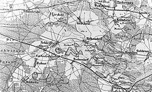
The place Trebendorf is divided into four parts. In addition to the village center ( street village ), these are Kaupe, (Alt-) Hinterberg (both scattered settlements ) and Klein Trebendorf (Sorbian Trjebink ; also called Neu Trebendorf) about one kilometer away from the rest of the village . From 2008, Hinterberg was relocated in favor of the Nochten opencast mine, with the name being retained in one of the new settlement locations. In 2016 only three plots of Alt-Hinterberg were still developed, at the end of 2018 there were still two.
The village of Mühlrose is divided into three parts. In contrast to Trebendorf, the center of the village is a circular structure , which is followed by the extension of the village with scattered farmsteads in a north-easterly direction. The hamlet of Ruhlmühle, mainly east of the Spree, is several kilometers west of the village. The Neustädter and Tzschellner extensions were located between the village and Ruhlmühle until the partial demolitions.
The open-cast mine operator LEAG plans to dismantle the Mühlrose subfield from around 2030. As part of the relocation to the Lieskauer Weg after Runde, only the Ruhlmühle settlement will remain from the original Mühlrose.
history
→ For the history of Mühlrose see Mühlrose #History .
Local history
A Trebindorf first mentioned in a document in 1382 can be referred to Trebendorf-Wiesengrund. Our place was first mentioned in a document in 1399 in connection with the village of Runde . In 1406 Trebendorf Heinrich von Köckritz paid interest onschleife , but his family had already disappeared from Runde by 1430. In the 15th century, Trebendorf became a pertinence of the Muskau rulership, along with other villages in the parish of Runde, and soon after became subordinate to it. The zoo between Trebendorf and Mühlrose was of particular interest to the class rulers, who remained the landlord until the peasants were replaced in the middle of the 19th century. Alleys and dams through the woods are still witnesses of that time.
In the 18th century, a little west of Trebendorf, the Neutrebendorf colony (now Klein Trebendorf) was established, and by 1810 it had seven farms.
Like the entire territory of Muskau, Trebendorf was in the part of Upper Lusatia that the Kingdom of Saxony had to cede to the Kingdom of Prussia in 1815 after the Congress of Vienna . With the majority of the class rule, Trebendorf was defeated to the province of Silesia and incorporated into the district of Rothenburg (Ob. Laus.) Founded in 1816 .
In 1867, an entrepreneur from Spremberg had lignite mined underground in the Gustav Adolph mine . After a few years, this first coal mining in Trebendorf was stopped because the parties involved could not agree. A little later, Trebendorfer found work in Weißwasser, when the heath village developed into the center of European glass production by the turn of the century.
Beginning with the Oder-Neisse crossing on April 16, 1945 and the advance to the Spree near Neustadt / Spree by April 18, the Red Army moved through Trebendorf in the last weeks of the Second World War . After the end of the war, the dead had to be rescued and properly buried. For the fallen Soviet soldiers from the surrounding villages, a Soviet military cemetery with a memorial was built in Trebendorf next to the cemetery. The inhabitants had to appear for the dedication of the Red Army Heroes' Cemetery on September 29, 1945.
The Silesian artist Dorothea von Philipsborn found a place to stay in Trebendorf in the first post-war years before she settled in Weißwasser in the early 1950s. During her time in Trebendorf she carved the new crucifix of the Schleifer Church in the living room of her host family.
As a result of the administrative reform of 1952 , the municipality, which had been in Saxony again since 1945, was assigned to the Weisswasser district in the Cottbus district of Brandenburg-Lower Lusatia .
In the early years of the GDR, the home festivals in Trebendorf had great popularity, for which a stop was set up on the railway line (for a limited period of time).
In addition to the Trebendorfer fields opencast mine, the agricultural production cooperatives (LPG) offered work in the village . Large cattle, pig and hen houses were built for animal production, forests were cleared and connected to form large fields for plant production.
In the first half of the eighties, the small community was able to build an administrative complex with a fire station , community office, post office and community nurses' room.
At the time of reunification , most of the residents in Trebendorf, as in the rest of the district, voted for a change from the Weißwasser district to the state of Saxony. In the Saxon district reform of 1994, the district became part of the Lower Silesian Oberlausitzkreis . As part of the Saxon municipal area reforms, the municipalities of Trebendorf and Mühlrose , as well as Groß Düben and Halbendorf , joined forces on January 1, 1999 and thus decided against incorporation into Runde . At the same time, the three municipalities formed the administrative community loop . As a result of a new district reform, Trebendorf has been part of the newly formed district of Görlitz since August 1st, 2008 .
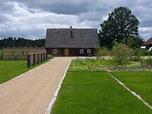
The Hinterberg part of the village has been designated for coal mining for the approaching Nochten opencast mine since 1994. The use of the priority area, which was applied for in 2006 and approved in 2014, meant that the open pit mine should be expanded beyond the area approved in 1994. In this context, the complete resettlement of Klein Trebendorf should have taken place by around 2020. After Vattenfall's sale of its lignite division, the new open- pit mine operator LEAG announced in March 2017 that the company would waive the use of the priority area (except for the Mühlrose subfield). For the resettlers, building areas were created in the village center and in Kaupe, of which around 70 developed plots remained undeveloped after they withdrew from the priority area. Between the village pond and the sports field, which was inaugurated in 1999, a new village center was also built in connection with the relocation of Hinterberg. The house of the bagpiper Hans Schuster (1910–1984) was moved there, and the daycare center was also given a new home in spring 2012.
School in Trebendorf
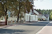
A school of their own was only built in Trebendorf in 1910, before that the children went to the local school in Runde. Initially, lessons took place in two classrooms for first to fourth and fifth to eighth grades. The building was exposed to fire on September 1, 1945 and was rebuilt in 1948. In the meantime, two rooms were rented in Paulo's Gasthof Waldesruh (since 1999: club room in the Gasthaus Kastanienhof ). Up until the 1950s, the children went to school in traditional Sorbian costume , and as industrialization progressed, bilingualism was gradually being pushed back, so that Sorbism in Trebendorf is little more than historical tradition and is mostly only really lived by older residents becomes.
Due to the decline in the birth rate in the period after reunification, the primary school , which the children from Groß Düben and Halbendorf also attended, had to be closed in July 2000. Since then, there has only been a primary school in the Loop administration community. Most recently, around 70% of students took Sorbian lessons. The school was named after the Trebendorfer writer and journalist Paul Thomas (1898–1942).
The secondary school is located in Runde , the next high school is in Weißwasser.
The school building and its outdoor facilities were renovated in 2009–2011. Rental apartments were built, and the municipal office moved to the ground floor.
Population development
| year | Residents (without Mühlrose) |
|---|---|
| 1782 | 125 |
| 1825 | 223 |
| 1863 | 306 |
| 1871 | 361 |
| 1885 | 384 |
| 1905 | 435 |
| 1910 | 537 |
| 1925 | 540 |
| 1939 | 629 |
| 1946 | 699 |
| 1950 | 710 |
| 1964 | 707 |
| 1971 | 708 |
| 1988 | 631 |
| 1991 | 598 |
| 1993 | 596 |
| 1996 | 731 |
| 1998 | 850 |
| 2000 | 883 |
| 2005 | 823 |
| 2010 | 752 |
| 2015 | 708 |
| year | farmers | Cottager | gardener | Economy as a whole |
|---|---|---|---|---|
| 1552 | 17th | 4th | 4th | 25th |
| 1630 | 18th | - | 2 | 20th |
| 1647 | 12 | - | - | 12 |
| 1699 | 17th | 2 | 4th | 23 |
| 1777 | 18th | 1 | 3 | 22nd |
| 1782 | 16 | 1 | 3 | 20th |
| 1810 | 17 - |
1 1 |
3 6 |
21 7 |
From the land register of the Muskau lordship it can be seen that there were 2 fiefdom farmers and 15 half-farmers (a total of 17 possessed men ) as well as 4 gardeners and 4 cottagers lived in Trebendorf . In total there were 25 farms. This number declined in the following period, so that during the Thirty Years War (1618-1648) only 20 farms in 1630 and only 12 occupied and 8 desert farms in 1647 could be recorded. Along with the rebuilding of the class rule, the population grew again in Trebendorf, so that in 1699 there were again 2 feudal farmers, 15 half-farmers, 2 gardeners and 4 cottagers.
During the Saxon state examination in 1777, 18 possessed men, 1 gardener, 3 cottagers (a total of 22 farms) and six desert farms were transmitted for Trebendorf. According to other sources, the number of possessed men was only 15.
In 1810 there were 17 possessed men, 1 gardener and 3 cottagers in the actual village. In the Colonie Neutrebendorf, which was a row of cottages on originally manorial land, 1 gardener and 6 cottagers lived.
In the further course of the 19th century and the early 20th century, the population rose rapidly. In the first census in 1825, in which every inhabitant was counted equally, there were still 223 inhabitants, in 1885 there were already 384 inhabitants and in 1925 540 inhabitants.
As a result of the Second World War and the expulsion of the German population from the formerly German eastern territories, the population continued to rise. While the last pre-war number in May 1939 was 629 inhabitants, in July 1946 more than 10% population growth was recorded. The population remained relatively constant at around 700 until the early 1970s, but then fell back, so that in 1988 there were 631 and in 1990 631 inhabitants.
Despite a decline in the birth rate and moving away due to the loss of jobs, Trebendorf was able to benefit from the onset of suburbanization in the nineties , so that the number of inhabitants rose from around 600 to 850 within five years through the construction of new homes. With 883 inhabitants, Trebendorf had reached its peak in 2000. Since then, the number has dropped to 708 (2015).
Also in 2000 the community of Trebendorf (with the districts Trebendorf and Mühlrose) reached its (statistical) maximum population. The number of 1,147 inhabitants has since fallen continuously and at the end of 2010 was back below the 1000 mark at 999.
Many of the residents of Trebendorf look back on a German-Sorbian past. In 1863, Sorbs made up the majority of the population with 288 of the 306 inhabitants . Industrialization, especially in the nearby Weißwasser, and the ensuing influx of people favored a mix, while Germanization was promoted during the Nazi era. Nevertheless, Ernst Tschernik still had a stable Sorbian-speaking majority of the population of 76.8% in 1956, including 140 children and young people. Since then, however, the number of Sorbian speakers has decreased significantly.
Place name
According to Jan Meschgang , the Sorbian name of Trebendorf, Trjebin, comes from trjebić 'clearing up the trees with roots', so Trebendorf is a 'clearing village'. Ernst Eichler and Hans Walther pointed out that due to the late onset of tradition and an inconsistent development, in addition to this meaning there is also the possibility of deriving a personal name, but the location of the place suggests an origin from an Old Sorbian clearing name.
The German place name developed from the first mention as Trebindorf (1382) via Dreben (1552), Dorff Treben (1597), Trebendorff (1704), Drebendorff (1732) to Trebendorf (1791).
Documented traditions of the Sorbian place name include Tŕebin (1843), Trjebin (1866) and Trebin (1885).
politics
(-4.9 % p )
(+ 3.6 % p )
(+ 9.0 % p )
(-1.8 % p )
Municipal council
Since the municipal council election on May 26, 2019 , the 12 seats of the municipal council have been distributed among the individual groups as follows:
- Voters' association Trebendorf: 4 seats
- Voter association We for Trebendorf: 4 seats
- Voters' association We for transparency in Trebendorf: 2 seats
- CDU : 2 seats
mayor
Waldemar Locke (CDU) from Mühlrose has been the honorary mayor of Trebendorf since December 8, 2017. He prevailed against another candidate with 52.9% of the vote; both candidates were local councilors before the election. The mayoral election took place at the same time as the 2017 Bundestag election ; the turnout of 85% was significantly higher than the average for previous mayoral elections.
Locke's predecessor Kerstin Antonius, against whom she won the mayoral election in 2010 with 78.6% of the valid votes, did not run again for personal reasons. Under her predecessor Peter Mäkelburg, who held the office of mayor from May 1, 1982 to September 30, 2010, she was a local councilor, chairwoman of the building committee and deputy mayor for many years.
coat of arms
The community of Trebendorf does not have a coat of arms, but has been using a coat of arms-like logo since 2008. A Sorbian bagpiper in festive costume is depicted on a yellow background and lined with the Sorbian flag. The logo is borrowed from the sleeve symbol of the Trebendorf volunteer fire brigade , which has shown a Sorbian bagpiper for a long time. This is to honor the legacy of the well-known Trebendorfer bagpiper Hans Schuster.
Attractions
- Schusterhof in Trebendorf's new town center
- Viewpoint of the Nochten opencast mine
- Three- and four-sided courtyards in clinker construction
- Fairground and hydroelectric power station in Ruhlmühle
Sources and further reading
literature
- Gerhard Fugmann, Manfred Noack: Trjebin Trebendorf - A Chronicle . 2013.
- Robert Pohl : Heimatbuch des Kreis Rothenburg O.-L. for school and home . Buchdruckerei Emil Hampel, Weißwasser O.-L. 1924, p. 186 f .
- From the Muskauer Heide to the Rotstein. Home book of the Lower Silesian Upper Lusatia District . Lusatia Verlag, Bautzen 2006, ISBN 978-3-929091-96-0 , p. 227 .
Footnotes
- ↑ Population of the Free State of Saxony by municipalities on December 31, 2019 ( help on this ).
- ↑ Population of the Free State of Saxony in 2006 by municipalities. (No longer available online.) Archived from the original on September 25, 2008 ; Retrieved July 1, 2008 .
- ↑ The State Statistical Office of the Free State of Saxony states 1921 ha of the 3,205 ha of community area as forest area, see community statistics 2019 for Trebendorf .
- ↑ STAA Bautzen, 50120 Landherrschaft Baruth, documents, No. 4 (Mitth. Thomas Wittig)
- ↑ StBA: Changes in the municipalities in Germany, see 1999
- ↑ a b administrative community loop. Community Loop, accessed December 26, 2019 .
- ^ A b c Hermann Graf von Arnim , Willi A. Boelcke : Muskau. Jurisdiction between the Spree and the Neisse . Verlag Ullstein, Berlin, Frankfurt / M., Vienna 1978, ISBN 3-550-07377-1 , p. 604 f .
- ↑ a b c Trebendorf in the Digital Historical Directory of Saxony
- ↑ a b From Muskauer Heide to Rotstein , page 227.
- ↑ Municipal directory Germany 1900. Retrieved on December 24, 2008 .
- ↑ a b Saxony regional register. Retrieved November 29, 2012 .
- ^ Ludwig Elle: Language policy in the Lausitz. A documentation 1949–1989 (= writings of the Sorbian Institute . Volume 11 ). Domowina-Verlag , Bautzen 1995, p. 255 .
- ^ Jan Meschgang : The place names of Upper Lusatia . 2nd Edition. Domowina-Verlag, Bautzen 1979 (edited by Ernst Eichler ).
- ↑ a b Ernst Eichler , Hans Walther : Ortnamesbuch der Oberlausitz - Studies on the toponymy of the districts of Bautzen, Bischofswerda, Görlitz, Hoyerswerda, Kamenz, Löbau, Niesky, Senftenberg, Weißwasser and Zittau. I name book (= German-Slavic research on naming and settlement history . Volume 28 ). Akademie-Verlag, Berlin 1975, p. 317 .
- ↑ Results of the 2019 municipal council election , State Statistical Office of the Free State of Saxony
- ↑ a b Mayoral election 2017. State Statistical Office of the Free State of Saxony , accessed on December 10, 2017 .
- ^ Daniel Preikschat: Antonius and Locke want to become mayors in Trebendorf. In: Lausitzer Rundschau . October 14, 2010, accessed December 10, 2017 .
- ↑ Trebendorf-Mühlroser Nachrichten, No. 15, October / November 2008.


