Dürrhennersdorf
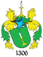
| coat of arms | Germany map | |
|---|---|---|

|
Coordinates: 51 ° 3 ' N , 14 ° 36' E |
|
| Basic data | ||
| State : | Saxony | |
| County : | Goerlitz | |
| Management Community : | Neusalza-Spremberg | |
| Height : | 396 m above sea level NHN | |
| Area : | 10.71 km 2 | |
| Residents: | 986 (Dec. 31, 2019) | |
| Population density : | 92 inhabitants per km 2 | |
| Postal code : | 02708 | |
| Area code : | 035872 | |
| License plate : | GR, LÖB, NOL, NY, WSW, ZI | |
| Community key : | 14 6 26 070 | |
| Community structure: | 2 districts | |
| Address of the municipal administration: |
Hauptstrasse 60 02708 Dürrhennersdorf |
|
| Website : | ||
| Mayor : | Albrecht Gubsch (independent) | |
| Location of the municipality of Dürrhennersdorf in the district of Görlitz | ||
Dürrhennersdorf ( Upper Sorbian search Hendrichecy ) is a Saxon community in the district of Görlitz . It extends in the valley of the Großschweidnitzer water , near the border with the Czech Republic and belongs to the administrative community Neusalza-Spremberg .
Geography and traffic
The municipality of Dürrhennersdorf is located in the western part of the district, about 7 km south of Löbau on the northern edge of the Lausitzer Bergland between the Kuhberg (433.6 m), the Seidelberg (424.7 m), the Hutberg (422.5 m) and the Hölleberg (347.1 m). The federal highway 96 and the border with the Czech Republic run south of the municipality. The Dürrhennersdorf station is located on the Ebersbach – Löbau railway line , which, however, has been closed except for goods traffic and special trips. The Höllengrund , a narrow valley of Großschweidnitz water, begins northeast of the village .
From 1892 to 1945 the narrow-gauge railway Taubenheim – Dürrhennersdorf ran via Schönbach and Oppach to Taubenheim / Spree .
history
Dürrhennersdorf was placed under the High Court of Löbau in 1306, like most of the villages in the area, at that time it was written as Heinrickesdorpp, which indicates a locator Heinrich. This year is also considered the first written mention of the place. In 1631 during the Thirty Years' War Dürrhennersdorf was sacked.
In the spring of 1940, the Polish couple Anton and Josefa Mielniczuk came to the local manor as slave labor . Her son Kazimierz was raised by the German midwife Gertrud Landgraf - contrary to the NS instructions on the treatment of "foreigners" - and thus she saved his life.
At the end of the Second World War, after the railway viaduct and the small railway bridge were blown up, Dürrhennersdorf was forcibly the temporary terminus for numerous displaced persons and refugees from the Sudetenland and Silesia. Some stayed here forever.
Place name forms
1306: Heinrickesdorpp, 1348: Henrichisdorf, 1419: Heynerßdorff dorre, 1448: Heinirsdorff, 1483: Heinerßdorff, 1503: Dorrheynerßdorff, 1569: Dorrenhennerßdorf, 1657: Dürrhennersdorff
Administrative affiliation
1777: Bautzen district, 1843: Löbau district court, 1856: Neusalza court office , 1875: Löbau district administration , 1952: Löbau district , 1994: Löbau-Zittau district, 2008: Görlitz district
Population development
| year | Residents |
|---|---|
| 1777 | 19 possessed men, 22 gardeners, 66 cottagers |
| 1834 | 870 |
| 1871 | 1,100 |
| 1890 | 969 |
| 1910 | 978 |
| 1925 | 1.311 |
| 1939 | 1,321 |
| 1946 | 1,609 |
| 1950 | 1,724 |
| 1964 | 1,523 |
| 1990 | 1,203 |
| 2000 | 1,272 |
| 2007 | 1,163 |
| 2009 | 1,148 |
| 2012 | 1,046 |
| 2013 | 1,018 |
Community structure
Districts are Dürrhennersdorf and Neuschönberg .
politics
Since the municipal council election on May 26, 2019 , the 12 seats of the municipal council have been distributed among the individual groups as follows:
- Free voters' association (FW): 7 seats
- CDU : 3 seats
- vacant, not enough candidates: 2 seats
Attractions
- Half-timbered houses
- Schützenhaus (restaurant with club room and bowling alley)
- Park with annual cultural events
The cultural monuments are recorded in the list of cultural monuments in Dürrhennersdorf .
Sons and daughters of the church
- Karl Eduard Hofmann (1792–1860), a friend and colleague of Beethoven, piano teacher in Prague
- Richard Petri (1823–1906), chief public prosecutor, member of the Saxon state parliament
- Oskar Schwär (1890–1968), local poet and researcher of Upper Lusatian customs
- Willi Hennig (1913–1976), biologist
- Siegfried Hauptmann (1931–2011), chemist
- Wolfgang Böhmer (* 1936), physician and politician (CDU), 2002–2011 Prime Minister of Saxony-Anhalt
literature
- Cornelius Gurlitt : Dürrhennersdorf. In: Descriptive representation of the older architectural and art monuments of the Kingdom of Saxony. 34. Issue: Official Authority Löbau . CC Meinhold, Dresden 1910, p. 95.
Individual evidence
- ↑ Population of the Free State of Saxony by municipalities on December 31, 2019 ( help on this ).
- ↑ Ursula Höntsch: Kazio und seine Mütter , in: Die Stunden Null, Berlin 1966, p. 140
- ^ Dürrhennersdorf in the Digital Historical Directory of Saxony
- ↑ Results of the 2019 municipal council elections
- ↑ http://www.schuetzenhaus-duerrhennersdorf.de/
- ↑ http://www.park-duerrhennersdorf.de/


