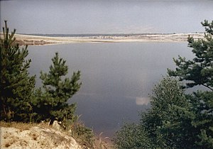
Lohsa II reservoir
| Lohsa II reservoir | ||
|---|---|---|

|
||
| Geographical location | Upper Lusatia , Germany | |
| Tributaries | Spree | |
| Drain | Spree | |
| Places on the shore | Lohsa | |
| Location close to the shore | Hoyerswerda , Weißwasser | |
| Data | ||
| Coordinates | 51 ° 26 '0 " N , 14 ° 27' 0" E | |
|
|
||
| Altitude above sea level | 110.6 m above sea level NN | |
| surface | 10.81 km² | |
| volume | 97,000,000 m³ | |
|
particularities |
Remaining lake from the Lohsa opencast mine |
|
The Lohsa II reservoir, also known as Lohsaer See ( Upper Sorbian Łazowski jězor ), is a lake in the Lusatian Lakeland in Upper Lusatia, Saxony . It is located in the area of the eponymous municipality Lohsa between Hoyerswerda and Weißwasser .
lake
The flooding of the open pit of the Lohsa opencast mine by the LMBV with Spree water began on August 14, 1997 and was completed in 2013. The lake covers an area of about 10 km² and stores 97 million m³ of water. This makes it one of the larger lakes in the Lusatian Lakeland.
In the vicinity are the reservoirs Bärwalder See in the southeast, Dreiweibern and Lohsa I in the south, and Scheibesee and Bernsteinsee in the west. For some of these lakes, the Lohsa II reservoir will act as a water reservoir via canals.
The reservoir also serves to balance the water in the Spree and thus for the nearby Boxberg power plant , the Spreewald biosphere reserve and Berlin's water balance . In addition to the 61 million m³ of usable storage volume, 25 million m³ of water are available from the upstream Bärwalder See.
