Sea manual
The sea handbook (also sailing instructions , English: Sailing Directions ) is a practical compendium of nautical science with directories of the oceans, shipping routes, weather and nature observations, legal regulations of the individual countries as well as the ports with their facilities and controls. Sea handbooks have been published in Germany since 1990 by the Federal Maritime and Hydrographic Agency . For some time now, the BSH has only been issuing sea manuals for the German Baltic and North Sea coasts.
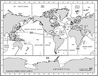
The comparable, English-language Sailing Directions of the US National Geospatial Intelligence Agency can be downloaded free of charge from the Internet.
history
Until the 18th century, sailing instructions were the basis of nautical navigation . Only in the course of the creation of precise nautical charts did their importance decrease somewhat or shift towards more detailed information on shipping routes.
The oldest German sea book dates from around 1470 and is based on sources that in some cases go back to the first half of the 14th century. It contains information about tides and tides, sea depths and basic conditions, anchorages, harbors , courses and directions. In earlier times, the seafarers' wealth of experience with coastal navigation was passed on orally.
In modern times, the British Hydrographic Department of the Royal Navy published the Sailing Directions known as Pilots since 1828 . Since 1863, the Hydrographic Bureau in Germany published information for shipping as messages for seafarers. Since 1883 they have been printed weekly as an independent publication. "Sailing instructions" for the German coast have been processed since 1867, and since 1878 in book form. Over time, complete sea manuals were initially created for the domestic areas.
From 1885 until the end of the Second World War , 63 sea manuals were published for worldwide seafaring.
Examples
- Baltic Sea Handbook, Part I: Poland, Baltic Republics, Russia and Finland ISBN 3-89871-087-4
- Natural conditions in the Mediterranean and Black Sea, Part B of the Mediterranean manuals, first to fifth part ISBN 3-89871-063-7
- Mediterranean Manual, Part Five The Levant, Black Sea and Sea of Azov ISBN 3-89871-051-3
literature
- The history of maritime services in Germany - The BSH and its predecessors. (PDF; 158 kB) Retrieved September 20, 2010 .
Individual evidence
- ↑ Albrecht Sauer: The "Seebuch" . The oldest surviving sea manual and the late medieval navigation in northwestern Europe. Kabel Verlag, Hamburg 1997, ISBN 978-3-8225-0395-9 .
