Shag Island (Heard and McDonald Islands)
| Shag Island | ||
|---|---|---|
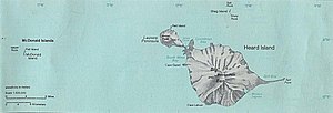
| Map of the Heard Archipelago and McDonald Islands with Shag Island north of Heard | ||
| Waters | Indian Ocean | |
| Archipelago | Heard and McDonald Islands | |
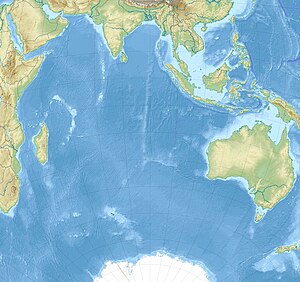
| Geographical location | 52 ° 55 ′ 0 ″ S , 73 ° 35 ′ 0 ″ E | |
|
|
||
| length | 800 m | |
| Residents | uninhabited | |
Shag Island (from English shag ' Kormoran , Scharbe' ) is an 800 m long island in the Archipelago Heard and McDonald Islands in the southern Indian Ocean . It is the central and largest in a group of three islands (the others are Sail Rock and Drury Rock ) that are 10 km north of Heard Island .
The island appears for the first time as Shag Rock on maps of the US sealer captain HC Chester from 1860, who was operating in the waters around the archipelago at that time. A more precise mapping and naming under the name common today took place in 1874 during the British Challenger Expedition (1872–1876).
Web links
- Shag Iceland in the Geographic Names Information System of the United States Geological Survey (English)
- Shag Island on geographic.org (English)

