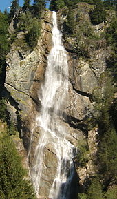
Steiner waterfalls
The Steiner waterfalls are located at the end of the Matrei basin in East Tyrol and plunge from the Äußere Steiner Alm into the valley. The eponymous Steiner Bach overcomes an altitude difference of around 1000 meters. The Steiner waterfalls are divided into the Upper and Lower Steiner waterfalls and are among the highest waterfalls in Austria.
The Obere Steiner Wasserfall ( ⊙ ) has a height of 160 meters (according to other information only 90 meters) and is the higher of the two falls. Due to the unfavorable location, it can only be seen from Steinerweg and is rather unknown. A memorial plaque for Munich insurance director Carl von Thieme , owner of Weissenstein Castle , who sponsored the construction of a now dilapidated wooden walkway over the waterfall in 1903, is placed near it .
The lower Steiner waterfall ( ⊙ ) plunges over a height of 120 meters from the Lublaß into the Prosseggklamm through which the Tauernbach flows and can already be seen from Seblas .
In 1920, a power plant ( ⊙ ) was built on the Steiner Bach between the two falls , which could supply the entire Matrei valley floor with electricity. In 1940 the power station was expanded to become the Tauernbach power station. The municipality sold the system to TIWAG . The Tauernbach power plant fits harmoniously into the bottom of the gorge. Due to a rockfall event in 2002, the power plant was shut down.
Web links
- Stone fall. In: European Waterfalls. Retrieved November 25, 2014 (images).
Individual evidence
- ↑ Helmut Dumler / Gerhard Hirtlreiter: East Tyrol North . 60 hikes and mountain tours in the East Tyrolean part of the Hohe Tauern National Park. 2014, ISBN 978-3-7633-4099-6 , pp. 54–55 ( limited preview in Google Book Search [accessed November 25, 2014]).
- ↑ Helmut Dumler / Gerhard Hirtlreiter: East Tyrol North . 60 hikes and mountain tours in the East Tyrolean part of the Hohe Tauern National Park. 2014, ISBN 978-3-7633-4099-6 , pp. 41–43 ( limited preview in Google Book Search [accessed November 25, 2014]).
- ↑ Proseggklamm hydroelectric power station on the Tauernbach - upper level. Office of the Tyrolean Provincial Government * Department of Water, Forestry and Energy Law, 2012, accessed on November 25, 2014 (extract from the water book).
- ↑ Prosseggklamm natural heritage. Retrieved November 25, 2014 .
- ^ Minutes of the meeting of the municipal council of the market town of Matrei in East Tyrol. (PDF) October 4, 2010, accessed November 25, 2014 .
