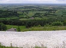
Sutton Bank
Sutton Bank is an elevation in North Yorkshire , north east England. It is on the edge of the Howardian Hills and thus also on the edge of the North York Moors . It is best known for its spectacular views, especially from the Roulston Scar cliff : from there, the Vale of York and the Vale of Mowbray can be seen, the visibility is around 50 kilometers on a clear day. The almost vertical cliff on its south side is 140 meters high.
history
Sutton Bank was formed during the Vistula Ice Age when a glacier pushed through the depression between the North York Moors to the east and the Pennines to the west.
The ridge already served as the site of a large fortification in the Iron Age that dates back to around 400 BC. BC originated. The earthworks that still exist today suggest a size of the system of at least 24 hectares, the largest remaining earthfill is today a height of almost three meters. Larger parts of the facility were destroyed in the second half of the 20th century when the gliding club built a runway and clubhouse; that parts of the fort had stood there only later became apparent.
tourism
Today, Sutton Bank is mainly used for tourism: as the A 170 enters the North York Moors here, Sutton Bank is considered the “gateway to the national park” and is the location of a visitor center.
The Cleveland Way long distance hiking trail runs over the elevation. A gliding club, the Yorkshire Gliding Club, has been using the cliff as an airfield since 1933.
The Kilburn White Horse has graced a slope of Sutton Bank since 1857.
Pass road
The A 170 overcomes a height difference of 160 meters on the Sutton Bank ascent on a distance of about 1200 meters, with individual sections having a gradient of up to 25%, including a hairpin curve . The road is closed to campers.
The police have to provide assistance to broken down trucks around 120 times a year, and another 400 trucks sometimes take several hours to climb.
Remarks
- ↑ Northyorkmoortour: Introduction ( Memento of the original from July 5, 2008 in the Internet Archive ) Info: The archive link was inserted automatically and has not yet been checked. Please check the original and archive link according to the instructions and then remove this notice.
- ^ English Heritage
- ^ Nationaltrail.co.uk: Cleveland Way: Attractions near the Trail
- ^ Yorkshire Gliding Club
- ↑ Northyorkmoortour: The Bank ( Memento from October 12, 2006 in the Internet Archive )
- ↑ Drive to keep traffic moving on notorious Dales road In: Yorkshire Dales Country News. January 30, 2007.
Web links
- North York Moors National Park on Sutton Bank (English)
- English Heritage: Sutton Bank Hillfort (English)
Coordinates: 54 ° 14 ′ N , 1 ° 13 ′ W

