Tandsawer
Coordinates: 39 ° 21 ′ 1 ″ N , 46 ° 19 ′ 42 ″ E
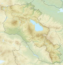
Tandsawer ( Armenian Տանձավեր ) is a village and a rural community ( hamaynkner ) with about 200 inhabitants in the southern Armenian province of Sjunik . In the center of the village there is an Armenian Apostolic Church from 1705.
location
Tandsawer is located at around 1,600 meters above sea level in a densely wooded valley on an earth road (H45) that leads from Tatev Monastery in a southeastern direction to Kapan . The rarely used “Alte-Tatew-Straße” mainly serves as a connection between the villages in the valley, while the north-south long-distance traffic uses the M2 between Goris and Kapan. From Tatev the road overcomes a ridge with a pass height of 1970 meters to the first village of Aghwani and reaches Tandsawer three kilometers further. The next place in the south is called Werin Chotanan.
Townscape
In the 2001 census, the official population was given as 263. According to official statistics, there were 214 inhabitants in Tandsawer in January 2009.
The consistently simple farmhouses are surrounded by vegetable gardens and apple trees. Between them lie haystacks and cattle stalls. The settlement extends along the road on the slope of the valley below wooded hilltops and above the valley depression used as pastureland.
The Surb Hripsime Church ("Holy Hripsime "), dated 1705, was preserved directly on the street . In the three-aisled basilica , two massive pillars in each row, which are connected to one another by round arches, divide the space into a wide, high central nave and two narrower, lower aisles. They are covered by a single gable roof, the stone slabs of which are overgrown with grass. This type of building is characteristic of the rural churches built in southern Armenia from the 17th century. Especially in the Sangesur area , archaic-looking pillar basilicas were built in the early Christian style. The elongated type with two pairs of pillars also includes the church in Old Chndzoresk (1665), the Haranc Anapat monastery (founded in 1613 and destroyed by an earthquake in 1658), Mec Anapat (“Great Hermitage”, which was subsequently rebuilt in 1662) in the province of Sjunik ) established, and in the province of Vayots Dzor Province Our Lady Church of Yeghegis dated (1703) and the monastery church of Schatiwank (around 1655).
The outer walls consist of roughly hewn basalt and tuff stones that are walled up in horizontal layers. There is no architectural jewelry. The only entrance in the middle of the south wall is bordered by a pointed arch. The interior walls are plastered. In addition to the semicircular altar apse raised by a bema (pedestal) there are narrow rectangular side rooms. Half-height partition walls in the arched fields between the rear pillars and the west gable show that the church has recently been used as a cattle shed or warehouse. A similar, poorly preserved church with the entrance to the west is in the neighboring village of Verin Khotanan.
Web links
- Brady Kiesling: Rediscovering Armenia Guidebook - Syunik Marz. 2005 (at Armeniapedia)
Individual evidence
- ↑ Rick Ney: Siunik . (PDF; 1.6 MB) TourArmenia, 2009, p. 24
- ^ RA 2001 Population and Housing Census Results. (PDF; 927 kB) armstat.am
- ^ RA Syunik Marz. Marzes of the Republic of Armenia in Figures 2009. (PDF; 284 kB) armstat.am, p. 262
- ^ Jean-Michel Thierry: Armenian Art. Herder, Freiburg / B. 1988, p. 321, ISBN 3-451-21141-6


