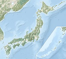
Tango Amanohashidate Ōeyama Quasi-National Park
|
Tango Amanohashidate Ōeyama Quasi-National Park
|
||
| location | Kyoto Prefecture , Japan | |
| surface | 190.23 km² | |
| WDPA ID | 555575149 | |
| Geographical location | 35 ° 34 ' N , 135 ° 11' E | |
|
|
||
| Setup date | August 3, 2007 | |
| administration | Kyoto Prefecture | |
The Tango Amanohashidate Ōeyama Quasi National Park ( Japanese 丹 後 天橋 立 大 江山国 定 公園 , Tango amanohashidate kokutei kōen ) is one of over 50 quasi national parks in Japan . The park, founded on August 3, 2007, covers an area of approx. 190 km².
See also
Web links
Commons : Tango-Amanohashidate-Oeyama Quasi-National Park - Collection of pictures, videos and audio files
- Kyoto Prefecture website (Japanese)

