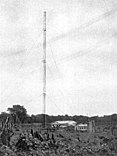
Telefunken Railway (Samoa)
| Telefunken Railway | |||||||||||||
|---|---|---|---|---|---|---|---|---|---|---|---|---|---|
|
Tamasese , the native king of Samoa,
inspects the narrow-gauge railway | |||||||||||||
| Gauge : | 600 or 610 mm | ||||||||||||
| Top speed: | 19 km / h | ||||||||||||
|
|||||||||||||
The Telefunken Railway was a more than 6.4 km long private narrow-gauge railway from the coast near Apia to the Telefunken station on Mount Vaea in what was then German Samoa .
history
The Germans built the narrow-gauge railway to bring building materials to the new Telefunken radio station in Samoa. The radio station was put into operation as planned on August 1, 1914, shortly after the start of the First World War . The main route was about 6.4 km long and the network had a total length of 12.9 km, including branches into several coconut plantations. A locomotive with a gasoline engine , which must have been manufactured for Telefunken by the Oberursel engine factory , could pull a maximum load of five tons at a top speed of 19 km / h (12 mph).
When the NZR railroad workers arrived in Samoa as the armed forces of the 3rd Auckland Regiment, the railway line was not operational, but a group of track builders under Lieutenant Christophers re-aligned the tracks and bedded them in new gravel. For several days there was brisk activity with an average of 30 trains per day from the landing stage at Apia to Vaea Camp, where the Railway Corps had set up camp. The locomotive was quickly labeled NZR and named A1 , but the men missed the typical New Zealand A-class steam whistle sound , so two engine drivers were hired to put a whistle on the locomotive.
It was difficult for the regiment to put the radio station back into operation because the Germans had removed important parts. As an emergency solution, the kerosene generator of the ice cream machine of the Apia butcher's shop was confiscated in order to use it on a trial basis to operate the radio station. But he wasn't powerful enough for that. After the rev limiter of the glow-head diesel engine, which the Germans had removed, was reinstalled, the engine could be started. However, it turned much too fast because the rev limiter had not been set correctly, so that the flywheel shattered and a part hit the mast at a height of 75 m, which bent it and then tore off the leg of a radio station employee. The restart of the radio station was a point of honor for the English, New Zealand and Australian troops. Their futile efforts did not go unnoticed by the natives. In particular the accident with the diesel generator got around quickly despite the strictest secrecy, which damaged the reputation of the English among the Samoans.
The New Zealand railroad workers extended the route to their camps at Vaea and Malifa. During the occupation, the railway was used to transport supplies and ammunition as well as to transport sawn timber for the huts in the camp and gravel for paving the way to the radio station. The 'Apia Express' was also used for excursions on Sundays when the soldiers had their day off.
See also
Individual evidence
- ↑ Telefunken-Zeitung, No. 18, October 1919. Retrieved July 29, 2018.
- ^ Evening Post , November 11, 1914. Retrieved July 29, 2018.
- ↑ Jens Merte: engine factory Oberursel AG. Retrieved July 29, 2018.
- ^ Maritime Radio: Apia Radio (Samoa). Retrieved July 29, 2018.
- ^ The Railwaymen in Samoa. NZ National Army Museum. Retrieved July 29, 2018.
Coordinates: 13 ° 53 ′ 1 ″ S , 171 ° 49 ′ 55 ″ W.


