Tell Hassuna
Coordinates: 36 ° 10 ′ 0 ″ N , 43 ° 6 ′ 0 ″ E
Tell Hassuna ( Arabic حسونة, DMG Ḥasūna ) is an archaeological dig site in northern Mesopotamia .
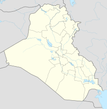
location
The settlement hill ( Tell ) is located about 35 kilometers south of the northern Iraqi city of Mosul . The excavations date from between 5500 and 5000 BC. Chr.
excavation
A homestead in Tell Hassuna can be seen as a prototype of the farm at the end of the Neolithic . This homestead at Tell Hassuna and a group of similar structures form a village that is likely to be typical of the early farming settlements. The pottery found there is characteristic and eponymous for the entire period of the Hassuna culture .
The homestead shows a clear system of walls intersecting at right angles. The core of the complex is a rectangular nave. With the access on the long side, it follows the principle of cross-access. The main room goes through the entire width of the house, four smaller rooms lie in pairs on both sides. A side wing is attached to the main house at a right angle, presumably as a stable and tool shed. Both wings of the house have vertical masonry at the ground floor level.
literature
- Seton Lloyd, Fuad Safar, Robert J. Braidwood: Tell Hassuna Excavations by the Iraq Government Directorate General of Antiquities in 1943 and 1944. Journal of Near Eastern Studies Vol. 4, October 1945, pp. 255-289
Web links
- 034. Hassuna (ancient name unknown). Colorado State University
Individual evidence
- ↑ Peter N. Peregrine, Melvin Ember (Ed.): Encyclopedia of Prehistory: Volume 8: South and Southwest Asia (= Yale University. Human Relations Area Files [Ed.]: Encyclopedia of Prehistory: South and Southwest Asia . Volume 8 ). Springer Science & Business Media, 2003, ISBN 0-306-46262-1 , p. 50–51 (English, limited preview in Google Book Search).
- ↑ dtv-Atlas Baukunst, 2009
