Tunb Islands
| Tunb Islands | ||
|---|---|---|
| Sketch map from 1928 | ||
| Waters | Persian Gulf | |
| Geographical location | 26 ° 15 ′ N , 55 ° 13 ′ E | |
|
|
||
| Number of islands | 2 | |
| Main island | Tonb-e Bozorg | |
| Total land area | 12.3 km² | |
| Residents | 450 | |
| Big and Small Tunb with Abu Musa | ||
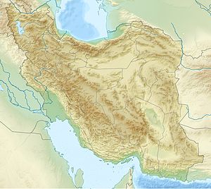
The Tunb Islands ( Persian تنب بزرگ و تنب کوچک, Tonb-e Bozorg va Tonb-e Kutschak , Arabic طنب الكبرى وطنب الصغرى, DMG Ṭunb al-kubrā wa-Ṭunb aṣ-Ṣuġrā , engl. Greater and Lesser Tunbs , dt. Large and Small Tunb ;طنب/ Tonb means "hilly place") are two small islands twelve kilometers apart in the eastern Persian Gulf , which are currently administered as part of the Iranian province of Hormozgan . They are claimed by the United Arab Emirates as the territory of the Emirate of Ra's al-Khaimah .
history
According to several reports from seafarers, the islands were uninhabited in the early 19th century. On the largest island lived antelopes, which were hunted by the British ship crews who anchored in Basidu on the island of Qeschm .
In the 1908 Gazetteer Tunb Island was listed as part of the Khaimah (Rās-al) District .
The islands, which together have an area of 12.3 km², are the subject of territorial disputes between the United Arab Emirates and Iran. In 1971, during the time of the Shah , Iran occupied the Tunb Islands militarily. This was followed by the establishment of naval bases to secure the oil transport through the Strait of Hormuz.
Geographical location
The island TonB e Bozorg ( 26 ° 15 '45 " N , 55 ° 18' 16" O ) has an area 10.3 sq km (3.75 x 3.9 km) and about 450 population, mainly from fish Life. The highest point is 53 m above sea level. d. M. She is about five times the size of Tonb-e Kutschak.
The approximately triangular west of the TonB e Bozorg deeper in the Persian Gulf island TonB e Kutschak ( 26 ° 14 '28 " N , 55 ° 8' 51" O , arabic Tunb as-sughra , persian: Dschazire-ye TonB e Kutschak ) has an area of approx. 2 km² and is uninhabited. The highest point is 36 m above sea level.
The neighboring island of Abu Musa is located south of these islands. The Tunb Islands are at the western entrance to the Strait of Hormuz . The next place on land is Bandar Lengeh (Iran) in the north.
See also
literature
- Guive Mirfendereski: The Toponymy of the Tonb Islands. In: Iranian Studies, Vol. 29, No. 3/4, summer – autumn 1996, pp. 297-320


