Valdes Island
| Valdes Island | ||
|---|---|---|
| Coast of Valdes Island | ||
| Waters | Strait of Georgia , (Pacific Ocean) | |
| Archipelago | Gulf Islands | |
| Geographical location | 49 ° 3 ′ N , 123 ° 38 ′ W | |
|
|
||
| length | 15.1 km | |
| width | 2.5 km | |
| surface | 23 km² | |
| Highest elevation | Mexicana Hill 212 m |
|
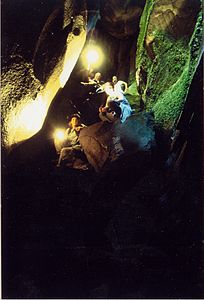
| Cave on Valdes Island | ||
The island of Valdes Island belongs to the southern part of the Gulf Islands in the Canadian province of British Columbia and is located between the mainland and Vancouver Island .
The island in the Strait of Georgia is a maximum of 10 miles long and a maximum of 2 kilometers wide. The highest point on the island is Mexicana Hill with a height of 212 meters. The island is covered with other smaller mountains that reach a height between 100 and 140 meters.
The island is separated from Vancouver Island to the west by four smaller islands. The northern neighbor island is Gabriola Island while the southern one is Galiano Island . In the southwest is Thetis Island .
The island is part of the Cowichan Valley Regional District . There is no real place or a focus of settlement on the island. The few permanent residents live in separate houses. Smaller clusters of houses can be found on the north coast and in the Lyackson reservations , mainly the one at Shingle Point on the west coast.
history
The island was named after the Spanish navigator Cayetano Valdés y Flores , who sailed these waters with the expedition of 1791 under Alessandro Malaspina di Mulazzo and that of 1792 under Dionisio Alcalá Galiano . However, the name was not given to the island until 1859 by the English navigator and hydrographer George Henry Richards .
Before the arrival of the first European explorers and settlers, however, the island was already inhabited by First Nations , mainly the Lyackson tribe. More than 60 archaeological sites have been found on the island. Settlement of the island has been proven for more than 1000 years.
traffic
Valdes Island is not regularly accessible by ferries. There is also no official seaplane base on or around the island, but a corresponding landing is still possible. The island still has no road network.
Parks
On the island there is a provincial park, the Wakes Cove Provincial Park . This park, in the north of the island, can only be reached by water.
Web links
- Valdes Island . In: BC Geographical Names (English)
- Information on the island on britishcolumbia.com (Engl.)
Remarks
- ^ Mexicana Hill. peakbagger.com, accessed April 17, 2013 .
- ^ Andrew Scott: The Encyclopedia Of Raincoast Places Names: A Complete Reference to Coastal British Columbia . Habour Publishing, Madeira Park (BC) 2009, ISBN 978-1-55017-484-7 , pp. 616 (English).
- ^ Walbran, John T. British Columbia Coast Names, 1592-1906: their origin and history. Ottawa, 1909


