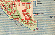
Vippetangen
Vippetangen is the name of the southern tip of a peninsula and a jetty in the port of the Norwegian capital Oslo . It is located southeast of Akershus Fortress . The name is derived from a Vippefyr , a movable beacon that is said to have stood on the tip of the headland . Up until the beginning of the 20th century there was a public bathing area here.
The modern quays were built from 1899 onwards. They included the town's fishing port with fish processing halls and cold stores, as well as the pier for the transatlantic liners , the so-called "Amerikabåtene". A specially constructed freight tram , the so-called Korntrikk ( grain tram) , led from the large grain silo located there to a mill in the Grünerløkka district . Today are on the Vippetangen the quays for the ferry to Copenhagen and investors for the island ferries to the islands of the inner Oslo Fjord .
Web links
- Information about Vippetangen on the port administration website with map, webcam and aerial photo
- Vippetangen on geographic.org
Coordinates: 59 ° 54 ′ 10.4 " N , 10 ° 44 ′ 30.7" E

