Wasserburg Hofteich
| Wasserburg Hofteich | |
|---|---|
|
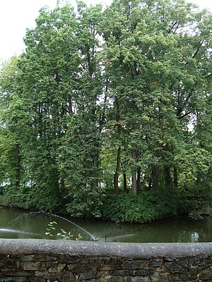
The island in Gelenau called Hofwall |
|
| Alternative name (s): | Hofwall, Hofinsel, moat, castle, Bühl |
| Creation time : | 13th century |
| Castle type : | Niederungsburg |
| Conservation status: | Burgstall, surrounding moat |
| Geographical location | 50 ° 42 '46.8 " N , 12 ° 58' 59.5" E |
The Wasserburg Hofteich , also called Hofwall , Hofinsel , Wallgraben , Schloss , Bühl , is a lost moated castle in Gelenau in the Ore Mountains . The complex was probably built in the 13th century.
Description and history
The facility was located in the eastern part of Gelenau on the south side of the former manor. The castle was first mentioned in a document in 1279 as the manor of Rudegerus de Geilnowe . The defense system had a square, walled core structure with a side length of 23 meters. In the north there was access via a bridge. The trench is about 18 meters wide at this point, on the other sides it is much larger - in the northwest about 40 meters, in the southeast about 30 meters. The core plant plateau is about 1 meter above the water surface of the pond. In front of this runs from the northwest over the south side to the northeast an outer wall 6 meters wide and a maximum of 3 meters high. In 1960 the complex was placed under protection as a historical monument .
literature
- Volkmar Geupel : The protected ground monuments in the Karl-Marx-Stadt district (= small writings of the State Museum for Prehistory Dresden. H. 3, ISSN 0232-5446 ). State Museum for Prehistory, Dresden 1983.
Individual evidence
- ^ Description of the facility in Volkmar Geupel: soil monuments in the Karl-Marx-Stadt district. 1983, p. 75
