Wiedenfeld
Wiedenfeld was an independent municipality in the Bergheim (Erft) district until 1958 and was part of the city of Bergheim until it was relocated due to the Bergheim open-cast mine in 1965 . With Wiedenfeld, the places Frauweiler and Garsdorf also disappeared from the map.
history
As with Frauweiler and Garsdorf , the history of Wiedenfeld begins with a document from the early 12th century. The name Wiedenfeld means something like a field in the forest. The first master of Wiedenfeld is the Count of Jülich . However, as all too often in history, rulers change over the years.
In contrast to its neighboring villages Frauweiler and Garsdorf, Wiedenfeld has a special feature. It had a second "district". Mondaysend was at the eastern end of Wiedenfeld. The Maendach inn stood here once in the 16th century (Monday), and over time more houses have been built around the inn.
In the 17th or 18th century there was a hermit in Wiedenfeld who gave lessons to the children of the village. Later a school was built in the village, which was expanded in 1888 and 1935. Wiedenfeld was characterized by agriculture. Although the quality of the soil was not that good, it was enough for the Wiedenfeldern to live. With the industrialization through mining, many workers were drawn to the place. In 1956 360 people lived here.
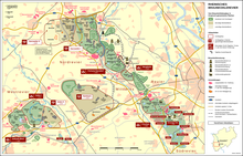
If Wiedenfeld, Frauweiler and Garsdorf were founded the same, their end was the same. On April 1, 1958, the independent community Wiedenfeld was dissolved and came to the city of Bergheim. In 1968 the excavators of the Garsdorf opencast mine were at the door. The Wiedenfelder found a new home in Neu-Wiedenfeld near Bergheim. In memory of the place, the local recreation area between Niederaussem and Bergheim is now called Wiedenfelder Höhe and can be reached via the B 477 .
Individual evidence
- ↑ Martin Bünermann: The communities of the first reorganization program in North Rhine-Westphalia . Deutscher Gemeindeverlag, Cologne 1970, p. 185 .
Coordinates: 50 ° 59 ′ 43.4 " N , 6 ° 37 ′ 27.4" E

