
Zuma (Nubia)
Zuma is a village and a burial ground named after it in the vicinity of the Barkal mountain (approx. 25 km downstream) in what is now Sudan . The place is about 10 km south of al-Kurru on the right side of the Nile .
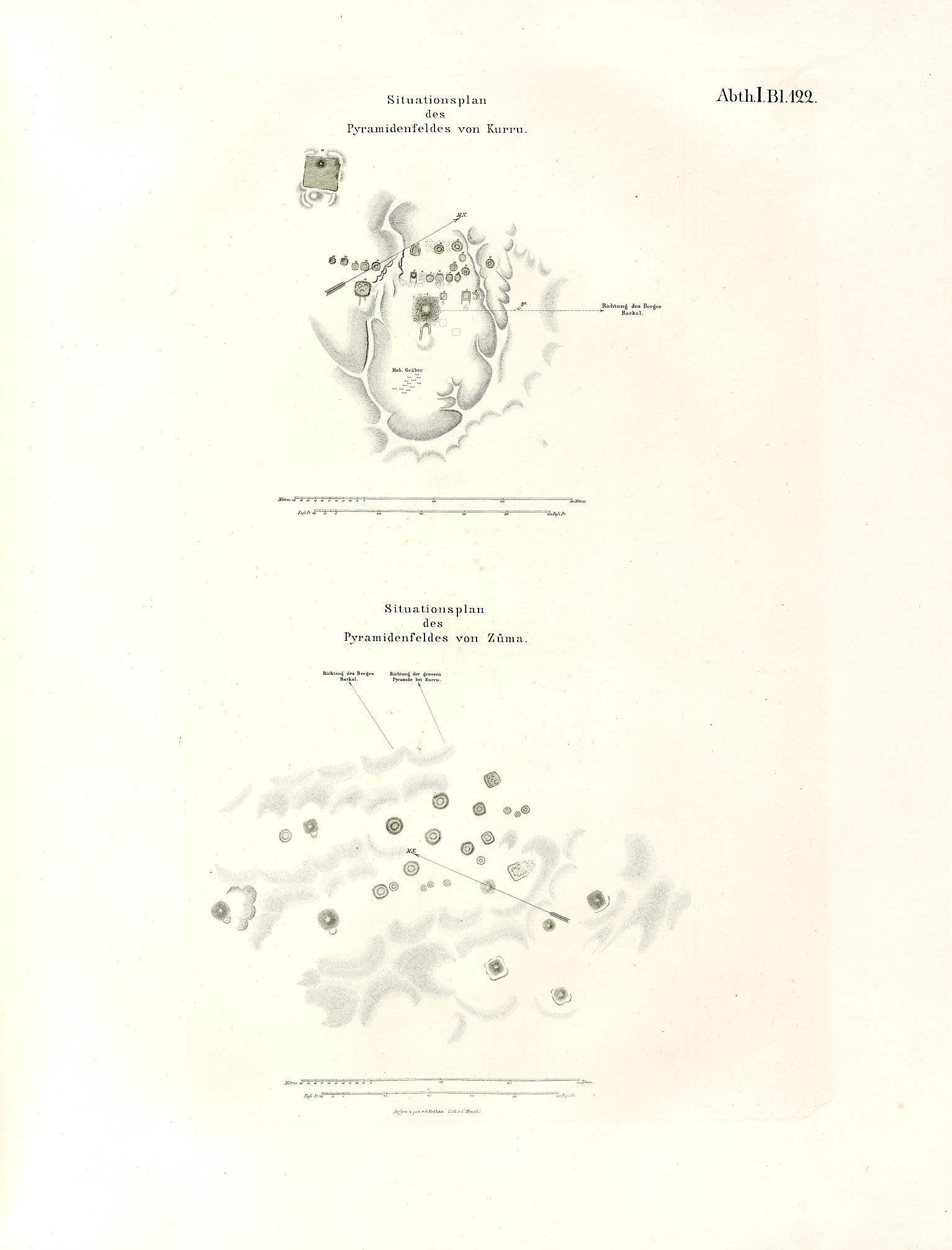
The cemetery has been visited several times over the past two hundred years, but there have only been brief descriptions and no excavations. Richard Lepsius' expedition drew z. B. a plan.
Modern excavations
Modern, systematic Polish- Sudanese excavations began in December 2004. On the surface, 29 burial mounds can still be seen today. So far, three graves have been excavated. Three types of graves could be distinguished, mainly based on the grave mound. Type I consists of hills that are completely covered with stones. The burial mounds have a diameter of 25 to 53 m and were once 6 to 13.5 m high. Type II mounds are 21 to 31 m in diameter. They are made of sand and loose stones. A stone ring that goes around the hill holds it together. The underground grave shaft is M-shaped (viewed from above) and has two chambers, one for burial and the other for grave goods. Type III hills are flat and less than 1 meter high. They have a diameter of 9 to 20 m and only one burial chamber.
All burial chambers were robbed when they were found and only contained numerous ceramics, pearls, metal fragments and animal bones. The ceramics in particular date the graves to the end of the 5th and the first half of the 6th century.
The cemetery of Zuma received 2003 together with other places around the UNESCO status World Heritage Site .
See also
literature
- Mahmoud El-Tayed: Early Maukrua Research Project, Excavations at El-Zuma, Preliminart Report. In: Polish Archeology in the Mediterranean XVI, 2004, pp. 389-399.
- Artur Obluski: Remarks on a Survey of the Tumuli Field at El-Zuma. In: Polish Archeology in the Mediterranean XVI, 2004, pp. 400-403.
- Marta Osypinska: Animal Bones from the Excavations at Ez-Zuma. In: Polish Archeology in the Mediterranean XVI, 2004, pp. 404-408.
Individual evidence
Web links

Cultural heritage: Jebel Barkal and the sites of the Napata region: al-Kurru , Nuri , Sanam and Zuma (2003) | Archaeological Sites of Meroe Island : Musawwarat es-Sufra and Naqa (2011)
Natural heritage: Sanganeb Atoll Marine National Park and Dungonab Bay Marine National Park - Mukkawar Island (2016)
Coordinates: 18 ° 22 ′ N , 31 ° 45 ′ E