
Jöhstadt
| coat of arms | Germany map | |
|---|---|---|

|
Coordinates: 50 ° 31 ' N , 13 ° 5' E |
|
| Basic data | ||
| State : | Saxony | |
| County : | Erzgebirgskreis | |
| Height : | 780 m above sea level NHN | |
| Area : | 49.7 km 2 | |
| Residents: | 2620 (Dec. 31, 2019) | |
| Population density : | 53 inhabitants per km 2 | |
| Postal code : | 09477 | |
| Area code : | 037343 | |
| License plate : | ERZ, ANA, ASZ, AU, MAB, MEK, STL, SZB, ZP | |
| Community key : | 14 5 21 330 | |
| LOCODE : | DE JST | |
City administration address : |
Market 185 09477 Jöhstadt |
|
| Website : | ||
| Mayor : | Olaf Oettel (independent) | |
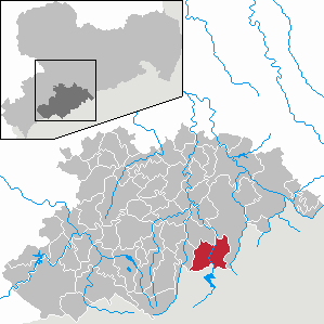
| Location of the city of Jöhstadt in the Erzgebirge district | ||
  |
||

Jöhstadt is a country town in the Saxon Ore Mountains and is located 45 kilometers south of Chemnitz .
geography
Jöhstadt is located in the Ore Mountains directly on the border with the Czech Republic , which can be reached via two border crossings for pedestrians. One leads from the town into the Black Water Valley to Černý Potok ( Pleil-Sorgenthal ), the other lies in the Preßnitz Valley and leads from the Schmalzgrube district to Kryštofovy Hamry ( Christophhammer ).
Neighboring communities
| Mildenau | ||
| Königswalde |
.svg)
|
Marienberg |
| Kryštofovy Hamry (Christophhammer) |
City structure
|
Districts:
|
Parish parts: |
Furthermore, on the road to Kühberg is the group of houses Weißer Hirsch , which is better known today under the name "Berghof".
Incorporations
- January 1, 1949: incorporation of Oberschmiedeberg into Steinbach
- March 1, 1994: Incorporation of Schmalzgrube
- July 1, 1996: incorporation of Grumbach
- January 1, 1999: Incorporation of Steinbach and Oberschmiedeberg
history
.jpg)


Jöhstadt was founded in 1513 on the corridor of the forest hoof village Goswinsdorf , which was mentioned in 1386 . Presumably Goswinsdorf was founded around 1200, later the place was called Josephsdorf . In 1429 it was called a desert . In 1459, however, the place again had 64 houses and 5 Hufen.
At the beginning of the 16th century, in the course of the second mountain screeching from the direction of Annaberg, a wave of miners settled on the former site of Goswinsdorf. Silver mining began in Jöhstadt in 1513 with the first successful prospecting. In 1555 the place was referred to as a mountain town and in 1591 as a patch. 1518 the place received the Bergfreiheit, 1655 the town charter , but was allowed to rise until 1791 own taxes. In 1655, the year the town was granted town charter, the “Jöhstadt Mining, Knapp and Brotherhood”, which still exists today, was founded. Between the 16th and 19th centuries, mining for silver, cobalt, iron and copper was carried out in Jöhstadt. In 1539 a stamping mill was opened in Schlössel . Treasure trove around Jöhstädt were u. a. the Augusta-Schacht , Buquoy-Rottenhan-Erbstolln , the Friedrich-August-Fundgrube , the Hilfe-Gottes-Stolln , the Josephsstolln and the Maschkeschacht . With the closure of the Josephs tunnel in 1836, active mining in Jöhstadt ended.
Goswinsdorf and later Jöhstadt belonged to the Reformation the parish Arnsfeld . Around 1459 a clergyman from the Wolkenstein monastery was a clergyman in Arnsfeld and had a quarterly mass to read in Goswinsdorf. The oldest church in town was St. Joseph's Church , which was located on the market. According to a message from 1459, it was dedicated to St. Joseph , Mary's husband . This is where the later name Jöhstadt comes from . The church had relics of the namesake, which is why it was a pilgrimage church in Catholic times . During the reign of Elector John the Steadfast (1525 to 1532) these shrines were removed. Shortly thereafter, in the course of the Reformation, it was appointed an independent Protestant parish church. In the 17th century, Jöhstadt on the border with Electoral Saxony experienced an influx of Protestant religious refugees from Bohemia , so-called exiles , who were expelled in their Catholic homeland due to their beliefs in the course of the Counter Reformation . These immigrants settled near the border and founded the village of Dürrenberg between 1623 and 1651 . Due to the increasing number of Protestant Christians in Jöhstadt, the existing St. Joseph's Chapel became too small. Since the mountain town was not in a position to financially support the construction of a church, a call for donations was started with the approval of Elector Johann Georg II of Saxony . The foundation stone for the new church was laid on April 15, 1675. After two and a half years of construction, the church was renamed “St. Salvator "(" The Holy Redeemer ") consecrated. It was not until 1852 that it received its 45-meter-high tower extension. The St. Joseph's Chapel was used for fasting and funeral sermons until the 19th century. After that, the building, which had meanwhile become dilapidated, was de-dedicated in 1838 and demolished a year later. At the beginning of the 1960s, a new, Catholic "St.Josephs Chapel" was built in Jöhstadt.
Until 1856, Jöhstadt was in the Electoral Saxon or Royal Saxon office of Selva . In 1835 the individual estate Weißer Hirsch (known today as "Berghof") to the west of the city was placed under the administration of Jöhstadt. From 1856, the city with its parts of the settlement Dürrenberg and Schlössel belonged to the Jöhstadt court office and from 1875 to the district administration of Annaberg .
On June 1, 1892, Jöhstadt was connected to the Selva – Jöhstadt narrow-gauge railway. In the following year, the line was extended to the Fladerschen Feuerlöschgerätefabrik (today: PF Pumpen und Feuerlöschtechnik GmbH) on the state border. A continuation planned in the years 1912–1914 across the Bohemian border to Pleil-Sorgenthal and Weipert failed because of the outbreak of the First World War and the subsequent political development. The section from Jöhstadt station to the state border was closed in 1964, and the section from Jöhstadt to Niederschmiedeberg followed in January 1984 . Between 1992 and 2000, the section between Jöhstadt and Steinbach was rebuilt as a museum railway (Preßnitztalbahn).
As a result of the second district reform in the GDR , Jöhstadt came to the Annaberg district in the Chemnitz district in 1952 (renamed the Karl-Marx-Stadt district in 1953 ), which was continued as the Saxon district of Annaberg from 1990 and became part of the Erzgebirge district in 2008. Between 1994 and 1999 the current districts were incorporated.
Population development
On October 3, 1990, there were 3,820 inhabitants in Jöhstadt.

|
|
Source: State Statistical Office of the Free State of Saxony
politics
Municipal council
Since the municipal council election on May 26, 2019 , the 13 seats of the municipal council have been distributed among the individual groups as follows:
The turnout in 2019 was 71.6%.
mayor
In June 2013 Olaf Oettel was elected mayor. In 2017 there was a referendum "Voting Mayor Olaf Oettel". In order to vote Oettel out, a simple majority of those entitled to vote would have been required for the necessary referendum, for which 3 votes were missing.
coat of arms
In the oldest known local seal from 1553 a fir tree and charcoal burning equipment ( poker , rake) are depicted. The number 1655 marks the year in which city rights were granted. The coat of arms indicates silver finds in this area, the fir tree with the equipment indicates active coal burning.
Blazon : In gold a blaugegürteter kneeling angel in a silver dress and silver wings holds the two blue coats of arms . These show a crossed golden mallet and iron at the front, a green, rooted fir tree at the back , poker crossed at an angle and a golden coal rake. In the base of the shield the year 1655.
Town twinning
- Velden (Pegnitz) , Bavaria
- Olsberg , North Rhine-Westphalia
- Gutach im Breisgau , Baden-Wuerttemberg
- Ebelsbach , Bavaria

.jpg)
Culture and sights
- see also: List of cultural monuments in Jöhstadt
Museums
On the eight-kilometer stretch from Jöhstadt to Steinbach, a museum railway, the Preßnitztalbahn, has been running on a section of the former narrow-gauge railway between Selva and Jöhstadt since 1993 .
The exhibition and vehicle hall of the Preßnitztalbahn is located in Schlössel . In this multifunctional hall, exhibitions are regularly shown between May and October. A permanent exhibition is dedicated to the Pressnitz Valley Railway. There are other thematic events (also without reference to the museum railway).
Buildings
- St. Salvator Church in Jöhstadt with an extraordinary altar and historical organ
- Old melting furnace in the Schmalzgrube district: evidence of iron mining
- Saxon post mile column and royal Saxon station stone on the market in front of the town hall
Visitor mine
Between the districts of Steinbach and Schmalzgrube, on the western slope of the Preßnitz valley, there is the visitor mine "Andreas-Gegentrum-Stolln", whose name is derived from its location opposite the "Andreas-Stolln". At the visitor mine there is a stop for the narrow-gauge railway Wolkenstein – Jöhstadt .
The ironworks Schmalzgrube is a UNESCO World Heritage Site of the Erzgebirge Mining Region .
Hiking and biking trails
- Stage 7 of the Erzgebirge – Vogtland ridge trail from Statute to Bärenstein runs through Schmalzgrube to Schlössel. Then the Kammweg bypasses the center of Jöhstadt to the south. In Dürrenberg it runs right on the border with the Czech Republic.
- The Annaberger Landring (Südring) runs through Jöhstadt and then through the valley of the Jöhstädter Schwarzwasser and the Preßnitz through Schlössel, Schmalzgrube, Steinbach and Oberschmiedeberg.
Economy and Infrastructure
Business
One of the largest wind energy parks in Saxony is located in Jöhstadt. The main branches of business are small and medium-sized industry (wood processing, tool construction) and tourism. On the former site of the factory of EC Flader Feuerlöschgerätefabrik , fire pumps are still manufactured today by the company PF Pumpen- und Feuerlöschtechnik GmbH.
.jpg)
traffic
The city is located on Landesstraße 265. In 1892, the previously remote Jöhstadt was connected to the narrow-gauge railway from Wolkenstein to Jöhstadt . After the cessation of traffic on the last section to Jöhstadt in 1984, the line was initially dismantled. From 1992, part of the route to Steinbach was rebuilt by enthusiasts. The museum railway operation of the Preßnitz Valley Railway, which began in 2000, through Schmalzgrube to Steinbach, with steam locomotives on weekends, has since contributed significantly to the region's tourist significance. The city of Jöhstadt has been the licensed railway infrastructure company for the narrow-gauge railway since 1994 .
The connection to Annaberg-Buchholz and other neighboring towns is now ensured daily with the regular buses of the Erzgebirge regional transport .
In the neighboring Czech towns of Černý Potok (Pleil-Sorgenthal) and Kryštofovy Hamry (Christophhammer) there are hiking border crossings from Jöhstadt and Schmalzgrube.
Personalities
- Johann Andreas Cramer (1723–1788), writer and theologian
- Friedrich Lindemann (1792–1854), educator and philologist
- Franz Alexander Maschke (1844–1923), conservative politician, Member of the State Parliament (Kingdom of Saxony)
- Paul Alfred Biefeld (1867–1943), astronomer and physicist
- Herbert Schönemann (1936–2019), art historian
- Christine Meyer (* 1948), politician (CDU)
literature
- Richard Steche : Jöhstadt. In: Descriptive representation of the older architectural and art monuments of the Kingdom of Saxony. 4th booklet: Official Authority Annaberg . CC Meinhold, Dresden 1885, p. 80.
- Jöhstadt . In: August Schumann : Complete State, Post and Newspaper Lexicon of Saxony. 17th volume. Schumann, Zwickau 1830, pp. 101-106.
- Jöhstadt. In: Max Grohmann “The Upper Ore Mountains and its Cities”, pp. 1–24 of Chapter 9, Graser, Annaberg 1903
- Between Wolkenstein, Marienberg and Jöhstadt (= values of our homeland . Volume 41). 1st edition. Akademie Verlag, Berlin 1985.
- Local history of Jöhstadt. Edited by Bernd Schreiter . VBS Arnsfeld 2012
Web links
- Official website of the city of Jöhstadt
- Jöhstadt in the Digital Historical Directory of Saxony
Individual evidence
- ↑ Population of the Free State of Saxony by municipalities on December 31, 2019 ( help on this ).
- ^ A b Albert Schiffner: Handbook of Geography . First delivery, containing the district of Zwickau. Friedrich Fleischer, Leipzig 1839, Jöhstadt, p. 280 ff . ( Reading sample ).
- ^ Website of the Knappschaft Jöhstadt
- ↑ Jöhstadt in the book "Sächsischer Erzbergbau"
- ^ History of the Church of Arnsfeld
- ↑ History of the Jöhstadt Church of St. Salvator
- ↑ The old St. Joseph's Chapel in Jöhstadt on www.alt-erzgebirge.de ( page no longer available , search in web archives ) Info: The link was automatically marked as defective. Please check the link according to the instructions and then remove this notice.
- ↑ Jöhstadt. In: www.tu-chemnitz.de. KSG Chemnitz, accessed on February 3, 2020 .
- ^ Karlheinz Blaschke , Uwe Ulrich Jäschke : Kursächsischer Ämteratlas. Leipzig 2009, ISBN 978-3-937386-14-0 ; P. 68f.
- ↑ The White Stag in the Bärenstein community gazette, edition 02/2013, p. 9f. ( Memento of the original from December 5, 2017 in the Internet Archive ) Info: The archive link was inserted automatically and has not yet been checked. Please check the original and archive link according to the instructions and then remove this notice.
- ^ The official authority Annaberg in the municipal register 1900
- ↑ Archived copy ( memento of the original from August 8, 2017 in the Internet Archive ) Info: The archive link was inserted automatically and has not yet been checked. Please check the original and archive link according to the instructions and then remove this notice.
- ^ Jöhstädter gazette. docplayer.org, January 11, 2017, accessed February 3, 2020 .
- ↑ Deselection fails due to three votes: Olaf Oettel can remain in office. www.freipresse.de, March 20, 2017, accessed on February 3, 2020 .
- ↑ The election of Jöhstädter Mayor Oettel failed. www.radioerzgebirge.de, March 20, 2017, accessed on February 3, 2020 .
- ↑ Worsened supply: prescription collection point has to go. m.apotheke-adhoc.de, May 14, 2019, accessed on February 3, 2020 .
- ^ Map of the Annaberger Landring
- ↑ Information from the Federal Railway Authority - List of EVUs in the FRG ( Memento of the original from October 25, 2007 in the Internet Archive ) Info: The archive link was inserted automatically and has not yet been checked. Please check the original and archive link according to the instructions and then remove this notice.

Amtsberg | Annaberg-Buchholz | Aue-Bad Schlema | Auerbach | Bear Stone | Bockau | Börnichen / Erzgeb. | Breitenbrunn / Erzgeb. | Burkhardtsdorf | Crottendorf | Deutschneudorf | Drebach | Ehrenfriedersdorf | Eibenstock | Parents | Gelenau / Erzgeb. | Geyer | Gornau / Erzgeb. | Gornsdorf | Großolbersdorf | Großrückerswalde | Grünhain-Beierfeld | Grünhainichen | Heidersdorf | Hohndorf | Jahnsdorf / Erzgeb. | Johanngeorgenstadt | Jöhstadt | Königswalde | Lauter-Bernsbach | Loessnitz | Lugau | Marienberg | Mildenau | Neukirchen / Erzgeb. | Niederdorf | Niederwürschnitz | Oberwiesenthal | Oelsnitz / Erzgeb. | Olbernhau | Pockau-Lengefeld | Raschau-Markersbach | Scheibenberg | Schlettau | Schneeberg | Schönheide | Schwarzenberg / Erzgeb. | Sehmatal | Seiffen / Erzgeb. | Stollberg / Erzgeb. | Column green | Tannenberg | Thalheim / Erzgeb. | Thermal bath Wiesenbad | Thum | Selva | Zschopau | Zschorlau | Zwönitz