
Olsberg
| coat of arms | Germany map | |
|---|---|---|

|
Coordinates: 51 ° 21 ′ N , 8 ° 29 ′ E |
|
| Basic data | ||
| State : | North Rhine-Westphalia | |
| Administrative region : | Arnsberg | |
| Circle : | Hochsauerlandkreis | |
| Height : | 360 m above sea level NHN | |
| Area : | 118 km 2 | |
| Residents: | 14,430 (Dec. 31, 2019) | |
| Population density : | 122 inhabitants per km 2 | |
| Postal code : | 59939 | |
| Primaries : | 02962, 02904 , 02985 , 02983 | |
| License plate : | HSK | |
| Community key : | 05 9 58 036 | |
| LOCODE : | DE OLS | |
| City structure: | 12 localities | |
City administration address : |
Bigger Platz 6 59939 Olsberg |
|
| Website : | ||
| Mayor : | Wolfgang Fischer ( CDU ) | |
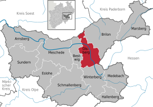
| Location of the city of Olsberg in the Hochsauerlandkreis | ||
  |
||

Olsberg is a city in North Rhine-Westphalia , Germany and belongs to the Hochsauerlandkreis . It is classified by the state statistics as a large rural community and takes the rank of a basic center with partial functions of a middle center . The place is in the upper Ruhr valley . In addition to the highest mountain in North Rhine-Westphalia, the Langenberg at 843.2 m above sea level. NN , which borders the Bruchhausen district in the north-northwest, there are more than 50 mountains over 500 meters high in the urban area. Olsberg is a state-approved Kneipp spa.
geography
Geographical location

Olsberg is located in the Ruhr Valley between the Arnsberg Forest Nature Park in the north-west and the Diemelsee Nature Park in the east. The Rothaargebirge connects to the south .
The location of the city of Olsberg in the eastern Hochsauerland is characterized by mostly wooded heights and meadow valleys through which watercourses flow. The core city lies in a wide valley in which the young Ruhr, coming from the south, turns its course to the west and leaves the city area shortly after the core city. There is 313 m above sea level. NN the lowest point in the urban area.
The core area of Olsberg is surrounded by wooded heights, the Langer Berg (555 m) in the north, the Eisenberg (606 m) in the east, and the Olsberg (703 m) and the Steinhelle (613 m) in the south. The highest point in North Rhine-Westphalia is the Langenberg (843 m) in the extreme south-east of the city on the border with Hesse.

In the urban area, the Gierskoppbach coming from the east flows into the Ruhr. Upstream of the Gierskopp follow the districts of Elleringhausen and Bruchhausen in a wide curve to the right. A striking point on the edge of the valley is the 721 m high Istenberg with the Bruchhauser stones , four large porphyry rocks . A section of the Rhine-Weser watershed runs over the Istenberg and the Hömberg (730 m) to the south . This means that the east running Schmalah strives over Hoppecke and Diemel to the Weser , while the west flowing Gierskopp flows over the Ruhr to the Rhine .
To the south of the Olsberg core city, the Neger flowing north west of the Ruhr flows into the Ruhr. The districts of Brunskappel and Wulmeringhausen lie in its valley, and the districts of Wiemeringhausen and Assinghausen in the Ruhr valley .
The former mining settlements of Elpe and Heinrichsdorf are located in the valley of the Elpe , which flows northward in the very west of the Olsberg urban area . Just before the Elpe leaves the city, the Gevelinghausen district lies to the east .
In the north of the Antfeld district is the Antfelder Forst. This up to 550 m high ridge belongs to the eastern foothills of the Arnsberg Forest Nature Park.
Neighboring communities
Olsberg borders on Winterberg to the south, Bestwig to the west and Brilon to the east . Like Olsberg itself, these communities are located in the Hochsauerlandkreis . In the north, adjacent to the Olsberg to Kreis Soest belonging Rüthen . In the southeast, Olsberg shares a border for a short distance with Willingen in Hesse ( Waldeck-Frankenberg district ).
City structure
The city of Olsberg is divided into twelve localities : Antfeld , Assinghausen , Bigge , Bruchhausen , Brunskappel , Elleringhausen , Elpe / Heinrichsdorf , Gevelinghausen , Helmeringhausen , Olsberg, Wiemeringhausen and Wulmeringhausen .
Of the total area of 11,787 hectares (as of 2009), 1,372 hectares are settled and traffic areas. 2512 hectares are used for agriculture. Most of the urban area of 7,835 hectares is forest.
The core city area consisting of the former communities Bigge and Olsberg is of central importance. Around half of all residents live there, and shopping, administration, infrastructure facilities and the like are concentrated in this area. In terms of urban planning, a special feature is that a new city center was built on an industrial wasteland in the early 1980s between the old settlement centers of Bigge and Olsberg. As a result, Olsberg also gained importance beyond the municipal boundaries. The city comes close to the function of a middle center.

climate
| Precipitation amounts measuring station Olsberg-Brunskappel |
||||
|---|---|---|---|---|
| Months | millimeter | |||
| January | 112 | |||
| February | 78 | |||
| March | 94 | |||
| April | 83 | |||
| May | 88 | |||
| June | 103 | |||
| July | 102 | |||
| August | 87 | |||
| September | 78 | |||
| October | 82 | |||
| November | 106 | |||
| December | 124 | |||
| (Mean values of the DWD for the period 1961 to 1990) | ||||
In Olsberg there is a low-mist, low mountain range climate. Due to the different altitudes within the urban area, there are differences in the amount of precipitation of 900 mm to 1400 mm in annual mean. The annual average temperatures are between five and eight degrees Celsius.
In the Brunskappel district, which is 413 m above sea level. NN, the German Weather Service measured an annual average of 1141 mm of precipitation between 1961 and 1990 . On average, the highest amounts of precipitation were found in January and December with 112 mm and 124 mm. The wettest months were February and September with 78 mm.
history

Parts of today's urban area were at least temporarily inhabited as early as the pre-Roman Iron Age . The Bruchhauser Steine Wallburg is dated to the 6th to 3rd century BC.
middle Ages
Various districts of today's city were mentioned in documents, partly as early as the 11th and 12th centuries. The place Olsberg was first mentioned in 1281. At that time there were still the settlement areas Gierskopp, Drönkhausen, Duinkhausen, Bodinghausen and Olsberg. In the 16th and 17th centuries, more and more residents settled in the growing villages in the area, such as B. in Olsberg to find shelter more easily. As a result, most of the named residential areas fell into desolation.
The noblemen of Grafschaft were wealthy in today's urban area . They owned goods in the parishes of Neger (another desolate place), Brunskappel and Assinghausen. The properties in the Vogtei Brunskappel were summarized. However, they were unable to establish a state rule against the Archbishops of Cologne. A large part of today's urban area belonged to the so-called Assinghauser or Freie Grund in the Middle Ages . The rule over the free court belonged to the Counts of Arnsberg until the end of the 13th century . At the time of Count Gottfried IV , the free court fell to the neighboring Counts of Waldeck . The free chair in Assinghausen was of great importance as a court .
Early modern age

Since the Archbishops of Cologne also claimed it, the Assinghauser Grund remained controversial between Kurköln and Waldeck until the 17th century . In the 17th century the people of Cologne prevailed. The area around Olsberg finally belonged to the Duchy of Westphalia .
The area around Olsberg was badly affected by the effects of the Thirty Years' War . Especially since 1637 the area was devastated by Swedish and Hessian soldiers. The appraisal claims in Assinghauser Grund had to be reduced considerably in 1638, as three quarters of the residents were dead or completely impoverished. Hundreds of buildings in the area are said to have been destroyed at the end of the war. Many courtyards in the municipalities that now belong to the city lay in desolation for years. Some places were not repopulated.
In the 17th and 18th centuries there were 41 full-span and 10 half-span farmers in Olsberg. In addition there were three inherited and six unheralded dogs. In the 19th century, the average parcel in Assinghauser Grund was very small at three acres. The reason was the real division in inheritance law that applied there in contrast to many parts of the Duchy of Westphalia.
Iron ore has been mined and smelted in the area since the Middle Ages. In the 17th century there were ironworks in various places in what is now the urban area. In 1629 there were two huts in Bigge, one in Olsberg and one in Bruchhausen. There were also various hammer mills. Most companies had to give way to industrial competition in the 19th century. The Olsberger Hütte was able to adapt successfully through specialization .
19th and 20th centuries

At the beginning of the revolution of 1848/1849, the area of today's city of Olsberg was the scene of unusually violent rural unrest compared to other places. In Bigge and Assinghausen there were threats to set fire to the houses of the landlords. There was open violence in Bruchhausen. A crowd moved to the pension building of Schloss Bruchhausen, sang revolutionary songs and called for freedom and justice. The building was stormed, windows and furniture were smashed and files and account books were burned.
Because of the commercial operations in some districts in the 19th century there was a large part of the population in addition to the agricultural sector who was commercially active. In Bigge, for example, in 1892 there were 8 farmers, 40 servants, 6 day laborers, 40 employees in industry and mining, 46 craftsmen, 20 employed in trade and transport, 12 people in service professions and 26 widows.
With the help of the highly specialized formers of the Olsberger Hütte, Bigge-Olsberg developed into a stronghold of the Christian trade union movement. A large part of the workers had been organized in the Christian Metalworkers Association since 1903 . In 1910 there was a bitterly led strike. After the First World War , Olsberg became the seat of a full-time union secretary.
Olsberg has been supplied with electricity since 1909. A reservoir was built between 1927 and 1928 .
In terms of party politics, Olsberg was a central stronghold . In 1930 a local NSDAP group was founded, which soon became very active. From here it spread to the southern part of the Brilon district. In 1932, August Wilhelm von Prussia , a prominent member of the NSDAP , spoke at a large party meeting. When cries of protest became loud, the SS used force against the opponents.
During the Second World War , the city was first attacked from the air by the Allies on September 24, 1944. In the next few months, several other attacks took place, the main targets of which were the rail link and the Olsberger Hütte . In an attack on March 25, 1945, six locomotives were destroyed in a low-flying attack on the station, killing several German soldiers. After US troops occupied neighboring Brilon on March 29, 1945, fleeing German military units marched through Olsberg. The district leadership of the NSDAP of the Brilon district in Olsberg tried quickly to burn some files. The NSDAP district leadership also called on the Volkssturm . Positions and anti-tank barriers were built, and explosive charges were attached to bridges. From April 1, Olsberg was part of the Ruhr basin enclosed by the Allies . On April 2nd and 3rd, 1945 artillery of the 9th US Infantry Division fired at targets in the city area from Brilon and Altenbüren. Three civilians died. Numerous buildings were hit, including the house of the district leadership of the NSDAP. On April 5, around 12 noon, Wiemeringhausen was the first suburb of Olsberg to be conquered by the US Army . On the same day, Assinghausen, Wulmeringhausen, Brunskappel, Bruchhausen and Elleringhausen were also occupied. From Olsberg itself, the US troops withdrew their tanks for the time being, because resistance was still being offered in the village, and opened fire on the artillery again. On April 6th and 7th, Olsberg was conquered after heavy street fighting. In Olsberg alone, 120 gunmen are said to have died on the German side. The relatively high losses can be explained by the fact that the ultimately pointless fight was based primarily on Volkssturm men, 15-year-old labor service boys and scattered soldiers who were poorly equipped. Most of the fighters killed belonged to the Sauerland Freikorps . On April 6, Bigge, Helmeringhausen and Antfeld were also taken by American troops. As the last villages in today's urban area, Elpe, Heinrichsdorf and Gevelinghausen were occupied on April 7th. The village of Brunskapel suffered severe damage from artillery fire and bombing. Seven of 49 houses there were burned down, 21 houses with a church and school were badly damaged, and all other buildings had roofs and windows damaged. During the Second World War, 120 Olsbergers died as soldiers , mostly on the Eastern Front , or died in captivity.
In the 1970s and early 1980s, the Ruhrtalsperrenverein (RTV) planned to build the Negro dam in the valley of the negroes near Brunskappel. The village of Brunskapel would have disappeared in the dam. This led to the resistance of the valley residents to the planning approval decision of the Arnsberg district government from 1982. The Higher Administrative Court in Münster ended the planning in 1984 because the district president Arnsberg had not examined the "essential points of the water management capacity calculation", which had justified the need for the dam .
City or community association
Olsberg became part of the municipal reorganization in North Rhine-Westphalia due to the Sauerland / Paderborn law on January 1, 1975 through the merger of the town of Bigge-Olsberg, which had existed since July 1, 1969, with the communities of Antfeld , Assinghausen , Bruchhausen , Brunskappel , Elleringhausen , Elpe , Helmeringhausen , Wiemeringhausen and Wulmeringhausen from the Bigge office and the community of Gevelinghausen from the Bestwig office .
Population development
While many places in the Brilon district had a declining population due to emigration and emigration after the decline of pre-industrial trade in the 19th century, the connection to the railroad and the growing industry between Bigge and Olsberg ensured a comparatively strong population growth.
| Population development in the community of Olsberg 1875–1961 | |
| year | Residents |
| 1818 | 424 |
| 1858 | 719 |
| 1867 | 840 |
| 1871 | 988 |
| 1885 | 1,026 |
| 1895 | 1,237 |
| 1905 | 1,590 |
| 1925 | 1,663 |
| 1933 | 2.014 |
| 1939 | 2,327 |
| 1950 | 3.131 |
| 1961 | 3,068 |
The municipality of Bigge had 3146 inhabitants on June 6, 1961 (census) and thus had slightly more inhabitants than the municipality of Olsberg, which had 3068 inhabitants.
| Population development in the municipalities of Bigge and Olsberg in 1961 and in the city of Bigge-Olsberg in 1970 and 1974 |
|
| year | Residents |
| 1961 | 6.214 |
| 1970 | 6,790 |
| 1974 | 7,051 |
The population development of the city of Olsberg was essentially upwards until 1998. After that, a clear downward trend can be observed. Apart from the general demographic change , the city loses inhabitants mainly between the ages of 18 and 30 due to emigration. The population is aging even more than anywhere else. The migration losses in Olsberg as in the neighboring communities Brilon , Marsberg , Schmallenberg , Sundern and Winterberg are as high as only in some East German cities and communities. For the period between 2006 and 2025, a further population decline of 11.3% is expected. By 2025, the proportion of people over 80 will roughly double.
| Population development in the city of Olsberg 1975–2009 | |
| year | Residents |
| 1975 | 14,141 |
| 1979 | 14,180 |
| 1984 | 14.054 |
| 1989 | 14,715 |
| 1994 | 16,030 |
| 1999 | 16,349 |
| 2004 | 15,872 |
| 2009 | 15,223 |
| 2012 | 14,786 |
Religions

The origin of the parish in Brunskappel goes back to the 11th century, at Bigge to the 13th century and in Assinghausen to the 14th century. Olsberg was a branch of Bigge until an independent parish was formed in 1915. In 1903 the newly built Olsberg Church was consecrated. It replaced the chapel from 1747, which had become too small for the growing population.
As a result of belonging to the former Electoral Cologne Duchy of Westphalia, the Catholic Church is still the largest religious community today. 70% of the population profess their faith, 15% are Protestants and a further 13% belong to other communities or are non-denominational.
The Catholics in Olsberg belong to the Deanery Hochsauerland-Ost of the Archdiocese of Paderborn . Until November 30, 2011, seven parishes belonged to the Olsberg-Freier Grund pastoral association and five parishes to the Bigge pastoral association . Since December 1, 2011, as part of the restructuring of the archdiocese, both associations have belonged to the pastoral area Bigge-Olsberg, based in St. Martin Bigge. In the future there will be a pastoral network Bigge-Olsberg with three parishes.
An evangelical chapel has existed since 1898 and its own parish has existed since 1957. The community Olsberg-Siedlinghausen belongs to the parish of Arnsberg of the Evangelical Church of Westphalia .
There was a Jewish community at least in Bigge until the Holocaust. There were Jewish schoolmasters in Assinghausen and Bigge as early as 1737. A synagogue already existed before 1819. There were also Jewish residents in Wiemeringhausen. The Jewish cemetery still exists with occupancies from between 1873 and 1935.
politics

Local elections
Three parties are currently represented in the city council. In the local elections, the parties won the following voting shares and number of seats in the city council.
| Voting shares | ||||||
|---|---|---|---|---|---|---|
| year | CDU | SPD | Green | OF 1 | FDP | FWG / BP 2 |
| 1979 | 67.3 | 28.3 | 3.0 | 1.3 | ||
| 1984 | 64.1 | 30.6 | 5.3 | |||
| 1989 | 57.5 | 30.4 | 7.0 | 4.9 | ||
| 1994 | 56.2 | 31.8 | 6.9 | 5.1 | ||
| 1999 | 66.6 | 26.2 | 3.1 | 4.1 | ||
| 2004 | 65.1 | 28.0 | 6.9 | |||
| 2009 | 58.3 | 32.5 | 9.2 | |||
| 2014 | 56.2 | 33.6 | 10.2 | |||
| Distribution of seats | ||||||
| year | CDU | SPD | Green | OF 1 | FDP | FWG / BP 2 |
| 1979 | 23 | 10 | 0 | 0 | ||
| 1984 | 22nd | 10 | 1 | |||
| 1989 | 20th | 11 | 2 | 0 | ||
| 1994 | 19th | 11 | 2 | 1 | ||
| 1999 | 25th | 10 | 1 | 2 | ||
| 2004 | 23 | 10 | 2 | |||
| 2009 | 21st | 12 | 3 | |||
| 2014 | 18th | 11 | 3 | |||
|
1 OF: Olsberger Forum 2 FWG / BP: Free voter community / citizens' party |
||||||
mayor
The mayor of the city of Olsberg is Wolfgang Fischer (CDU). In 2009, Fischer was elected the new mayor of Olsberg with 56.5% of the vote. He was confirmed in office in the 2014 local elections. The deputy mayors are Karl-Josef Steinücken (CDU) and Peter Rosenfeld (SPD).
Former mayor
- 1844–1847: Friedrich Kropff
- 1847–1851: Johann Vorderwülbecke
- 1851–1888: Engelbert Kropff
- 1888–1894: Heinrich Körner (Matzen)
- 1894–1912: Franz Vollmer (Sägemüller)
- 1912–1924: Theodor Vollmer (Sägemüller)
- 1924–1926: Bernhard Stratmann (Rumpes)
- 1926–1934: Franz Steinrücke (Meggers)
- 1934–1945: Karl Kropff (Lingenubers)
- May to September 1945: Heinrich Kropff (Veltens) (He was used by the Allies)
- September 1945 to September 1946: August Gerbracht (deputy for Heinrich Kropff)
- September 1946 to December 29, 1949: Bernhard Stratmann (farmer)
- December 29, 1949 to 1969: Fritz Lenze
- 1975–1992: Josef Niggemann
- 1992–1999: Werner Menke
- 1999–2009: Elmar Reuter
coat of arms
|
|
Blazon :
Squared of yellow and red, above it a free-standing black ring with applied black squares, each of which sits in the middle of the adjacent fields. Description: The squared fields in yellow and red were taken from the coat of arms of the former municipality of Brunskappel , now Olsberg. Gold and red were the colors of the Grafschaft bailiffs who had their seat on Gut Wildenberg in Brunskappel. The free-standing black ring with the four black squares placed on top symbolizes: the Germanic refugee castle on the Istenberg with the four Bruchhauser stones as a significant scenic feature of the city of Olsberg, the merger of the four valleys of the Ruhr , the Neger, the Elpe and the Medebach, respectively the Gierskopp formerly independent municipalities to the city of Olsberg, the black ring the "O" for Olsberg. The official approval took place on March 10, 1978. |
Description of the flag : From yellow to red in seven strips of equal width, the black ring of the city coat of arms in the square yellow flag head.
Description of the banner : From yellow to red in seven strips of equal width, the black ring of the city arms in the square yellow banner head.
Description of the seal : It shows the city's coat of arms and has the inscription "Stadt Olsberg" at the top, and the inscription "Hochsauerlandkreis" in a smaller type at the bottom.
Town twinning
Olsberg has been twinned with Fruges , France , since 1965. Since 1974 with Olsberg , Switzerland and since 1990 with Jöhstadt , Germany.
Culture and sights


There are a number of attractions in the Olsberg urban area. The Bruchhauser stones in the Bruchhausen district are among the most well-known attractions in Olsberg .
Museums
Local museums in Bruchhausen, Assinghausen and Wulmeringhausen present a wide range of cultural and historical backgrounds. The Africa Museum Vogt and the local history museum "Alte Mühle" are also located in Gevelinghausen . In the Bruchhausen district there is a historic nail forge and in Assinghausen there is a Friedrich Wilhelm Grimme memorial room.
Visitor mines
Iron has been mined on the Eisenberg since at least the middle of the 14th century. The Philippstollen was made accessible again for visitors. There is also a tunnel in Wulmeringhausen and the Hilarius tunnel in Helmeringhausen .
Buildings
There are five castles in the city. They are in the districts of Antfeld, Bigge, Bruchhausen, Brunskappel and Gevelinghausen. In 1705, Bernhard Christof von Schade had Antfeld Castle , a baroque three-wing complex built on the site of an older predecessor, by the builder Nikolaus Wurmstich from Lippstadt . Bruchhausen Castle was built below the Bruchhauser Steine at a height of around 450 m. Gevelinghausen Castle is located in the district of the same name. The poet Annette von Droste-Hülshoff stayed in the castle as a guest in 1824 and 1831. Schellenstein Castle, probably built in 1183, was first mentioned in a document in 1270. The noble lords of Grafschaft once resided at Wildenberg Castle as Vogt of the Grafschaft Monastery .
The Kropff'sche Haus was originally a trade union in Olsberg; its origins go back to the beginning of the 18th century and was rebuilt and expanded several times in the following centuries. The (old) eagle pharmacy is a half-timbered building, the rear part of which was built in 1678 and the front part probably in 1769 or as early as 1604. A pharmacy was established there in the 19th century.
The church of St. Martinus in Bigge was built in the late baroque style. The church tower dates from the 11th to 13th centuries. In 1222 the church was first mentioned as St. Martinus. The organ prospectus is remarkable. A neo-Romanesque transept with large rose windows was added later. The Roisen or Reisenspeicher in Assinghausen used to be a tithe warehouse and was built in 1556. The granary is the oldest well-preserved secular building in Olsberg. The Grimmehaus in Assinghausen was built around 1800 as a schoolhouse in the Franconian half-timbered style.
Nature and landscape protection
Since April 15, 2004, there has been a landscape plan for the Olsberg urban area in which the areas outside the built-up districts and the scope of a development plan have been designated as landscape protection areas, provided that there is no higher protection status such as a nature reserve (NSG).

The landscape protection areas are divided into types A, B and C, in which different requirements for the protection of nature must be observed. In the landscape protection area type A, general landscape protection , the erection of buildings is prohibited. In type B, locations on the outskirts and in the character of a landscape , first afforestation, including new Christmas tree cultures, is prohibited. In the case of type C, meadow valleys and significant extensive grassland, there is also a ban on converting grassland and fallow grassland. Of the type A landscape protection area, there is only the large-scale Olsberg landscape protection area with 7,947.1 hectares. Type B includes eleven areas between 9.1 and 275.8 hectares. Type C has eleven areas, which are between 7.3 and 47.8 hectares in size.
There are a total of 46 nature reserves from 0.5 to 168.9 hectares in size. The best-known NSG are the Bruchhauser stones . In addition to rare plants, lichens and mosses, eagle owls and peregrine falcons breed there . The Bruchhauser Steine are the only EU bird sanctuary in Olsberg and also designated as European protected areas ( FFH areas ). Other FFH areas are the Ruhr areas (which includes parts of the Ruhr Valley), the caves and tunnels near Olsberg and Bestwig, and the gorge forests near Elpe , gorge forests north of Niedersfeld . The large FFH areas, which often consist of several sub-areas, usually comprise several nature reserves and areas of other protection categories. In the FFH area caves and tunnels near Olsberg and Bestwig , which consists of ten sub-areas, there are ten caves or tunnels. The caves and tunnels are important supraregional winter quarters for bats .
In the urban area there are also 39 protected landscape components (LB), 144 legally protected biotopes , which are also in areas of other protection categories, and 54 natural monuments . 20 natural monuments are old individual trees or remarkable groups of trees, while the other 34 natural monuments are rocks.
In addition to other bird species, the large bird species black stork , heron , common raven , eagle owl and red kite occur in Olsberg .
Sports

The Ruhr Valley Cycle Path runs through Olsberg . A paragliding training center and flying club is located in the Elpe district. Winter sports are possible at the Sternrodt ski area in Bruchhausen. The AquaOlsberg has a brine and Kneipp area, a forest sauna and a leisure pool.
Regular events
In all districts find shooting matches each on different weekends instead. In addition, there are regular events in the concert hall located directly on the Ruhr (up to 1100 seats or 2000 standing places).
Economy and Infrastructure
Economic development
In pre-industrial times there was iron ore mining, iron production and processing in the Olsberg area. Home-made nail smiths existed in various places. From the year 1804 it is said that “Bruchhausen, Elleringhausen, Bigge, Olsberg, Assinghausen, Silbach, Schmallenberg too are being nailed in enormous numbers. In some villages there are just as many nail smiths as residential houses. ”The house industry in the area was no longer competitive with industrially manufactured nails. As early as the first half of the 19th century, nail production shrank to the village of Bruchhausen, where the trade was operated as a sideline until well into the 20th century. By specializing in the manufacture of stoves, the Olsberger Hütte was able to hold its own .
Economic structure
Based on the iron industrial tradition, the manufacturing industry is still an important pillar of the local economy today. In addition to the Olsberger Hütte (since 2014 Olsberg GmbH ) - a contract foundry and heating technology producer, best known for its electric ovens, there is a company in the metalworking industry in Bigge, the likewise traditional company FW Oventrop GmbH & Co. KG. The company Hüttemann Holz GmbH & Co. KG in Bigge was founded in 1891. It is a family business that has been run by the fourth generation since 1990. Another location is in Wismar. There is also HSK Duschkabinenbau KG in Bigge .
The following banks have branches in Olsberg: Commerzbank , Sparkasse Hochsauerland , Volksbank Sauerland eG and Volkbank Brilon-Büren-Salzkotten eG . The Postbank is represented with a service shop at the supermarket.
The second mainstay is the health industry. A Dr. Grüne, pupil Sebastian Kneipp laid the foundations for this with the construction of a sanatorium in 1894. Today there are several clinics and other facilities in the health sector in the Kneipp spa .
The third mainstay of the economy today is tourism. The city is building on hiking and cycling tourism. The Rothaarsteig and the Sauerland Forest Route lead through the urban area . Olsberg is also part of the Sauerland mountain hiking park. For cyclists, the Ruhr Valley Cycle Path leads through Olsberg. With the Aqua Olsberg, the place has a brine bath.
In 2002 there were 5115 employees subject to social security contributions. Most of them (2276) were employed in manufacturing. 1715 people were employed in the service sector (excluding public administration). This is followed by trading with 362 employees.
traffic

Olsberg is on federal highways 7 and 480 . The B 7 heading west leads to the Bestwig junction of the federal motorway 46 . The Wünnenberg-Haaren motorway junction can be reached via the B 480 . From there there are motorway connections in the direction of Bielefeld ( A33 ) and Kassel ( A 44 ). To the south lies Marburg . The B 480n bypass (construction started in 2005) was opened on November 5, 2010. It leads from the Losenberg tunnel at the entrance to Bigge to Steinhelle around the city center. The construction costs were around 30 million euros.
Via the Olsberg station, which is on the Upper Ruhr Valley Railway Hagen - Warburg , the Hagen / Dortmund or Warburg nodes can be reached with regular regional trains ; In some cases there are direct connections with the Kassel-Wilhelmshöhe ICE train station . Since December 2011, Brilon Stadt has also been accessible again. The Bigge stop is on the Nuttlar – Frankenberg railway line , which runs from Bestwig to Winterberg . Opened stops are in Brunskappel, Elleringhausen and Wulmeringhausen.
media
The Westfalenpost, part of the Funke media group, is published in Olsberg as a daily newspaper with a local edition . In addition, the free Sauerland courier and the Briloner Anzeiger are distributed on Wednesdays and Sundays .
The WOLL magazine , a magazine with regional topics , is also published quarterly .
Radio Sauerland's local radio comes from the Meschede broadcasting station.
WDR transmission system
On the Olsberg there is a 58 meter high and 1985 built transmission mast of the WDR (free-standing tubular steel construction weighing 50 tons, diameter below 2.20 m, above 1.60 m) at 51 ° 20'20 ″ north latitude and 8 ° 30 ′ 17 ″ east longitude, from which the following programs are broadcast:
| program |
Frequency ( MHz ) |
ERP |
|---|---|---|
| WDR 5 | 98.6 MHz | 10 kW |
| WDR 2 Studio Siegen | 102.1 MHz | 10 kW |
| WDR 4 | 104.1 MHz | 10 kW |
| Deutschlandradio Kultur | 106.1 MHz | 10 kW |
| One live | 107.0 MHz | 10 kW |
education

There are kindergartens in many parts of Olsberg. These are partly urban (Wiemeringhausen, Olsberg, Elpe, Bruchhausen and Assinghausen), partly they are sponsored by the Catholic Church (Kindergarten St. Vinzenz Antfeld, St. Nikolaus Olsberg, St. Martin Bigge). The family center and catholic kindergarten St. Laurentius Elleringhausen is also church sponsored. There is also the Kinderest Hort for individual care of disabled children and the special educational kindergartens St. Andreas and Sonnenschein.
The city has a number of primary schools in the districts . (St. Martinus Primary School in Bigge, Cardinal von Galen School in Olsberg with the sub-location Wiemeringhausen and the St. Franziskus Primary School in Bruchhausen). In the area of the lower secondary level there is an urban secondary school and a secondary school, which are being phased out as a school type, since a secondary school was established in 2012.
The special schools are also important beyond the city. The school on the Ruhraue in Bigge is a special needs school with a special focus on physical and motor development. The all-day school is attended by around 200 students. The majority are learner drivers. There are also boarding school students. These come from almost all of North Rhine-Westphalia. The catchment area is the eastern part of the Hochsauerlandkreis and part of the Soest district. There is also the municipal special school with the special focus on learning in Olsberg. At the Heinrich Sommer Vocational College in Josefsheim Bigge, people with disabilities receive qualified vocational training with the aim of integrating them into the primary labor market.
The Olsberg vocational college is also of regional importance (vocational, vocational, technical and technical colleges of the Hochsauerland). It is an institution of the Hochsauerlandkreis and is attended by around 2000 students.
Personalities
Honorary citizen
- Prince August Wilhelm of Prussia was unanimously made an honorary citizen by resolution of October 25, 1933. In 2014, the honorary citizenship, which expires with the death of the person, was posthumously revoked.
sons and daughters of the town
- Friedrich Wilhelm Grimme (1827–1887), writer , local poet and botanist
- Josef Guntermann (1856–1932), artist
- Adalbert Schmücker (1878–1927), Roman Catholic Bishop and Vicar Apostolic of Tsinanfu in China
- Maria Kahle (1891–1975), writer
- Karl Weiken (1895–1983), geodesist and polar researcher
- Hubert Köster (1895–1939), member of the Hessian state parliament
- Franz Fischer (1901–1989), SS-Sturmbannführer and war criminal
- Martha Schlinkert (1913–1979), children's book author
- Bernhard Balkenhol (1914-2004), politician (Member of the Bundestag)
- Günter Meyer (* 1935), politician (former Minister of State)
- Wolfgang Paul (* 1940), football player
- Jörg Twenhöven (* 1941), CDU politician and was the district president of the Münster administrative district from 1995 to 2007
- Detlef Rost (* 1945), professor of psychology
- Gabriele Kuhnke (* 1946), writer
- Hubert Kleff (* 1948), politician (MdL)
- Gerd Bollermann (* 1949), was a university professor and member of the SPD in the state parliament of North Rhine-Westphalia; from 2010 to 2015 regional president of the administrative district of Arnsberg
- Diethard Urbansky (* 1958), cook
- Johannes Schettel (* 1959), luge rider
- Udo Zelinka (1959-2006), German Catholic theologian
- Christof Bartsch (* 1962), administrative scientist and local politician
- Hans Schulte-Nölke (* 1963), legal scholar
- Anke Velmeke (* 1963), writer
- Gisela Meßollen (* 1964), jazz musician
- Hans-Peter Liese (* 1965), since 1994 CDU Member of the European Parliament for North Rhine-Westphalia in the European People's Party
- Sigrid Blömeke (* 1965), educational scientist
- Martin Cohn (* 1966), SPD politician
- Dirk Mündelein (* 1969), guitarist and composer
- Jörg Wanderer (* 1973), photographer and photo artist
- Frederik Köster (* 1977), jazz musician and composer
Personalities who have worked on site
- Maria Franziska von Eptingen (1631–1707), abbess at Olsberg Monastery
- Ida Kropff (born June 10, 1839 - August 1, 1918), entrepreneur
- August Grüne (born October 31, 1865 - † September 23, 1937), founder of the spa and bathing tradition in Olsberg
- Martha Schlinkert (born April 24, 1913 in Gelsenkirchen ; † June 30, 1979 in Olsberg), writer
- Heinrich Festing (born December 10, 1930), General Praeses of the international Kolping Society, was vicar in Bigge from 1962 to 1965
- Jürgen Suberg (* 1944), sculptor in Elleringhausen
literature
- Hugo Cramer: The district of Brilon in the Second World War 1939–1945 - reports from many employees from all over the district . Ed .: District administration Brilon. Josefs-Druckerei, Bigge, 1955.
- Wilhelm Winkelmann: The Bruchhauser stones near Olsberg, Hochsauerlandkreis. Early castles in Westphalia 3 . Antiquities Commission for Westphalia, Münster, 1983.
- Jochen Krause: Olsberg. History and tradition. 100 years of Savings and Loan Fund Olsberg-Bigge . Drees, 1983.
- Fritz Droste: City of Olsberg - Pictures from the history of their villages . Heimatbund, 1983.
- Richard Götte: Flora in the eastern Sauerland, distribution maps for all fern and flowering plants in the area of the cities of Brilon, Marsberg, Olsberg, Winterberg, Medebach, Marsberg and the municipality of Bestwig . Ed .: Association for nature and bird protection in the Hochsauerlandkreis . 2007, ISBN 978-3-00-021099-0 .
- Hochsauerlandkreis - Lower Landscape Authority (Hrsg.): Landscape plan Olsberg . 2004 ( hochsauerlandkreis.de [PDF; 915 kB ]).
- Association for nature and bird protection in the HSK e. V. (Ed.): Handbook of nature: fauna and flora in the Hochsauerland . 1998, ISBN 3-00-003345-9 .
- Fritz Droste, Johannes Stöber, Erich Völlmecke, Hans Müller: City of Olsberg - Your Villages in History, Volume 2 . Ed .: City of Olsberg. Josefs-Gesellschaft, 1998, ISBN 3-925680-29-2 .
Web links
- Internet presence of the city of Olsberg
- Internet presence of the Olsberg district
- Olsberg in the Westphalian Cultural Atlas
Individual evidence
- ↑ Population of the municipalities of North Rhine-Westphalia on December 31, 2019 - update of the population based on the census of May 9, 2011. State Office for Information and Technology North Rhine-Westphalia (IT.NRW), accessed on June 17, 2020 . ( Help on this )
- ↑ a b c Community profile Olsberg ( Memento of the original from July 5, 2015 in the Internet Archive ) Info: The archive link was inserted automatically and has not yet been checked. Please check the original and archive link according to the instructions and then remove this notice. (PDF file; 215 kB)
- ^ Elisabeth Nieder: Olsberg. In: Sauerland 2/2009, p. 67
- ^ Homepage of Olsberg , accessed on November 6, 2010.
- ↑ Recognition of the city of Olsberg as a Kneipp spa. Order of the Arnsberg District Government of December 15, 2016 ( MBl. NRW. 2017 p. 4 )
- ↑ § 3 Paragraph 1 of the main statute of the city of Olsberg ( page no longer available , search in web archives ) Info: The link was automatically marked as defective. Please check the link according to the instructions and then remove this notice. (PDF file; 84 kB)
- ^ Elisabeth Nieder: Olsberg. In: Sauerland 2/2009, p. 69
- ↑ Ulrike Peyrer: Olsberg. In: The Hochsauerlandkreis, Volume 6 from the series "Cities and Municipalities in Westphalia". Ardey-Verlag, Münster 1999, ISBN 3-87023-100-9 , p. 123.
- ^ German Meteorological Service (Olsberg-Brunskappel measuring station): Mean values Olsberg-Brunskappel for the period 1961–1990
- ↑ http://www.olsberg-mittendrin.de/index.php?option=com_content&view=article&id=1290:wngen-im-bereich-des-dorfes-olsberg&catid=30:35-este-sten&Itemid=30
- ^ Josef Rüther: Local history of the Brilon district. Münster 1956, p. 62.
- ^ Josef Rüther: Local history of the Brilon district. Münster 1956, p. 75.
- ^ Josef Rüther: Local history of the Brilon district. Münster 1956, p. 96.
- ^ Josef Rüther: Local history of the Brilon district. Münster 1956, pp. 157–159.
- ↑ Wilfried Reinighaus, Horst Conrad (ed.): For freedom and law. Westphalia and Lippe in the revolution of 1848/49. Münster 1999, p. 33.
- ^ Westfälisches Staatsarchiv Münster, Kreis Brilon 1107
- ↑ Jens Hahnwald: Black Brothers in Red Undergarments. Workers and labor movement in the Arnsberg, Brilon and Meschede districts 1889–1914. In: Karl-Peter Ellerbrock, Tanja Bessler-Worbs (Hrsg.): Economy and society in south-eastern Westphalia. Dortmund 2001, p. 266f.
- ^ Wilfried Rosenkranz: The construction of the Olsberg reservoir and the Steinhelle power station.
- ^ Alfred Bruns: The Gau Westfalen-Süd. In: The swastika in the Sauerland. Schmallenberg 1988, pp. 45f.
- ^ A b Hugo Cramer: The district of Brilon in the Second World War 1939–1945 . 1955, section Olsberg, pp. 152-156.
- ↑ Willi Mues: The large cauldron. A documentary about the end of the Second World War between Lippe and Ruhr / Sieg and Lenne . Erwitte 1984.
- ^ Hugo Cramer: The district of Brilon in the Second World War 1939-1945 . 1955, honor roll section Olsberg, pp. 197–199.
- ↑ Rolf Dfidder: Negertalsperre: No downfall . In: The time . No. 25/1984 , 1984 ( online ).
- ↑ Martin Bünermann: The communities of the first reorganization program in North Rhine-Westphalia . Deutscher Gemeindeverlag, Cologne 1970, p. 88 .
- ^ Federal Statistical Office (ed.): Historical municipality directory for the Federal Republic of Germany. Name, border and key number changes in municipalities, counties and administrative districts from May 27, 1970 to December 31, 1982 . W. Kohlhammer, Stuttgart / Mainz 1983, ISBN 3-17-003263-1 , p. 332 .
- ^ Josef Rüther: Local history of the Brilon district. Münster 1956, p. 374.
- ^ Numbers for 1818 and 1867: Wilhelm Benkert: Economic Geographical Conditions, Population Density and Settlement Studies of the Ederkopf-Winterberger Platform. Diss. Marburg, 1911, p. 72ff .; Number for 1858: Statistical news for the administrative district of Arnsberg. Arnsberg 1859, p. 10ff .; 1871–1950: State Statistical Office of North Rhine-Westphalia (ed.): Municipal statistics of the State of North Rhine-Westphalia. Population development 1871–1964. Düsseldorf 1964, p. 490ff .; 1961: Martin Bünermann, Heinz Köstering: The communities and districts after the municipal territorial reform in North Rhine-Westphalia . Deutscher Gemeindeverlag, Cologne 1975, ISBN 3-555-30092-X , p. 234 .
- ↑ Figures for 1961 and 1970: Federal Statistical Office (Hrsg.): Historical municipality register for the Federal Republic of Germany. Name, border and key number changes in municipalities, counties and administrative districts from May 27, 1970 to December 31, 1982 . W. Kohlhammer, Stuttgart / Mainz 1983, ISBN 3-17-003263-1 , p. 332 . , Figures for 1974: Martin Bünermann, Heinz Köstering: The municipalities and districts after the municipal territorial reform in North Rhine-Westphalia . Deutscher Gemeindeverlag, Cologne 1975, ISBN 3-555-30092-X , p. 131 .
- ^ Elisabeth Nieder: Olsberg. In: Sauerland 2/2009, pp. 69f.
- ↑ 1975: Population as of June 30, 1974, territorial status: January 1, 1975: Martin Bünermann, Heinz Köstering: The communities and districts after the municipal territorial reform in North Rhine-Westphalia . Deutscher Gemeindeverlag, Cologne 1975, ISBN 3-555-30092-X , p. 131 .
- ^ Josef Rüther: Local history of the Brilon district. Münster 1956, p. 230.
- ^ Peter Kracht: Sauerland, Siegerland and Wittgensteiner Land. Münster 2005, p. 186.
- ↑ History of the Protestant Congregation ( page no longer available , search in web archives ) Info: The link was automatically marked as defective. Please check the link according to the instructions and then remove this notice.
- ↑ Diethard Aschoff: Jews in the Duchy of Westphalia. In: Harm Klueting (Ed.): The Duchy of Westphalia, Vol. 1: The Duchy of Westphalia: The Electorate of Westphalia from the beginnings of Cologne rule in southern Westphalia to secularization in 1803. Münster 2009, p. 700.
- ↑ cf. overview map in: Diethard Aschoff: Jews in the Duchy of Westphalia. In: Harm Klueting (Ed.): The Duchy of Westphalia, Vol. 1: The Duchy of Westphalia: The Electorate of Cologne from the beginnings of Cologne rule in southern Westphalia to secularization in 1803. Münster 2009, p. 671.
- ^ Entry Jewish cemeteries in Westphalia
-
↑ LDS NRW: Local elections (issue series)
- 1979: Issue 4: Results by municipalities, corrected edition, Düsseldorf, undated
- 1984: Issue 4: Results by municipalities, Düsseldorf, undated
- 1989: Issue 4: Results by municipalities, Düsseldorf, undated
- 1994: Issue 4: Results by municipalities, Düsseldorf, undated
- 1999:
- Issue 3: Final results ( page no longer available , search in web archives ) Info: The link was automatically marked as defective. Please check the link according to the instructions and then remove this notice. , Düsseldorf, October 1999, PDF file, approx. 6.8 MB
- Issue 4: Results by municipalities ( page no longer available , search in web archives ) Info: The link was automatically marked as defective. Please check the link according to the instructions and then remove this notice. , Düsseldorf, December 1999, PDF file, approx. 5.8 MB
- 2004:
- Issue 3: Final results ( page no longer available , search in web archives ) Info: The link was automatically marked as defective. Please check the link according to the instructions and then remove this notice. , Düsseldorf, January 2005, PDF file, approx. 5.9 MB
- Issue 4: Results by municipalities ( page no longer available , search in web archives ) Info: The link was automatically marked as defective. Please check the link according to the instructions and then remove this notice. , Düsseldorf, February 2005, PDF file, approx. 7 MB
- 2009:
- Issue 3: Final results ( page no longer available , search in web archives ) Info: The link was automatically marked as defective. Please check the link according to the instructions and then remove this notice. , Düsseldorf, November 2009, PDF file, approx. 1.9 MB
- Issue 4: Results by municipalities ( page no longer available , search in web archives ) Info: The link was automatically marked as defective. Please check the link according to the instructions and then remove this notice. , Düsseldorf, February 2010, PDF file, approx. 3.5 MB
- ↑ Local election results 2004 , accessed on July 3, 2011.
- ↑ Local election results 2009 , accessed on July 3, 2011.
- ^ The State Returning Officer North Rhine-Westphalia, local election Olsberg 2014, results
- ^ WDR - municipal election 2009, accessed on July 3, 2011
- ^ City of Olsberg: City Council , accessed on April 28, 2010
- ^ Josef Roggenkamp: Olsberg yesterday and today. Ed. Municipality of Olsberg, p. 132
- ^ Report in the Sauerlandkurier from January 14, 2009
- ↑ from the manual of the district council of the Hochsauerlandkreis for the 6th electoral period, as of May 1, 2002
- ^ Report in the Westfalenpost from October 9, 2009
- ↑ § 2, paragraph 2 of the main statute of the city of Olsberg ( page no longer available , search in web archives ) Info: The link was automatically marked as defective. Please check the link according to the instructions and then remove this notice. (PDF file; 84 kB)
- ^ Eduard Belke, Alfred Bruns, Helmut Müller: Communal coats of arms of the Duchy of Westphalia. Arnsberg 1986, ISBN 3-87793-017-4 , p. 62.
- ↑ § 2 para. 3 of the main statute of the city of Olsberg ( page no longer available , search in web archives ) Info: The link was automatically marked as defective. Please check the link according to the instructions and then remove this notice. (PDF file; 84 kB)
- ↑ § 2 para. 4 of the main statute of the city of Olsberg ( page no longer available , search in web archives ) Info: The link was automatically marked as defective. Please check the link according to the instructions and then remove this notice. (PDF file; 84 kB)
- ↑ § 2 para. 5 of the main statute of the city of Olsberg ( page no longer available , search in web archives ) Info: The link was automatically marked as defective. Please check the link according to the instructions and then remove this notice. (PDF file; 84 kB)
- ^ City of Olsberg , accessed on June 11, 2011.
- ↑ Description of the house ( page no longer available , search in web archives ) Info: The link was automatically marked as defective. Please check the link according to the instructions and then remove this notice.
- ↑ Ludwig Hermann Wilhelm Jacobi: The mining, metallurgy and trade in the administrative district of Arnsberg in statistical representation. Iserlohn 1857 [unchanged reprint Kreuztal 1988], p. 347.
- ↑ Statistical representation of the Meschede district. Meschede 1874, p. 134; Annual report of the Chamber of Commerce for the districts of Arnsberg, Brilon, Meschede and Olpe for the year 1852. Arnsberg 1853; cf .: Josef Walter: Brochhusen. A Sauerland village book.
- ↑ see Paul Vorderwülbecke: The Olsberger Hut. An industrial story. Bad Fredeburg 1993.
- ^ Elisabeth Nieder: Olsberg. In: Sauerland 2/2009, pp. 67-69.
- ^ Peter Kracht: Sauerland, Siegerland and Wittgensteiner Land. Münster 2005, p. 189.
- ^ Elisabeth Nieder: Olsberg. In: Sauerland 2/2009, p. 67.
- ↑ Josef Roggenkamp Olsberg yesterday and today. Published by the municipality of Olsberg, Druck Wullenweber oHG, Meschede 1965, p. 106
Arnsberg | Bestwig | Brilon | Eslohe (Sauerland) | Hallenberg | Marsberg | Medebach | Meschede | Olsberg | Schmallenberg | Sundern (Sauerland) | Winterberg