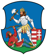
Neutra county
|
Nitra County (Nyitra) (1910) |
|
|---|---|

|
|
| Administrative headquarters : | Nyitra |
| Area : | 5,519 km² |
| Population : | 457.455 |
| Ethnic groups : | 71% Slovaks 22% Magyars 6% Germans 1% others |

|
|
The County Neutra (German and Nitra County ; Hungarian Nyitra vármegye , Slovak Nitrianska stolica / župa or Nitriansky County , Latin comitatus Nitriensis ) is the name of a historic administrative unit (County / County) of the Kingdom of Hungary . The large area is in what is now western Slovakia .
location
County Neutra bordered to the north by the County Trenčín (Trencsén) , on the northeast by the County Turz (Turóc) , to the east by the County Bar , the south by the Komárom County (Komárom) , on the west by the County Pressburg (Pozsony) and in the northwest to the Austrian Moravia .
The county consisted of an area between the river March in the north and the town of Nové Zámky in the south, and since the 11th century there was an area around the town of Prievidza , which was only connected to the rest of the county by a narrow strip . The area was traversed by the Waag and Neutra and in 1910 had 457,455 inhabitants on an area of 5519 km².
Administrative offices
The administrative seat of the county was originally the castle Neutra and since the Middle Ages the city of Nitra (German Neutra ).
history
A kind of predecessor of Nitra County already existed in the 9th century during the rule of Great Moravia over this area. After the area was occupied by Hungarian tribal leaders around 925 , the county was probably established around 1000 as one of the first in the Kingdom of Hungary .
The area around Prievidza was attached to the county in the 11th century, the western part of the county (the area around the Waag and the areas to the west of it) at the beginning of the 14th century.
In the 16th and 17th centuries (until 1685) the southernmost parts of the county were occupied by the Ottomans for most of the time and therefore became part of the Ottoman Empire .
In 1918 the area became part of the newly formed Czechoslovakia , which was confirmed under international law by the Treaty of Trianon in 1920. There it existed as Nitrianska župa until 1928, but the competencies of this administrative area were completely different from the previous ones and the borders were also changed slightly in 1923.
From 1938 to 1945 the area of the former county south of the city of Nitra was occupied by Hungary due to the First Vienna Arbitration . This part was combined with the parts of Pressburg County, which were also occupied by Hungary, to form Nyitra-Pozsony County . Nové Zámky (Hungarian Érsekújvár ) was set as the county seat . During the independence of Slovakia from 1939 to 1945, the (almost re-established) administrative unit Nitrianska župa existed in the Slovak part from 1940 .
After the war, Czechoslovakia was restored and in 1993 the area became independent Slovakia after its dissolution . Today the area belongs to the Neutra Regional Association ( Nitriansky kraj ) created in 1996 as well as to the Trenčian Landscape Association ( Trenčiansky kraj ) and Tyrnau Regional Association ( Trnavský kraj ).
The administrative area of the county was incorporated chronologically as follows:
- 1918–1928: Nitrianska župa (Neutra County), CS
- 1928–1939: Slovenská krajina / zem (Slovak Land), CS
- 1938–1945: Nyitra és Pozsony kee vármegye (provisionally unified administered counties Neutra and Pressburg), H (southern part)
- 1940–1945: Nitrianska župa (Neutra County), SK (northern part)
- 1945–1948: Slovenská krajina (Slovak Country), CS
- 1949–1960: Nitriansky kraj (Neutraer Landschaftsverband - not to be confused with today's), CS
- 1960–1990: Západoslovenský kraj (West Slovak Regional Association) + Stredoslovenský kraj (Central Slovak Regional Association), CS
- since 1996: Nitriansky kraj (Neutra Landscape Association) + Trenčiansky kraj ( Trenčian Landscape Association) + Trnavský kraj (Tyrnau Landscape Association), SK
District subdivision
In the early 20th century the following chair districts existed (mostly named after the name of the administrative seat):
| Chair districts (járások) | |
|---|---|
| Chair district | Administrative headquarters |
| Nyitra | Nyitra, today Nitra |
| Galánta | Galánta, today Galanta |
| Vágsellye, today Šaľa | Tornóc, today Trnovec nad Váhom |
| Vágújhely | Vágújhely, today Nové Mesto nad Váhom |
| Galgóc | Galgóc, today Hlohovec |
| Nagytapolcsány | Nagytapolcsány, today Topoľčany |
| Privigye | Privigye, today Prievidza |
| Érsekújvár, today Nové Zámky | Nagysurány, today Šurany |
| Miava | Miava, now Myjava |
| Scenic | Scenic, today Senica |
| Szakolca, today Skalica | Holics, today Holíč |
| Pöstyén | Pöstyén, today Piešťany |
| Nyitrazsámbokrét | Nyitrazsámbokrét, today Žabokreky nad Nitrou |
| City districts (rendezett tanácsú városok) | |
| Nyitra, today Nitra | |
| Érsekújvár, today Nové Zámky | |
| Szakolca, today Skalica | |
See also
- List of traditional regions of Slovakia
- List of historical counties of Hungary
- Administrative division of Slovakia
literature
- Neutra . In: Meyers Konversations-Lexikon . 4th edition. Volume 12, Verlag des Bibliographisches Institut, Leipzig / Vienna 1885–1892, pp. 104–105.
Web links
- Entry in the Pallas Lexicon (Hungarian)
Individual evidence
- ↑ A magyar szent corona országainak 1910. évi népszámlálása . Budapest 1912, p. 12 ff.
- ↑ A magyar szent corona országainak 1910. évi népszámlálása . Budapest 1912, p. 22 ff. (1910 census)

