Landgrave Castle Sontra
Coordinates: 51 ° 4 ′ 5 ″ N , 9 ° 56 ′ 1 ″ E

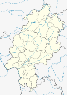
The Landgrave Castle Sontra , also called Old Castle , was a castle of the Hessian Landgraves in the town of Sontra in the Werra-Meißner district that emerged from an earlier castle . It was located immediately southwest of the church within the old city wall .
history
A landgrave's castle near the parish church was first mentioned in 1368. It was renewed and expanded in 1491 and then served the landgraves temporarily as a hunting lodge and later as an office building. The system survived the great city fire of 1558 because there was enough extinguishing water available in a nearby pond. In 1594 the stables and the so-called fruit house were demolished and rebuilt because of dilapidation . At the beginning of the 17th century, Landgrave Moritz von Hessen-Kassel had a new palace built in the late Renaissance style, which closed the palace courtyard between the old palace building on the north side and the two-storey stables opposite to the west. The new building seems to have been finished in 1611 at the latest. The previous castle, which was used as an official building and was now referred to as the “old building”, was given two stately timber-framed additional floors for the storage of taxes in kind.
The attachment
The new castle was made entirely of stone, which Landgrave Moritz himself depicted in several drawings in October 1630 after he had been forced to abdicate by the Hessian estates in 1627 . The castle was a two-story, ten-axis structure 100 feet (29 m) long and 30 feet (8.6 m) wide. The roof design is different on each of the three existing drawings. The first drawing shows a tail gable on the northern front side, a central gable on the (western) garden side and a stair tower on the (eastern) courtyard side. The second depiction shows a central risalite with arbor on the northern front side and three gables on the garden side. On the third drawing, the castle has two gables on the garden side. The various representations presumably represent suggestions for the further expansion of the building, which had belonged to the Rotenburger Quart since 1627 .
The building delimited the built-up area of the palace complex to the west. On its west side there was a large garden or park that reached as far as the city wall, on the outside of which the road from the Upper Gate to Königswald (via Berneburg and Rockensüß ) ran. The inner courtyard was surrounded in the north by the old building, in the south by the stables and in the west by the new palace building. The five-axis office building, the "old building", 90 feet long and 40 feet wide, had two stone floors and two half-timbered floors as well as a central gable on each of the two long sides. The stables had the same basic dimensions as the old building, but only had two floors. The inner courtyard was separated on its east side by a wall with a portal from the forecourt, which in turn was completely surrounded by farm buildings: horse stable in the south along the city wall, barn, cattle sheds and bakery. The entrance to the castle district was from the north past the town church, immediately east of the old building in the forecourt. The city wall encompassed the building complex on the south and west sides, including the park and garden to the west of the new palace.
The End
Only four years after Landgrave Moritz had made his sketches, Croatian horsemen set the town of Sontra on fire on Christmas night 1634. Most of the city fell victim to him, and the palace complex was also permanently destroyed. Only the former royal stables were restored to such an extent that they served as the office or renting of the Landgraves of Hessen-Rotenburg until the 18th century . In the 20th century, the remains of the facility were demolished. Only the outer walls of an adjoining building that was converted into a residential building remained.
literature
Web links
- Entry by Stefan Eismann on Sontra in the scientific database " EBIDAT " of the European Castle Institute
Notes and individual references
- ^ Georg Landau: Description of the Electorate of Hesse. Fischer, Kassel, 1842, p. 287
- ↑ http://de.wikisource.org/wiki/Topographia_Hassiae:_Sontra
- ↑ http://www.ub.uni-kassel.de/index.php?id=2077&L=2 ( page no longer available , search in web archives ) Info: The link was automatically marked as defective. Please check the link according to the instructions and then remove this notice.
- ↑ A Kassel foot = 28.7 cm.
- ↑ http://orka.bibliothek.uni-kassel.de/viewer/image/1323769653423/1/LOG_0000/
- ↑ http://orka.bibliothek.uni-kassel.de/viewer/image/1323769653481/1/LOG_0000/
- ↑ http://orka.bibliothek.uni-kassel.de/viewer/image/1323769653240/1/LOG_0000/
- ↑ http://www.ub.uni-kassel.de/index.php?id=2077&L=2 ( page no longer available , search in web archives ) Info: The link was automatically marked as defective. Please check the link according to the instructions and then remove this notice.
- ^ Georg Landau: Description of the Electorate of Hesse. Fischer, Kassel, 1842, p. 287
- ^ Carl Lorenz Collmann: History of the old mountain town of Sontra in Lower Hesse. Kassel, 1863, p. 6
