
District of Reutlingen
| coat of arms | Germany map |
|---|---|

|

Coordinates: 48 ° 30 ' N , 9 ° 13' E |
| Basic data | |
| State : | Baden-Württemberg |
| Administrative region : | Tübingen |
| Region : | Neckar-Alb |
| Administrative headquarters : | Reutlingen |
| Area : | 1,092.74 km 2 |
| Residents: | 286,748 (Dec. 31, 2018) |
| Population density : | 262 inhabitants per km 2 |
| License plate : | RT |
| Circle key : | 08 4 15 |
| NUTS : | DE141 |
| Circle structure: | 26 municipalities |
| Address of the district administration: |
Bismarckstrasse 47 72764 Reutlingen, Germany |
| Website : | |
| District Administrator : | Thomas Reumann (independent) |
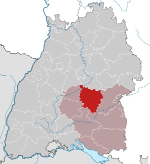
| Location of the Reutlingen district in Baden-Württemberg | |
  |
|

The district of Reutlingen is a district in Baden-Württemberg . Together with the district of Tübingen and the Zollernalb district, it forms the Neckar-Alb region , of which it is the largest district, and belongs to the administrative district of Tübingen .
geography
location
The district of Reutlingen has a share in the Swabian Alb and the Alb foreland. In the southeast the district extends almost to the Danube . The altitude extends from 290 m above sea level. NN in Mittelstadt up to 881 m above sea level. NN on the Bolberg near Willmandingen.
places
There are around 185 localities ( towns , villages , hamlets , farms , individual houses and groups of houses) in the Reutlingen district .
Neighboring areas
The district of Reutlingen borders clockwise in the north, beginning with the districts of Esslingen , Göppingen (with a very short border), Alb-Donau-Kreis , Biberach , Sigmaringen , Zollernalbkreis , Tübingen and Böblingen .
nature
The Reutlingen district has the following nature reserves . According to the protected area statistics of the State Institute for the Environment, Measurements and Nature Conservation Baden-Württemberg (LUBW), in 1973.33 hectares of the district are under nature protection, that is 1.92 percent.
- Bauenofen-Häulesrain valley : 40.0 ha; Community Hohenstein , district Meidelstetten
- Blasenberg-Ringelesberg : 6.8 ha; Hohenstein community, Eglingen district
- Böttental : 44.8 ha; Mehrstetten district
- Buttenhausener Eichhalde : 34.4 ha; City of Münsingen, Buttenhausen district
- Digelfeld : 111.5 ha; Hayingen district
- Echazaue : 50.0 ha; District Pfullingen
- Eckenlauh-Weißgerberberg : 41.0 ha; City of Münsingen, Münsingen and Trailfingen districts
- Oak wood : 17.0 ha; Hohenstein municipality, Eglingen district and Gomadingen municipality, Dapfen district
- Einwinkel : 8.6 ha; City of Reutlingen , Gönningen district
- Geißberg : 25.1 ha; Hohenstein community, Eglingen district
- Goldland-Klausenberg : 117.3 ha; District Dettingen an der Erms
- Greuthau : 192.0 ha; Lichtenstein community, Honau district
- Großer Stöckberg : 13.1 ha; Hohenstein community, Oberstetten district
- Halmberg : 10.0 ha; Hohenstein community, Oberstetten district
- Hochwiesen-Pfullinger Berg : 68.8 ha; District Pfullingen
- Hohenäcker-Imenberg : 75.0 ha; Lichtenstein community, Unterhausen district
- Höhnriß-Neuben : 50.0 ha; City of Münsingen, Dottingen and Rietheim districts
- Hüttenstuhlburren : 19.0 ha; Hohenstein community, Eglingen district
- Kälberberg-Hochberg : 60.0 ha; City of Münsingen, districts Dottingen, Rietheim and Münsingen
- Krähberg-Kapellenberg : 4.0 ha; Hohenstein community, Eglingen district
- Kugelberg : 26.7 ha; District Pfullingen
- Listhof : 123.0 ha; Reutlingen district
- Nägelesfelsen : 13.4 ha; District Bad Urach
- Ohnastetter Bühl : 6.3 ha; Sankt Johann community, Ohnastetten district
- Ruchberg : 24.3 ha; Sonnenbühl community, Willmandingen district
- Slides : 226.5 ha; Gemarkungen Dettingen an der Erms and Bad Urach
- Schaichtal : 467.8 ha, of which 133.2 ha in the Reutlingen district; Walddorfhäslach community, Walddorf and Häslach districts
- Schandental : 98.0 ha; Mehrstetten district
- Schopflochberg : 6.0 ha; City of Münsingen, Trailfingen district
- Seetalhalde-Galgenberg : 136.5 ha; City of Münsingen, Münsingen and Trailfingen districts
- Steinberg-Dürrenfeld : 92.2 ha; Hohenstein community, Oberstetten district
- Steinbuckel : 3.97 ha; Hohenstein community, Eglingen district
- Sulzeichen : 1.9 ha; Walddorfhäslach municipality, Häslach district
- Tannenhalde : 33.8 ha, of which 16.0 ha in the Reutlingen district; Zwiefalten district
- Taubenäcker : 10.2 ha; City of Reutlingen, Gönningen district
- Under lurking : 6.9 ha; City of Reutlingen, Gönningen district
- Upfinger Ried : 5.8 ha; Sankt Johann community, Upfingen district
- Ursulahochberg : 9.0 ha; District Pfullingen
- Neck of the wagon : 6.1 ha; District eningen
- Warmberg : 28.7 ha; Hohenstein community, Oberstetten district
- Wendelstein : 9.7 ha; Eningen under Achalm
- Wonhalde-Spielberg : 118.1 ha; Lichtenstein community, Unterhausen district
history
The district of Reutlingen goes back to the Württemberg Oberamt Reutlingen , which was established after the transition of the formerly free imperial city of Reutlingen to Württemberg in 1802. Already existed in what is now the district of Württemberg offices Urach , Münsingen and Pfullingen , Pfullingen which was dissolved already 1818th The remaining three senior offices have been changed several times throughout history. From 1810 they belonged to the Landvogtei on the Alb, from 1818 to the Black Forest district (Reutlingen and Urach) and the Danube district (Münsingen). In 1924 both districts were dissolved and in 1934 the three higher offices were renamed as rural districts. In 1938 the district of Urach was abolished and its area was divided between the districts of Reutlingen and Münsingen .
In the district reform the district of Reutlingen was enlarged on 1 January 1973 by most communities of the dissolved district Münsingen (the other came to the Alb-Donau ), three municipalities in the district of Tübingen , the community Upflamör the district Saulgau , the community Steinhilben of the district of Sigmaringen and the municipality of Grafenberg of the district of Nürtingen were added. In return, he gave the municipality of Bronnen to the district of Sigmaringen and the municipality of Gomaringen to the district of Tübingen.
Before that, the communities Sirchingen and Wittlingen were taken over from the Münsingen district on April 1, 1971 and incorporated into the city of Bad Urach . On January 1, 1972, the town of Trochtelfingen from the Sigmaringen district was added. The municipality of Hengen from the Münsingen district followed to enlarge the city of Bad Urach on December 1, 1972.
The Hörschwag community moved to the Zollernalb district on July 1, 1974 .
After the community reform has been completed, the Reutlingen district still comprises 26 communities and the community-free manor district of Münsingen . Among the 26 municipalities there are seven towns and of these two large district towns ( Metzingen and Reutlingen). The largest city in the district and the youngest city in Baden-Württemberg is Reutlingen, the smallest municipality (without the Münsingen manor district) is Mehrstetten .
On January 1, 2011, the Münsingen manor district was reduced to include its inhabited areas. The place Breithülen came to the Heroldstatt community in the Alb-Donau district .
Population development
The population figures are census results (¹) or official updates from the Baden-Württemberg State Statistical Office ( main residences only ).
|
|
politics
The district is administered by the district council and the district administrator.
District council
The district council is elected for five years by those entitled to vote in the district. The local elections on May 26, 2019 led to the result shown in the diagrams.
- Results of previous district elections
| Parties and constituencies |
% 2014 |
Seats 2014 |
% 2009 |
Seats 2009 |
% 2004 |
Seats 2004 |
% 1999 |
Seats 1999 |
% 1994 |
Seats 1994 |
% 1989 |
Seats 1989 |
|
| FW | Free voters | 31.42 | 22nd | 32.0 | 24 | - | - | - | - | - | - | - | - |
| Flat share | Electoral associations | - | - | - | - | 31.1 | 25th | 25.7 | 22nd | 24.6 | 21st | 22.0 | 21st |
| CDU | Christian Democratic Union of Germany | 28.48 | 20th | 26.0 | 19th | 29.3 | 21st | 35.6 | 23 | 33.4 | 23 | 37.4 | 25th |
| SPD | Social Democratic Party of Germany | 18.29 | 13 | 18.4 | 13 | 20.1 | 12 | 21.1 | 13 | 21.3 | 15th | 23.8 | 16 |
| GREEN | Alliance 90 / The Greens | 10.92 | 8th | 11.6 | 8th | 12.0 | 7th | 9.9 | 6th | 13.3 | 8th | 11.5 | 7th |
| FDP | Free Democratic Party | 5.08 | 3 | 8.1 | 6th | 6.3 | 5 | 5.5 | 4th | 4.6 | 3 | 5.2 | 3 |
| LEFT | The left | 3.45 | 2 | 2.8 | 2 | - | - | - | - | - | - | - | - |
| WE | We in Reutlingen | 1.89 | 1 | 1.1 | 0 | - | - | - | - | - | - | - | - |
| Pirates | Pirate party | 0.46 | 0 | 0.0 | 0 | - | - | - | - | - | - | - | - |
| REP | The Republicans | - | - | - | - | - | - | 2.2 | 1 | 2.9 | 1 | - | - |
| Otherwise. | Others | - | - | - | - | 1.2 | - | - | - | - | - | - | - |
| total | 100 | 69 | 100 | 72 | 100 | 70 | 100 | 69 | 100 | 71 | 100 | 72 | |
| voter turnout | 45.86% | 48.79% | 50.4% | 52.5% | 66.9% | ||||||||
|---|---|---|---|---|---|---|---|---|---|---|---|---|---|
- WG: Voter associations, as the results from 1989 to 2004 cannot be broken down into individual groups of voters.
District Administrator
The district council elects the district administrator for a term of eight years. This is the legal representative and representative of the district as well as chairman of the district council and its committees. He heads the district office and is an official of the district. His area of responsibility includes the preparation of the district council meetings and its committees. He calls meetings, chairs them and implements the resolutions passed there. He has no voting rights in the committees . His deputy is the first state official.
The district administrators of the former Münsingen district from 1945 to 1972 are shown in the Münsingen district article . The Oberamtmen of the former Oberamt Reutlingen from 1807 are shown in the article Oberamt Reutlingen .
The district councils of the district Reutlingen from 1935:
- 1931-1936: Robert Barth
- 1937–1945: Max Knöpfler
- 1945–1947: Oskar Kalbfell (acting)
- 1947–1963: Hans Kern
- 1964–1985: Gerhard Müller
- 1985-2005: Edgar Wais (independent)
- since 2005: Thomas Reumann (independent)
coat of arms
The coat of arms was awarded on August 26, 1980 by the Tübingen regional council.
Description : “In green two golden oblique bars, each accompanied by two small six-pointed golden stars; between the inclined beams three larger six-pointed golden stars. "
The circle flag in the colors yellow-green (gold-green) was awarded on October 27, 1988.
The former Reutlingen district did not have a coat of arms. From 1939 he only used the three stag sticks from Württemberg in his seals.
The new Reutlingen district was formed in 1973 from most of the former districts of Münsingen and Reutlingen, as well as fragments of the former districts of Sigmaringen, Tübingen, Saulgau, Hechingen and Nürtingen. He opted for the coat of arms, which in late medieval heraldic books represents the Counts of Achalm, who died out in the pre-aldic period (1098). Since members of this family founded the Zwiefalten monastery, it was used as the donor's coat of arms in the seals and coats of arms of this abbey. Achalm's sphere of influence extended from the vast area around its ancestral castle in the northwest to Zwiefalten in the southeast and thus covered most of today's district area. The circle coat of arms is based on the oldest known representation of the apocryphal Akhalm shield image in the "Stuttgart Wappenbuch" (1439/50),
See also: List of coats of arms in the Reutlingen district
District partnerships
The Reutlingen district maintains partnership relationships with the Saxon Switzerland district in Saxony, the Parma province in Italy and the Pardubice region in the Czech Republic (since 2003).
Economy and Infrastructure
In the 2016 Future Atlas , the Reutlingen district was ranked 80th out of 402 districts, municipal associations and independent cities in Germany, making it one of the regions with "high future prospects". In the 2019 edition, it was ranked 98th out of 401.
traffic
The district area is not touched by any federal motorway and is therefore only accessible through federal, state and district roads. The most important federal highways are the B 28 Tübingen - Ulm and the B 312 Reutlingen - Biberach an der Riss .
The " Neckar-Alb-Bahn " Tübingen - Stuttgart runs through the northern district. In addition, the " Ermstalbahn " from Metzingen to Bad Urach and the " Hohenzollerische Landesbahn " in the southern district are operated in regular intervals.
The public transport is in the Verkehrsverbund Neckar-Alb-Donau involved (NALDO).
District facilities
The Reutlingen district is responsible for the following vocational schools : Ferdinand-von-Steinbeis-Schule (commercial school I) Reutlingen, Kerschensteinerschule (commercial school II) Reutlingen, Theodor-Heuss-Schule (commercial school) Reutlingen, Laura-Schradin-Schule (home economics nursing and socio-educational school) Reutlingen, commercial school Metzingen, commercial and home economics school Bad Urach and vocational school (commercial, commercial, home economics-socio-educational and agricultural school) Münsingen also the special educational and advisory center with a focus on intellectual development Karl-Georg-Haldenwang -Münsingen School.
The district of Reutlingen is a partner in the district clinics Reutlingen GmbH. This society is responsible for the clinics in Reutlingen, Bad Urach and Münsingen.
Communities
(Residents on December 31, 2018)


Municipalities before the district reform
Before the district reform in 1973 or before the community reform , the (old) district of Reutlingen had a total of 37 communities from 1938 , including 4 towns . In addition to the actual main area, the district area included an exclave in the south consisting of the three communities Bronnen, Hausen an der Lauchert and Mägerkingen. Between the two parts were the municipalities of the districts of Hechingen and Sigmaringen .
On March 7, 1968, the state parliament of Baden-Württemberg set the course for a community reform . With the law to strengthen the administrative power of smaller municipalities , it was possible for smaller municipalities to voluntarily unite to form larger municipalities. The beginning in the old district of Reutlingen was made on January 1, 1971 by the communities of Bronnweiler, Gönningen, Oferdingen and Reicheneck, which were incorporated into the city of Reutlingen . In the period that followed, the number of communities steadily decreased. The remaining municipalities of the old Reutlingen district merged into the newly enlarged Reutlingen district on January 1, 1973 , only Gomaringen came to the Tübingen district and Bronnen came to the Sigmaringen district .
The largest municipality in the old Reutlingen district was the district town of Reutlingen , which has been a major district town since April 1, 1956 . The smallest community was Ohnastetten.
The old district of Reutlingen last covered an area of 442 km² and had a total of 189,569 inhabitants at the 1970 census .
The table shows the population development of the old Reutlingen district up to 1970. All population figures are census results.
|
|
In the table, the municipalities of the old Reutlingen district are before the municipal reform. Almost all municipalities still belong to the Reutlingen district, only Gomaringen belongs to the Tübingen district and Bronnen to the Sigmaringen district.

License Plate
On July 1, 1956, the district was assigned the distinguishing sign RT when the license plates that are still valid today were introduced . It is still issued today.
literature
- District of Reutlingen. (= The city and rural districts of Baden-Württemberg in words and numbers; Issue 51) . Published by the Ministry of the Interior and Ministry of Economics in Baden-Württemberg, processing and printing of the State Statistical Office of Baden-Württemberg, Stuttgart, 1970.
- Landesarchivdirektion Baden-Württemberg (Ed.): The state of Baden-Württemberg - official description by districts and communities. Volume VII: Tübingen administrative region , Stuttgart 1978. ISBN 3-17-004807-4 .
- Landesarchivdirektion Baden-Württemberg (ed.): The district of Reutlingen . Edited by the Tübingen branch of the State Research and State Description department in the Baden-Württemberg State Archives. Vol. 1. A. General part - B. Descriptions of the municipalities Bad Urach to Metzingen . Bd. 2. B. Community descriptions Münsingen to Zwiefalten - Münsingen manor district . Beil .. Map supplements - Statistical appendix - Archaeological site catalog - General register . Sigmaringen: Thorbecke, 1997.
- Gerhard Müller (Ed.): The Reutlingen district. Theiss, Stuttgart 1975, ISBN 3-8062-0136-6
Web links
Individual evidence
- ↑ State Statistical Office Baden-Württemberg - Population by nationality and gender on December 31, 2018 (CSV file) ( help on this ).
- ↑ LUBW's protected area statistics ( Memento of the original from January 20, 2015 in the Internet Archive ) Info: The archive link was inserted automatically and has not yet been checked. Please check the original and archive link according to the instructions and then remove this notice.
- ↑ a b Federal Statistical Office (ed.): Historical municipality register for the Federal Republic of Germany. Name, border and key number changes in municipalities, counties and administrative districts from May 27, 1970 to December 31, 1982 . W. Kohlhammer, Stuttgart / Mainz 1983, ISBN 3-17-003263-1 , p. 531 f. and 537 f .
- ↑ [1] ( Page no longer available , search in web archives ) Info: The link was automatically marked as defective. Please check the link according to the instructions and then remove this notice. Distribution of votes in the district elections 1989–2009
- ↑ [2] ( Page no longer available , search in web archives ) Info: The link was automatically marked as defective. Please check the link according to the instructions and then remove this notice. Distribution of seats in district elections 1989–2009
- ^ District and municipal coats of arms in Baden-Württemberg Volume 4, page 21; Publisher: Landesarchivdirektion Baden-Württemberg 1987 ISBN 3-8062-0804-2 .
- ↑ Future Atlas 2016. (No longer available online.) Archived from the original on October 2, 2017 ; accessed on March 24, 2018 . Info: The archive link was inserted automatically and has not yet been checked. Please check the original and archive link according to the instructions and then remove this notice.
- ↑ PROGNOS future atlas. Handelsblatt, accessed on December 10, 2019 .
- ↑ State Statistical Office Baden-Württemberg - Population by nationality and gender on December 31, 2018 (CSV file) ( help on this ).
Alb-Danube District | Baden-Baden | Biberach | Lake Constance district | Boeblingen | Breisgau-Upper Black Forest | Calw | Emmendingen | Enzkreis | Esslingen | Freiburg im Breisgau | Freudenstadt | Göppingen | Heidelberg | Heidenheim | Heilbronn (Land) | Heilbronn (city) | Hohenlohekreis | Karlsruhe (State) | Karlsruhe (city) | Constance | Loerrach | Ludwigsburg | Main-Tauber district | Mannheim | Neckar-Odenwald district | Ortenaukreis | Ostalbkreis | Pforzheim | Rastatt | Ravensburg | Rems-Murr-Kreis | Reutlingen | Rhein-Neckar District | Rottweil | Schwäbisch Hall | Schwarzwald-Baar district | Sigmaringen | Stuttgart | Tübingen | Tuttlingen | Ulm | Waldshut | Zollernalb district
.svg)
Basking | Backnang | Baden-Baden | Balingen | Biberach | Boeblingen | Bruchsal | Book | Bühl | Calw | Crailsheim | Donaueschingen | Ehingen | Emmendingen | Esslingen | Freiburg (city) | Freiburg (State) | Freudenstadt | Friedrichshafen | Göppingen | Hechingen | Heidelberg (city) | Heidelberg (Country) | Heidenheim | Heilbronn (city) | Heilbronn (Land) | Black Forest | Horb | Karlsruhe (city) | Karlsruhe (State) | Throat | Constance (city) | Constance (Country) | Künzelsau | Lahr | Leonberg | Loerrach | Ludwigsburg | Mannheim (city) | Mannheim (State) | Mergentheim | Mosbach | Muellheim | Münsingen | Neustadt | Nürtingen | Offenburg | Öhringen | Pforzheim (city) | Pforzheim (Country) | Rastatt | Ravensburg | Reutlingen | Rottweil | Säckingen | Saulgau | Schwäbisch Gmünd | Schwäbisch Hall | Sigmaringen | Sinsheim | Stockach | Stuttgart | Tauberbischofsheim | Tettnang | Tübingen | Tuttlingen | Überlingen | Ulm (city) | Ulm (State) | Vaihingen | Villingen | Villingen-Schwenningen | Waiblingen | Waldshut | Cheeks | Wolfach