List of cultural monuments in Bad Dürkheim
The list of cultural monuments in Bad Dürkheim includes all cultural monuments of the Rhineland-Palatinate city of Bad Dürkheim including the districts of Grethen , Hardenburg , Leistadt , Seebach and Ungstein (with Pfeffingen ). No cultural monuments have been designated for the Hausen district . The basis is the list of monuments of the state of Rhineland-Palatinate (as of September 26, 2017).
Bad Dürkheim
Monument zones
| designation | location | Construction year | description | image |
|---|---|---|---|---|
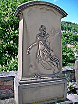
| Monument zone cemetery | Friedhofstrasse location |
1572 | southern walled area of the cemetery laid out in 1572 and expanded several times;
|
|
| Monument zone of the founding core | Eichstrasse, Kirchgasse, Römerstrasse, Römerplatz, Rote-Kreuz-Strasse, Schulgasse, Weinstrasse north location |
Medieval founding core around Römerplatz and the church, which was notarized in the 10th century, with medieval routing, fine structure has been preserved since the early 19th century, building fabric from the 18th and early 19th centuries | ||
| Kurbrunnenstraße monument zone | Kurbrunnenstraße 20, 22/24, 23, 26 location |
around 1900 | villa-like residential buildings dating from the late founding period, around 1900 |

|
| Monument zone extension of the spa park | Schlossgartenstrasse 2, Salinenstrasse 7 location |
1930s | Kurpark extension laid out in the 1930s with geometrical routing and planting, fountain hall, 1933/34, architect Joseph Müller , Neustadt an der Weinstrasse , and grape spa facility |

|
| Schlossgartenstrasse monument zone | Schlossgartenstrasse, next to No. 12 location |
1897 | Garden, symmetrical paths, 1897, bronze group of figures (1900?), Monumental grotto, around 1910, various spoils | |
| Black district monument zone | Weinstrasse Nord 21, 25–37 (odd numbers), 34 and 38–46 (even numbers), Mühlgasse 1, 3 and 2–14 (even numbers), Gerberstrasse 1 Lage |
Part of the former paradise suburb mentioned for the first time in 1562; One and two-storey residential houses and small courtyards, 18th and 19th centuries, as well as a cellar mill and three-storey late classicist row building | ||
| Monument zone western suburb | Kaiserslauterer Strasse 1–33, 35, Friedhofstrasse 1–4, Eichstrasse 22 Location |
Developed in the Middle Ages to the west of the suburb along the connecting road to today's western parts of the city, originally a rural settlement area, predominantly two-storey perimeter block development, 18th and 19th centuries | ||
| Monument zone Forsthaus Jägerthal | west of the city on the B 37 location |
18th and 19th centuries | Courtyard, 18th and 19th centuries, on the site of a Liningian "castle"; overall structure: in the core baroque single-storey building with a crooked hip, around 1825; Residential building southeast of it; former guard house at the entrance to the courtyard, small circular dome, around 1770; fountain in the front yard; two-part economy; Garden wall |

|
Individual monuments
| designation | location | Construction year | description | image |
|---|---|---|---|---|
| City fortifications | before 1360 | Tower-occupied city wall with a ditch in front of it mentioned for the first time in 1360, comprehensible by means of street layouts and sparse remains of wall and towers: tower remains Mannheimer Str. 12, Weinstrasse Nord 28, wall remnants Marktgasse 1, Marktgasse 7 and the Vigilienturm serving as an outpost (Sonnwendstrasse) | ||
| city wall | Burgstrasse, in No. 16 position |
14th Century | Part of the city fortifications from the 14th century preserved in a rear wall | |
| Residential building | Eichstrasse 7 location |
1769 | late baroque plastered building, marked 1769, heightened in 1835 |

|
| Courtyard | Eichstrasse 10 location |
late 18th century | Small farm, late 18th century; Single-storey late baroque house, some of the outbuildings were changed in the 19th century |

|
| Barrel oak | Eichstrasse 12 location |
1838 | former barrel oak; late classical plastered building, 1838 |

|
| Residential building | Eichstrasse 14 location |
1816 | Residential building of a former tannery, large-volume neighboring baroque half-hip roof building, marked 1816 |

|
| Residential building | Eichstrasse 16 location |
1717 | House of a former farm, baroque half-timbered house, marked 1717, stone renovations from the early 18th century |

|
| Graf's house | Eichstrasse 22 location |
after 1802 | also Old Museum ; Northern residential building: fourteen-axis classicist solid construction with mezzanine, after 1802; Southern residential building: around 1815, extension and heightening in 1876 |

|
| Courtyard | Gerberstrasse 13 location |
1812 | former winery, single-storey plastered building, 1812, rococo portal probably around 1770 |

|
| tannery | Gerberstrasse 16 location |
18th and 19th centuries | former tannery; elongated, kinked system, 18th and 19th centuries; Plastered building with a pitched gable roof, 1830s, connecting wing and single-storey gabled house, 18th century |
 more pictures more pictures
|
| Courtyard | Hinterbergstrasse 20 location |
18th century | Three-sided courtyard; Baroque dwelling house, partly decorative framework, 18th century, barn, former stable, gate pillar (Spolie) marked 1770, 19th century economy |

|
| Dürkheim house | Kaiserslauterer Strasse 1 location |
1835/36 | Formerly the house restaurant of the “Vier Jahreszeiten” wine cooperative ; Large-volume two-wing building, 1835/36, balcony around 1870, rear wing renewed in 1864 and 1875 |
 more pictures more pictures
|
| Pfälzer Hof restaurant | Kaiserslauterer Strasse 2 location |
around 1830 | Plastered building over barrel vaulted cellar and hall with hipped roof, around 1830, remodeling of the courtyard-side facade of the hall around 1870 |

|
| Courtyard | Kaiserslauterer Strasse 3 location |
Late 18th century | late baroque courtyard; single-storey plastered building with doorway and quarry stone barn, end of the 18th century, rear side wing renewed around 1900 over older remains, staircase around 1900; Characteristic of the street with No. 5 | |
| Courtyard | Kaiserslauterer Strasse 5 location |
second half of the 18th century | baroque winery, second half of the 18th century; Plastered building with gate drive, rear vaulted hall, around 1800; Characteristic of the street with No. 3 |

|
| Residential building | Kaiserslauterer Strasse 8 location |
1798 | late baroque plastered building with gate drive, marked 1798 | |
| Courtyard | Kaiserslauterer Strasse 16 location |
18th century | late baroque winegrower's farm, 18th century; Plastered building, probably from the middle of the 18th century, one-storey mansard hipped roof extension, late 18th century; Outbuilding 18th century, additional storey 19th century, wooden pavilion with pagoda roof in the garden, 1900 | |
| Door run | Kaiserslauterer Strasse, at No. 17 location |
18th century | late baroque gate drive, 18th century | |
| Hof zum Rossäuscher | Kaiserslauterer Strasse 30 location |
16th and 18th centuries | former vintner's farm, formerly Zum Roßtäuscher; Two residential houses, 16th and 18th centuries: half-hipped roof building, partly half-timbered, stair tower, partly half-timbered, marked 1591, basement exit marked 1559, second house, plastered building marked 1718, gate around 1600 | |
| Basement exit and gate drive | Kaiserslauterer Strasse, at No. 32 location |
1611 | Basement exit, marked 1611, gate drive probably at the same time | |
| Bart brothers winery | Kaiserslauterer Straße 42 location |
around 1910 | three-sided courtyard-like complex, around 1910; Baroque-style residential building, one-storey outbuilding, two-storey side wing, courtyard wall with gate | |
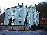
| Zumstein winery | Kaiserslauterer Strasse 45 location |
around 1787 | three late baroque buildings, around 1787, changes in the 19th and 20th centuries; Lesson table ( picture ), around 1840; sophisticated residential building, two-and-a-half-storey late classicist hipped roof building, marked 1863 and 1865, 1858/59, architect Theodor Brofft , Frankfurt; defining the townscape |
 more pictures more pictures
|
| Napoleon's Bank | Karl -räder-Allee, in front of No. 22c location |
18th or 19th century | Rest bench for placing loads carried on the head, 18th or 19th century, two crossbeams over three pillars |

|
| Residential building | Kirchgasse 9 location |
around 1820 | large-volume neighbourhood with a crooked hip roof, around 1820; defining the plaza | |
| city wall | Kirchgasse, at No. 13 location |
14th Century | Parts of the city fortifications in the rear wall of the house | |
| Protestant deanery and parish hall | Kirchgasse 14 location |
1606 | Plastered building, in the core from 1606, basement conversion and upper floor probably from the early 18th century, extension 1932 ff. | |
| Protestant castle church | Kirchgasse 16 location |
12th Century | Tower basement from the 12th century, upper floors and three-aisled transept-free sandstone pseudo-basilica from around 1300, neo-Gothic tower tower 1865/66; defining the townscape; Burial chapel of the Counts of Leiningen, soon after 1500, tombs from the 16th to 18th centuries; |
 more pictures more pictures
|
| Residential building | Kurbrunnenstraße 19 location |
1875 | two and a half storey Wilhelminian style building with a mansard gable roof, 1875; defining the square with no. 21a and 21b |

|
| villa | Kurbrunnenstraße 20 location |
1899 | Villa, 1899, rich ornamental framework in the attic, with equipment |

|
| Residential building | Kurbrunnenstraße 21a location |
1851 | Plastered building, 1851, increase probably around 1872 |

|
| House of Youth | Kurbrunnenstraße 21b location |
1877 | two and a half storey plastered building, 1877; Extension with a lively roof landscape, 1906; Marking the square with nos. 19 and 21a |

|
| Residential and commercial building | Kurgartenstrasse 5 location |
1866 | Residential and commercial building; narrow, three-storey plastered building, 1866; defining the streetscape | |
| Door run | Kurgartenstrasse, at No. 7 location |
1599 | late Gothic gate drive, marked 1599, in a late Baroque house that has been changed several times | |
| Residential building | Kurgartenstrasse 10 location |
1849 | sandstone-integrated row building, 1849 | |
| Catholic parish church of St. Ludwig | Kurgartenstrasse 15 location |
1828/29 | sophisticated classical hipped roof building with portico, 1828/29, architect Johann Bernhard Spatz , Speyer |
 more pictures more pictures
|
| Villa Denis | Kurgartenstrasse 18 location |
1868 | large-volume late Classicist building with hipped roof, 1868, architect possibly Paul Camille von Denis ; defining the streetscape |

|
| Castle Church | Leininger Strasse 19 location |
1756 | former Protestant parish church; Baroque tower, marked 1756 and 1758, raised in 1840, hood 1956, north gable 1877, two-storey restoration of the hall after war destruction 1953–56, architects Hans and Ernst Buch, Bad Dürkheim, and Hans Georg Fiebiger , Kaiserslautern; belonging: former rectory, today parish hall, plastered building with crooked hip, 1756 |
 more pictures more pictures
|
| Kreissparkasse | Mannheimer Strasse 12 location |
1937 | former building of the Kreissparkasse Bad Dürkheim ; Three-wing complex, high-pitched hipped roof buildings, 1937, architect Joseph Müller, Neustadt an der Weinstrasse; defining the plaza |

|
| City wall tower | Mannheimer Strasse, behind No. 12 Lage |
Mid 14th century | Round quarry stone ground floor of a city wall tower, mid-14th century, half-timbered upper floor, 18th century |

|
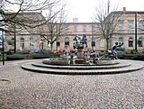
| Station building | Mannheimer Strasse 14 location |
1872/73 | three-wing, late classical sandstone building on an H-shaped floor plan, 1872/73; defining the plaza |
 more pictures more pictures
|
| War memorial 1870/71 | Mannheimer Strasse, in front of No. 14 location |
1911 | Monumental war memorial on the Bahnhofsplatz 1870/71, 1911, architect Oswald Bieber , Munich |

|
| Residential building | Mannheimer Strasse 22 location |
1832/33 | Large villa-like house, built in 1832/33 over baroque remains (18th century), extension with a sandstone-integrated hipped roof building in 1898 |

|
| Car hall of the Rhein-Haardt-Bahn | Mannheimer Strasse 53 location |
1913 | Car hall of the Rhein-Haardtbahn with the adjoining residence of the station master; overall structure , Heimatstil, 1913, architect Philipp Andresson ; Large-volume hall with a half-hip roof, technical equipment, sandstone-clad wing with pent roof, three-story house with a lively roof landscape |

|
| Castle tower | Marktgasse, at No. 1 location |
early 13th century | rounded wall of a tower of the castle fortifications, probably from the early 13th century | |
| Castle tower | Marktgasse, at No. 7 location |
early 13th century | in the cellar of an outbuilding, cellar walls of a tower of the castle fortifications, probably from the early 13th century | |
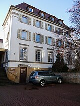
| Building of the Catholic Parish Association | Pfarrgässchen 2 location |
1926/27 | Building of the Catholic Parish Association; four-story historicizing hipped roof building, 1926/27 |
|
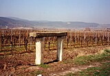
| Napoleon's Bank | Portugieserstraße, at No. 3 location |
18th or 19th century | Napoleon's Bank; Rest bench for placing loads carried on the head, 18th or 19th century, sandstone pillars |
|
| Residential and commercial building | Römerplatz 1 location |
late 18th century | late baroque residential and commercial building with a mansard gable roof, late 18th century, probably over older remains, marked 1739 |
 more pictures more pictures
|
| Residential and commercial building | Römerplatz 2 location |
1845 | large-volume corner residential and commercial building, 1845 over older remains; two-and-a-half-storey plastered building, shop fitting around 1880/90 and around 1925; defining the plaza |
 more pictures more pictures
|
| Residential building | Römerplatz 8 location |
1787 | late baroque house, marked 1787; defining the plaza |
 more pictures more pictures
|
| Residential and commercial building | Römerplatz 14 location |
Late 18th century | late baroque residential and commercial building with a mansard gable roof, essentially from the end of the 18th century, shop installation around 1860; defining the street and townscape |

|
| Residential and commercial building | Römerstrasse 6/8 location |
second half of the 16th century | Residential and commercial building with stair tower, the core from the second half of the 16th century, above probably medieval cellars (middle of the 13th century?), Gate drive from the early 17th century |

|
| basement, cellar | Römerstraße, under No. 10 location |
Part of a medieval cellar (see Römerstraße 6/8) | ||
| House of Catoir | Römerstrasse 20 location |
1781 | formerly Leiningen-Falkenburger Hof; late baroque plastered building with gate drive, marked 1781 and 1854 (renovation); defining the streetscape |

|
| Leiningisches schoolhouse | Römerstrasse 23 location |
1751 | former Leiningisches schoolhouse; Baroque plastered building, marked 1751, rich late classicist extension in 1876 |

|
| Residential and commercial building | Römerstrasse 30 location |
1902 | Corner residential and commercial building, neo-Gothic mansard hipped roof, marked 1902, pavilion in the courtyard; defining the plaza | |
| Front yard fence | Schlossgartenstrasse, at No. 10/12 location |
1903 | Front garden fence, wrought iron, Art Nouveau, 1903 |

|
| Residential and commercial building | Schlosskirchenpassage 2 location |
1787 | Two-and-a-half-storey sandstone-integrated residential and commercial building, gate drive marked 1787, renovation and expansion in 1866 |

|
| Kurhaus of the city and casino | Schlossplatz 1 location |
1822-26 | sophisticated classical plastered building, 1822–26, architect probably Johann Bernhard Spatz , Speyer; shape of the place; Sandstone ashlar wall with baroque inscription plaque, 1739–41; baroque pavilion with bell roof, 1741 (both remains of Dürkheim Castle, which was previously here ); English Garden (Kurgarten), 1845/46, architect, garden director Metzger, extension 1950, architect Max Fischer , Ludwigshafen; Ostertag Memorial, 1909/10, architects Düll and Pezold , Munich |
 more pictures more pictures
|
| Volksbank | Schlossplatz 3a location |
1906/07 | Volksbank administration building; large-volume three-storey neo-renaissance building with a moving roof landscape, 1906/07, architect Philipp Andressohn |
 more pictures more pictures
|
| Pestalozzi School | Schulgasse 7 location |
1876/77 | three-storey late classicist hipped roof building, marked 1876/77, architect Theodor Brofft, Frankfurt |

|
| District Court | Seebacher Strasse 2 location |
1901 | New baroque three-wing complex, sandstone block construction with hipped roof, 1901 |

|
| Residential building | Seebacher Straße 13 location |
1900 | one-and-a-half-storey row house dating from the late founding period, 1900; pavilion |

|
| Vigilio Temple | Sonnwendstrasse, behind No. 17a Lage |
1842 | Vineyard cottages; temple-like classical plastered building, 1842; erected on the stump of the vigilio tower of the city fortifications |

|
| Courtyard | Weinstrasse Nord 1 location |
second half of the 18th century | in the core late baroque hook courtyard, second half of the 18th century, extension to the four-sided courtyard and facade renovation in 1850; three-storey residential building, three-storey side wing, partly two-storey cellars, 18th and 19th centuries; defining the townscape |
 more pictures more pictures
|
| Courtyard | Weinstrasse Nord 5 location |
1764 | Former winery, three-storey plastered building in the late Baroque style, gate drive marked 1764, heightening and hipped gable roof in 1871 |
 more pictures more pictures
|
| Courtyard | Weinstrasse North 7 location |
1810 | former winery, late baroque corner house with crooked hip, marked 1810, above the high cellar, probably from the 18th century, back door of an adjoining building, late 18th century; Lesson table ( picture ), around 1840 |
 more pictures more pictures
|
| Residential and commercial building | Weinstrasse Nord 9 location |
1810 | three-storey baroque row residential and commercial building, 1810, shop fitting around 1850/60 |
 more pictures more pictures
|
| Door run | Weinstrasse Nord, at No. 19 location |
1795 | former gate drive, sandstone, marked 1795 |
 more pictures more pictures
|
| Mill and house | Weinstrasse Nord 21 location |
1731 | Former mill and house, late baroque half-hipped roof over vaulted cellars, marked 1731 |

|
| City wall tower | Weinstraße Nord, at No. 28 location |
around 1360 | round quarry stone building, around 1360 |

|
| Residential and commercial building | Weinstrasse North 33 location |
second half of the 18th century | Three-storey row residential and commercial building, partly in the core from the second half of the 18th century, extension around 1850 |

|
| Residential houses | Weinstrasse North 46 location |
1787 | two late baroque single-storey houses, marked 1787, combined in 1878 |

|
| Fitz-Ritter winery | Weinstrasse Nord 51 location |
1785 | L-shaped house with half-hipped roof, gate drive marked 1785; Guard house, probably around 1780, sandstone gate, marked 1786 |

|
| Spoilage | Weinstrasse Süd, at No. 1 location |
1748/49 | Spolie of the synagogue built in 1748/49 , Hebrew inscription tape, inscribed (5) 509 |

|
| Courtyard | Weinstrasse Süd 22 location |
1841 | Winzerhof, classicist hipped roof building on a U-shaped floor plan, 1841, possibly increased around 1860; the core of a late Baroque outbuilding, remodeled in 1841; Cellars under the garden, 1881 |

|
| Residential building | Weinstrasse Süd 30 location |
1836 | Classicist house of a winegrower's farm, 1836, heightened and extended in 1857; multi-part cellar, 19th century; Pavilion with a tent roof, late 18th century |

|
| Residential building | Weinstrasse Süd 62 location |
around 1908 | single-storey villa-like house with mansard roof, around 1908; defining the townscape |

|
| Weilach ruins | north of the city at the foot of the Peterskopf location |
1381 | Quarry stone wall remains of a former manorial court, first mentioned in 1381 |
 more pictures more pictures
|
| Napoleon Bank | north of the city on the L 517 location |
18th or 19th century | Rest bench for placing loads carried on the head, 18th or 19th century, sandstone pillars |

|
| Pagan wall | north of the city on a foothill of the Peterskopf location |
5th century BC Chr. | Remains of a Celtic hilltop settlement, 5th century BC |
 more pictures more pictures
|
| Kriemhildenstuhl | north of the city, below the east side of the heath wall location |
3rd century | roman quarry; Terraced sandstone walls with inscriptions and drawings, 3rd century |
 more pictures more pictures
|
| Kaiser-Wilhelm-Höhe | north of the city, below the southern tip of the Heidenmauer Lage |
1888 | Tower-like viewing platform, marked 1888, sandstone parapet 1898 |
 more pictures more pictures
|
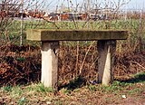
| Napoleon Bank | northeast of the city near the sewage treatment plant in Bruch location |
18th or 19th century | Rest bench for placing loads carried on the head, 18th or 19th century, sandstone pillars |
|
| White stone | south of the city on the border with Wachenheim ; District Planken location |
so-called straight ass | ||
| Flag tower | south of the city on the summit of the Fuchsmantels location |
1854 | former Malakoff tower; neo-Gothic yellow sandstone block, marked 1854 |
 more pictures more pictures
|
| Lambert's Cross | southwest of the city on the boundary to Wachenheim location |
15th century | Sandstone, probably from the 15th century |

|
| Wide or white stone | southwest of the city on the Salweidenkopf location |
inscribed with three crosses | ||
| Landmarks | southwest of the city at the Weisenberg location |
around 1830 | Boundary stone marked with four crosses and U; next to it, border stone, marked LD and 72 (= Limburg-Dürkheimer Wald No. 72), around 1830 | |
| Schaudichnichtum ruin | southwest of the city in Limburg-Dürkheimer Forest location |
18th century | Quarry stone wall remains of a hunting lodge, probably from the 18th century |
|
| Late Roman mountain fortifications at Drachenfels | west of the city on the Drachenfels location |
3rd century | fortified summit plateau; Remains of a double wall, probably from the 3rd century, another, possibly older wall |
 more pictures more pictures
|
| White stone | west of the city in the Isenach valley location |
1579 | Viergemarkstein, inscribed 1579, 1680, 1741, 1750 | |
| Forsthaus Kehrdichann nothing | west of the city in the Limburg-Dürkheim forest location |
1832/33 | Formerly a hunting estate in Lining, single-storey hipped roof building, 1832/33, architect Johann Bernhard Spatz , Speyer; on the facade spoils of the baroque predecessor; baroque partial cellar |

|
| Murrmirnichtviel ruins | west of the city in the Limburg-Dürkheim forest location |
Early 18th century | Remains of the foundation walls of the former hunting lodge, probably from the beginning of the 18th century; Hunting stone in relief below the ruins, 1618 |
 more pictures more pictures
|
Former cultural monuments
| designation | location | Construction year | description | image |
|---|---|---|---|---|
| Graduation building | Weinstrasse Nord and Salinenstrasse location |
1846/47 | open wooden construction on sandstone pillars, open roof truss, 1846/47, architect Albert Schenk ; defining the townscape; deleted from the list of monuments after a fire in 2007 |
 more pictures more pictures
|
| Spoilage | Weinstrasse Nord, at No. 28 location |
1762 | Portal-Keilstein, late baroque, marked 1762; deleted from list of monuments , today multi-storey car park (see picture) |

|
Grethen
Monument zones
| designation | location | Construction year | description | image |
|---|---|---|---|---|
| Monument zone monastery ruins Limburg an der Haardt | west of the village on the ridge above the Isenach location |
around 1042 | Surrounding walls of the early Romanesque three-aisled pillar basilica with double tower facade, around 1042; Crypt, around 1035; Remains of the Romanesque chapter house; late Gothic former summer and former winter refectory; Romanesque monastery fountain; Remains of the landscape gardening of the ruins, 1844 by Johann Christian Metzger |
 more pictures more pictures
|
Individual monuments
| designation | location | Construction year | description | image |
|---|---|---|---|---|
| War memorial and tombs | Bürgermeister-Gropp-Strasse, in the cemetery location |
from 1825 | Cemetery laid out around 1825, expanded around 1890 and 1983; War memorial, 1866 and 1870/71, red sandstone, around 1885; two tombs for Theobald Wernz († 1874) and Anna Wernz († 1864) by Aloys Boller , Worms; Grave of Peter Wernz († 1825) and Maria Wernz († 1851), 1852 by Ph. Wirth, Bad Dürkheim |

|
| Catholic parish church St. Margarethen | Bürgermeister-Gropp-Strasse 4 location |
1790-1805 | simple late baroque hall building, 1790–1805 |
 more pictures more pictures
|
| Council and school house | Friedrich-Ebert-Straße 29 location |
1849/50 | former town hall and school building; Two-and-a-half-storey sandstone block building, 1849/50, heightened in 1875/76 |

|
| Protestant parish church | Friedrich-Ebert-Straße 40 location |
1887-89 | three-aisled, neo-Gothic red sandstone cinder block hall, 1887–89, architect Theodor Bente , Speyer |
 more pictures more pictures
|
| Herzogmühle | Hermann-Schäfer-Strasse 17 location |
1736 | today the Palatinate Museum for Natural History ; representative baroque mansard hipped roof building, marked 1736, renewed around 1860 | |
| kindergarten | In Röhrich 2 location |
1927/28 | neo-baroque hipped roof building, partly above high cellar, 1927/28; shape of the place; on the garden enclosure war memorial 1914/18, 1931 by Fritz Herrfurth , Bad Dürkheim | |
| War memorial | In Röhrich, at No. 2 location |
1931 | at the garden enclosure: War memorial 1914/18, 1931 by Fritz Herrfurth , Bad Dürkheim | |
| Spoilage | In Röhrich, at No. 27 Lage |
1551 | Spolie of the former Limburg Abbey, sandstone relief, inscribed 1551 | |
| Milestone | Kaiserslauterer Strasse, in front of No. 184 Lage |
around 1875 | Mileage stone, around 1875 |

|
Hardenburg
Monument zones
| designation | location | Construction year | description | image |
|---|---|---|---|---|
| Monument zone castle ruins Schlosseck | northwest of the village on the spur of the Rahnfels location |
early 13th century | Section castle laid out to secure the Hardenburg, keep and shield wall with (rebuilt) portal, remains of the outer bailey, early 13th century |
 more pictures more pictures
|
| Monument zone for the castle ruins Hardenburg | west of the village location |
after 1205 | Castle of the Counts of Leiningen, founded after 1205, expansion in the 16th century, partially blown up in 1794, restorations in 1888, 1952, 1980ff .; small remnants of the original building, 13th century, main castle with three corner towers, 16th century, stair tower of the Herrenbau, 1550, basement in 1509, so-called stables, so-called coin; Fortification of the nuns rock |
 more pictures more pictures
|
Individual monuments
| designation | location | Construction year | description | image |
|---|---|---|---|---|
| Council and school house | Am Schlossbrunnen 13 location |
1911 | former town hall and school building; single-storey plastered building on a high base, 1855, late historical half-timbered ridge ridge with pointed helmet, 1911 |
 more pictures more pictures
|
| relief | Kaiserslauterer Strasse, opposite No. 336 location |
around 1770/80 | Hunting relief, late baroque, around 1770/80 | |
| Forestry Office | Kaiserslauterer Strasse 343 location |
1856 | Forestry office with the forest director's apartment; Plastered construction on partially above-ground basement, 1856 | |
| school | Kaiserslauterer Strasse 349 location |
1911 | former schoolhouse with teachers' residence; baroque plastered building, 1911, pyramid or hipped roof, stair tower; defining the streetscape | |
| War memorial | Kaiserslauterer Strasse, in front of No. 349 Lage |
around 1928 | monumental war memorial 1914/18, around 1928 by Theodor Joanni , Ludwigshafen | |
| Hotel and restaurant Leininger Hof | Kaiserslauterer Strasse 351/353 location |
1912 | Baroque-style building with hipped roof, stair tower with tent roof, one-storey outbuilding with hipped roof, marked 1912; Characteristic of the street with no.349 | |
| Residential building | Schlossberg 12 location |
around 1900 | one and a half storey villa-like house in the "Swiss style", around 1900 | |
| Milestone | west of the village on the B 37 opposite the Isenach-Sägemühle Lage |
around 1833 | Kilometer stone 25, hour column, around 1833, reworked after 1872 |

|
| Schleipen paper mill | west of the village on the B 37 (Kaiserslauterer Straße 405) location |
1779 | so-called large paper mill; Sandstone slab, marked 1779; former Keilstein, marked 1811 |
Leistadt
Individual monuments
| designation | location | Construction year | description | image |
|---|---|---|---|---|
| town hall | Hauptstrasse 15 location |
1750 | former town hall; elaborate late baroque plastered building with bell tower, marked 1750; Spolie, inscribed 1519 |
 more pictures more pictures
|
| Protestant parish church | Hauptstrasse 26 location |
1878-82 | neo-Gothic hall, 1878–82, architect Heinrich Erfle (father of the optician of the same name ); with equipment, Walcker organ from 1902 |
 more pictures more pictures
|
| Catholic Parish Church of St. Michael | Hauptstrasse 91 location |
1891/92 | neo-Gothic sandstone cuboid hall building, 1891/92, architect Joseph HA Lucas |
 more pictures more pictures
|
| Council and school house | Waldstrasse 22 location |
1873 | former town hall and school building; large-volume Wilhelminian style building, marked 1873 |
 more pictures more pictures
|
| Landmark | west of the village on the hamlet head location |
1595 | Border stone with coat of arms of the Counts of Leiningen , marked 1595; next to it a small Loogfels with a cross |

|
| Soup bowl | west of the village on the Weilerskopf; location |
1826 | Boundary stone, marked 1826 and H / N. 2 ( picture ) |

|
| Krummholzerstuhl | west of the village at the Ungeheuersee Lage |
2nd or 3rd century | Remains of a Roman quarry, 2nd or 3rd century | |
| Laurahütte | west of the village in the forest location |
1845 | elaborate temple-like hunting lodge, marked 1845 |
 more pictures more pictures
|
| sofa | west of the village near the Teufelsmauer location |
14th to 16th century | Remains of a hermitage supposedly inhabited between the 14th and 16th centuries |

|
Seebach
Individual monuments
| designation | location | Construction year | description | image |
|---|---|---|---|---|
| Courtyard | Dorfplatz 1 location |
1749 | late baroque courtyard, expanded into a three-sided courtyard in the 19th century; Residential house with crooked hip, marked 1749 and 1799 (remodeling?), Above the older cellar, marked 1533; large-volume former barn with a crippled hip, around 1745, conversion marked 1799; Gate run marked 1743; defining the townscape | |
| Protestant Church | Dorfplatz 3 location |
around 1220 | Ruins of the St. Laurentius monastery church; Transept and crossing tower Romanesque, around 1220, with older parts, probably around 1140; Renewal of the late Gothic nave 1880–87; two tombstones, 16th century and late baroque; In the lapidarium, fragments of medieval architecture and grave slabs, Romanesque sarcophagi |
 more pictures more pictures
|
| school | Dorfplatz 5 location |
1870 | former schoolhouse; two-and-a-half-story plastered building, 1870, with late Gothic vestments, 1482–88, basement probably from the 17th or 18th century |
Ungstein (with pepper)
Monument zones
| designation | location | Construction year | description | image |
|---|---|---|---|---|
| Monument zone in the center of Ungstein | Location at the church, Brunnengasse, Kirchstrasse, Schulstrasse, Waldgasse, Weinstrasse, Wormser Strasse |
Settlement core as it developed from the late Middle Ages to the 19th century. Closely lined up crooked and three-sided courtyards, barn wreath, building fabric from the 18th and 19th centuries, structural remains from the time before the Palatinate was destroyed | ||
| Monument zone of the late Roman Burgus | Kirchstrasse 19, 21, 23 and 25, Weinstrasse 66, 68, 72 location |
at 369 | small remains of the wall of a Roman fortification including the associated burial ground, probably around 369 | |
| Monument zone of the Roman estate on Weilberg | north of the village location |
around 20/30 AD | Remnants of the wall, at the beginning of the 2nd century, of an extensive Roman estate, used from around 20/30 to the early 5th century |
 more pictures more pictures
|
Individual monuments
| designation | location | Construction year | description | image |
|---|---|---|---|---|
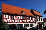
| Courtyard | Kirchstrasse 12 location |
16th or 17th century | Baroque mansard hipped roof, partly half-timbered, the core from the 16th or 17th century, gate system from the second half of the 18th century, arch to the courtyard around 1600 |
 more pictures more pictures
|
| Residential building | Kirchstrasse 14 location |
1780 | late baroque plastered building, gate drive, marked 1780 |

|
| Residential building | Kirchstrasse 16 location |
1598 | Residential house, partly half-timbered, marked 1598, late Baroque remodeling in the 18th century; defining the streetscape | |
| Goalposts | Kirchstrasse, at No. 17 location |
1594 | left goal post, marked 1594 | |
| school | Kirchstrasse 22 location |
1836/37 | former schoolhouse, hipped roof, 1836/37 | |
| Protestant parish church | Kirchstrasse 29 location |
1715 | late baroque hall building with a mighty bell tower, marked 1715; with equipment |
 more pictures more pictures
|
| War memorials | Kirchstrasse, at No. 29 location |
around 1900 to 1957 | War memorial 1870/71, 1914/18 and 1939/45, sandstone, 1957 by Franz Lind, Freinsheim |
 more pictures more pictures
|
| Rectory | Pfeffingen 2 location |
second half of the 18th century | former rectory; single-storey plastered late baroque building, second half of the 18th century, partly above a high cellar, 1828, mid-level houses 1828/29 |

|
| Door run | Weinstrasse, at No. 37 location |
second half of the 18th century | Gate drive and man gate, second half of the 18th century |

|
| Courtyard | Weinstrasse 46/48 location |
18th and 19th centuries | former farm, extensive courtyard, 18th and 19th centuries; No. 48 late Baroque plastered building, partly half-timbered (plastered), 18th century, courtyard entrance marked 1686 (Spolie), late baroque doorway | |
| Courtyard | Weinstrasse 49 location |
18th century | late baroque courtyard, 18th century; Residential house with plastered half-timbered gables, quarry stone barn, shed | |
| Gate wing | Weinstrasse, at No. 51 location |
1888 | Door wing, cast and wrought iron, marked 1888 | |
| Gate system | Weinstrasse, at No. 52 location |
second half of the 18th century | Gate system, gate drive and man gate, second half of the 18th century | |
| Residential building | Weinstrasse 53 location |
first half of the 18th century | single-storey late baroque high-rise cellar, probably from the first half of the 18th century, doorway around 1600 |

|
| town hall | Weinstrasse 54 location |
1856 | Former town hall, large-volume plastered building with a crooked hip, 1856 | |
| Residential building | Weinstrasse 55 location |
1741 | one and a half story plastered late baroque building, gate system, marked 1741 | |
| Residential building | Weinstrasse 66 location |
Mid 18th century | single-storey late baroque mansard roof, mid-18th century; in the rear new building keystone (?), probably 16th century | |
| Door frames | Weinstrasse, at No. 67 location |
1719 | Door walls of the former tithe barn in Lining, late Gothic and Baroque motifs, marked 1719 | |
| Door run | Weinstrasse, at No. 69 location |
second half of the 18th century | Gate drive and (clogged) man gate, second half of the 18th century |
 more pictures more pictures
|
| Courtyard | Weinstrasse 71/73 location |
around 1750 | former property of relatives of the Counts of Leiningen, baroque four-sided courtyard, around 1750; No. 73 L-shaped mansion, single-storey mansard gable roof, renovation in the second half of the 19th century, No. 71 servants' house, single-storey hipped mansard roof, extension around 1850, farm building and courtyard pavement 18th century, gate | |
| Residential building | Weinstrasse 74 location |
1766 | single-storey late baroque mansard gable roof, marked 1766, gate system | |
| Graflich-Liningisches Amtshaus | Weinstrasse 75 location |
1753 | former Count's Liningian office or tithe house (residence of the officials of the tithe court); late baroque hipped roof building, marked 1753, gate system; defining the streetscape | |
| Residential building | Wormser Strasse 3 location |
Mid 18th century | single-storey late baroque winegrower's house, probably from the middle of the 18th century, high cellar marked 1611, gate drive, around 1600, with half-timbered superstructure from the second half of the 19th century; defining the streetscape | |
| Residential building | Wormser Strasse 4 location |
1717 | single-storey late baroque high basement building, marked 1717, extension marked 1748, roof structure probably around 1830 | |
| Door run | Wormser Strasse, at No. 5 location |
around 1600 | Gate drive, Keilstein with coat of arms, around 1600, change marked 1738 | |
| Residential building | Wormser Strasse 9 location |
1738 | Late baroque house, partly half-timbered (plastered), marked 1738, high cellar to the rear, marked gate drive [16?] 20 | |
| Keystone | Wormser Strasse, at No. 15 location |
1599 | Keystone of a former gateway, marked 1599 | |
| Courtyard | Wormser Strasse 32 location |
17th and 18th centuries | Courtyard, 17th and 18th centuries; L-shaped dwelling house, partly ornamental framework, core around 1600, roof structure and roofing 18th century, farm building 18th century, courtyard wall with renaissance doorway, around 1600; Garden gate marked 1685 |
literature
- Georg Peter Karn, Rolf Mertzenich: Bad Dürkheim district. City of Bad Dürkheim, municipality of Haßloch, municipalities of Deidesheim, Lambrecht, Wachenheim (= cultural monuments in Rhineland-Palatinate. Monument topography of the Federal Republic of Germany . Volume 13.1 ). Wernersche Verlagsgesellschaft, Worms 1995, ISBN 3-88462-119-X .
- General Directorate for Cultural Heritage Rhineland-Palatinate (Ed.): Informational directory of cultural monuments in the Bad Dürkheim district (PDF; 5.1 MB). Mainz 2017.
Web links
Commons : Cultural monuments in Bad Dürkheim - collection of images, videos and audio files