Uspenskoye (Krasnodar)
| Village
Uspenskoye
Успенское
|
||||||||||||||||||||||||||||
|
||||||||||||||||||||||||||||
|
||||||||||||||||||||||||||||
| List of large settlements in Russia | ||||||||||||||||||||||||||||
Uspenskoje ( Russian Успе́нское ) is a village (selo) in the Krasnodar region in Russia with 12,409 inhabitants (as of October 14, 2010).
geography
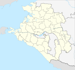
The place is about 190 km as the crow flies east -south- east of the regional administrative center of Krasnodar and almost 30 km southeast of the city of Armavir , not far from the border with the neighboring Stavropol region . It is located in the foothills of the Caucasus on the left bank of the Kuban .
Uspenskoe is the administrative center of the Rajons Assumption and seat the rural community Uspenskoe selskoje posselenije, (km south-east 10) which also includes the settlement Mitschurinski and Weiler (Chutor) Belezki (7 km south-east), Lok (14 km south-east), Podkowski (13 km south-southeast ), Ukrainski (5 km southwest) and Uspenski (12 km south-southeast) belong.
history
The village was founded in 1864 towards the end of the Caucasus War by initially 17 resettled families from the Yekaterinoslav Governorate and was named after the Christian holiday of the Assumption of Heaven , in Russian Uspenije Boschjei Materi.
From June 2, 1924, the village was the first administrative seat of a Rajon, then after the interim dissolution of the Rajon on November 6, 1929 again from December 31, 1934 to April 28, 1962. On February 21, 1975 the Uspenski rajon was again within its current boundaries spun off from the territory of the Novokubansky rajon .
Population development
| year | Residents |
|---|---|
| 1939 | 3,767 |
| 1959 | 5,970 |
| 1979 | 7,674 |
| 1989 | 9,945 |
| 2002 | 11,692 |
| 2010 | 12,409 |
Note: census data
traffic
Uspenskoje is bypassed south of the federal highway R217 Kawkas (formerly M29), which leads along the northern edge of the Caucasus to the Azerbaijani border. The stopping point is 1680 km of the Rostov-on-Don - Vladikavkaz / Makhachkala - Baku railway line, which was opened on this section in 1875 and electrified since 1962 . At distance kilometer 1676 (from Moscow ) the Konokowo station is closer to the village of the same name to the west .
Web links
Individual evidence
- ↑ a b Itogi Vserossijskoj perepisi naselenija 2010 goda. Tom 1. Čislennostʹ i razmeščenie naselenija (Results of the All-Russian Census 2010. Volume 1. Number and distribution of the population). Tables 5 , pp. 12-209; 11 , pp. 312–979 (download from the website of the Federal Service for State Statistics of the Russian Federation)

