
Wauwil
| Wauwil | |
|---|---|
 |
|
| State : |
|
| Canton : |
|
| Constituency : | Willisau |
| BFS no. : | 1146 |
| Postal code : | 6242 |
| Coordinates : | 643 813 / 225 981 |
| Height : | 521 m above sea level M. |
| Height range : | 497–686 m above sea level M. |
| Area : | 2.96 km² |
| Residents: | 2247 (December 31, 2018) |
| Population density : | 759 inhabitants per km² |
|
Proportion of foreigners : (residents without citizenship ) |
24.4% (December 31, 2,015) |
| Website: | www.wauwil.ch |
 Wauwil as seen from the Wauwilermoos |
|
| Location of the municipality | |
  |
|
Wauwil is a municipality in the Willisau constituency in the canton of Lucerne in Switzerland .
geography
The place is on the Sursee - Dagmersellen road between the southern slope of the Santenberg and the Wauwilermoos , which was covered by the Wauwilersee until 1859 . Apart from the Kohlrüti forest north of the Santenberg and Breitloo east of the village, the community has no forest areas. The settlements Engelberg ( 621 m above sea level ) and Schönbühl / Berghof ( 659 m above sea level ) lie on the southern slope of the Santenberg, from west to east . The settlements of Wauwilerberg (northeast), Sonnhalden and Sternmatt / Obermoos (east) used to be independent hamlets, but like the neighboring town of Egolzwil in the west they have now merged with Wauwil-Dorf. There are also some free-standing farms on Santenberg and Wauwilermoos. The lowest point in the community is at Falkenhof in Wauwilermoos at 498 m above sea level. M. , the highest point in the Kohlrüti Forest at 689 m above sea level. M.
By draining the Wauwilersee and later the Wauwilermoos for peat extraction , large agricultural areas were added. They cover 71.9% of the municipal area. Almost one fifth of the community area (18.0%) is settlement area and one tenth (10.2%) of the community area is forested.
Wauwil borders on Dagmersellen , Egolzwil , Ettiswil , Mauensee and Schötz .
population
| Population development | |
|---|---|
| year | Residents |
| 1850 | 487 |
| 1860 | 421 |
| 1910 | 637 |
| 1920 | 607 |
| 1970 | 1,324 |
| 1980 | 1,365 |
| 1990 | 1,645 |
| 2000 | 1,671 |
| 2004 | 1,657 |
| 2008 | 1,712 |
| 2017 | 2,190 |
The population decreased from 1850-1860 (1850-1860: −13.6%). This was followed by strong population growth up to 1910 (1860–1910: +51.3%), which at that time was very unusual for rural communities in Lucerne. The reasons for this unusual growth were the construction of the Olten – Emmenbrücke railway line, the peat cutting shop and the establishment of a glassworks. From 1920 on, the number of residents steadily more than doubled for half a century (1920–1970: + 118.2%). There was a further sharp increase in the 1980s, but the population stagnated until the end of the 1990s. Since 2005 the population has been increasing again due to the high number of immigrants.
languages
The population uses a highly Alemannic dialect as their everyday language. In the last census in 2000, 81.39% said German, 6.70% Serbian and 4.31% Albanian were the main languages.
Religions - denominations
In the past, all residents were members of the Roman Catholic Church. This has changed as a result of leaving the church and immigration from other regions in Switzerland and abroad. Today (as of 2000) the religious composition of the population is as follows. There are 67.92% Roman Catholic, 9.81% Orthodox and 5.98% Evangelical Reformed Christians. In addition, there are 6.16% Muslims, 3.35% non-denominational and 1.14% members of other non-Christian religions. Both the Orthodox and the Muslims come from the former Yugoslavia (Serbs, Montenegrins, Macedonians, Albanians and Bosniaks). The members of other non-Christian denominations are Hindus of Tamil origin.
Origin - nationality
At the end of 2014, 1,416 of the 1,904 inhabitants were Swiss and 488 (= 25.6%) were foreigners. The population consisted of 74.4% Swiss citizens. At the end of 2014, the foreign residents came from Serbia including Kosovo (49.0%), Germany (10.5%), Italy (8.8%), Portugal (7.4%), Turkey (2.5%) and Spain (0.8%). 14.5% came from the rest of Europe and 6.6 % came from outside Europe.
history

Wawile was first mentioned in 1070, when the abbot Seliger of Einsiedeln Monastery, who came from the von Wolhusen family, bequeathed a Meierhof in Wauwil to his monastery. However, the community must have been settled much earlier than the whole area around the former Wauwilersee (in the 6th millennium BC). The municipality came under the rule of the city of Lucerne through purchase in 1407 , after it had previously belonged to the Habsburgs . The city also acquired lower jurisdiction between 1450 and 1515. Wauwil thus formed part of the Willisau Landvogtei until 1798. After that she was part of the Altishofen district before she came to the newly established office of Willisau in 1803 . In 1853 the Wauwilersee was drained and the Wauwilermoos was created .
politics
Municipal council
The Wauwil municipal council consists of five members and is set up as follows:
- Annelies Gassmann-Wechsler: Mayor
- Daniel Keusch: Finance and Construction
- Lorenz Juchli: Social
- Simon Siegrist: Culture and Environment
- Hanspeter Woodtli: Education
Cantonal elections
In the 2015 Cantonal Council elections for the Canton of Lucerne, the share of the vote in Wauwil was: CVP 48.2%, SVP 23.0%, FDP 18.1%, SP 4.9%, GPS 3.7%, glp 2.1%.
National Council elections
In the Swiss parliamentary elections 2015, the share of the vote in Wauwil was: SVP 30.5%, CVP 29.8%, FDP 19.3%, SP 8.6%, glp 4.7%, Greens 4.2%, BDP 1, 7%.
traffic
Wauwil is on the Lucerne – Olten railway line and has its own train station. At the S-Bahn stop, in addition to S-Bahn No. S8, a RegionalExpress train (RE) stops every hour and direction. The station is characterized by its close proximity to the village center and a large number of free parking spaces.
Wauwil is on the Sursee – Nebikon road. The closest motorway connections are Dagmersellen 7 km away and Sursee 9 km away (both can be reached in about 10 minutes by car). Both are on the A2 .
Attractions
The Wauwilermoos is known far and wide . Wauwil gave this plain its name; however, it belongs to several parishes. A walk through the wonderful moorland is a true journey of discovery. The intact natural landscape is a habitat for numerous animal and plant species ( nature reserve ). The Wauwilermoos prison is not located in the municipality of Wauwil, but in the neighboring municipality of Egolzwil .
photos

Wauwil station
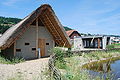
Wauwil archaeological learning path

Wauwilermoos


Web links
- Official website of the municipality of Wauwil
- Community profile of the cantonal statistical office (PDF, 110 KB)
- Waltraud Hörsch: Wauwil. In: Historical Lexicon of Switzerland .
Individual evidence
- ↑ Permanent and non-permanent resident population by year, canton, district, municipality, population type and gender (permanent resident population). In: bfs. admin.ch . Federal Statistical Office (FSO), August 31, 2019, accessed on December 22, 2019 .
- ↑ Permanent resident population by nationality category, gender and municipality ( memento from January 1, 2015 in the Internet Archive ) (permanent resident population)
- ↑ Balance of the permanent resident population according to demographic components, institutional structure, nationality and gender (Federal Statistical Office, STAT-TAB)
- ↑ LUSTAT: Community profile Wauwil ( Memento from May 8, 2016 in the Internet Archive )
- ↑ LUSTAT: Community profile Wauwil ( Memento from May 8, 2016 in the Internet Archive )
- ↑ National Council elections 2015: strength of the parties and voter turnout by municipality. In: Results of the National Council elections 2015. Federal Statistical Office, 2016, accessed on June 3, 2016 .
Alberswil | Altbüron | Altishofen | Dagmersellen | Egolzwil | Ettiswil | Fischbach | Gettnau | Grossdietwil | Hergiswil near Willisau | Luther | Menznau | Nebikon | Pfaffnau | Reiden | Roggliswil | Schötz | Ufhusen | Wauwil | Wikon | Willisau | Cell
Former parishes: Buchs | Boar corners | Kottwil | Langnau near Reiden | Ohmstal | Richenthal | Uffikon | Willisau Land | Willisau city
Canton of Lucerne | Constituencies of the Canton of Lucerne | Municipalities of the Canton of Lucerne